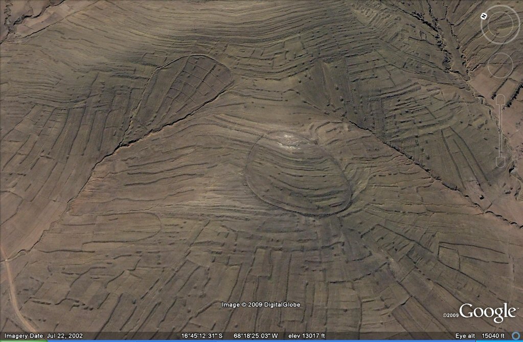
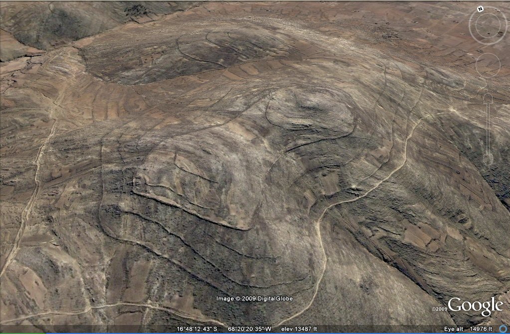
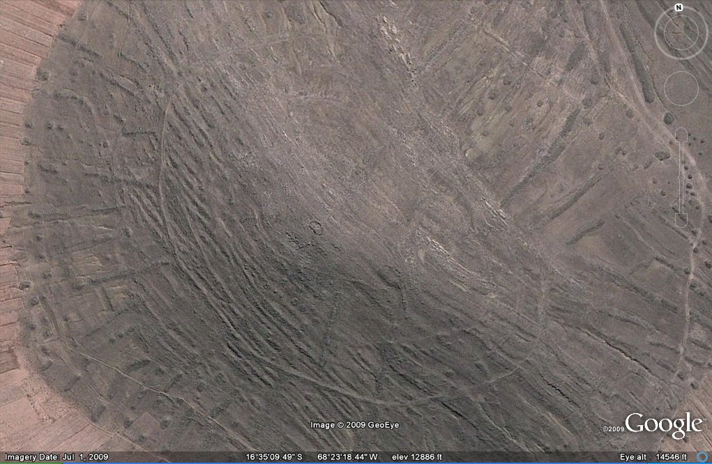
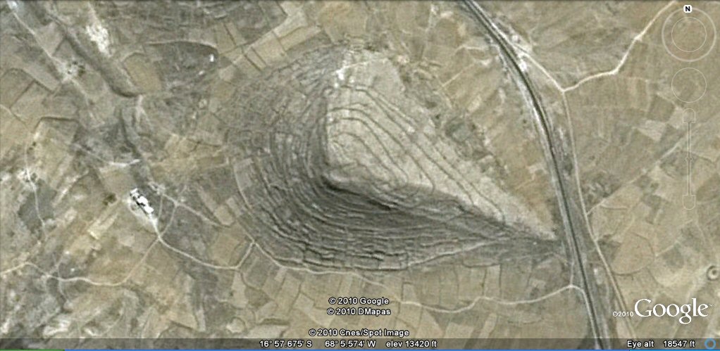
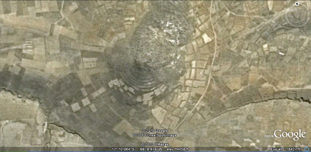
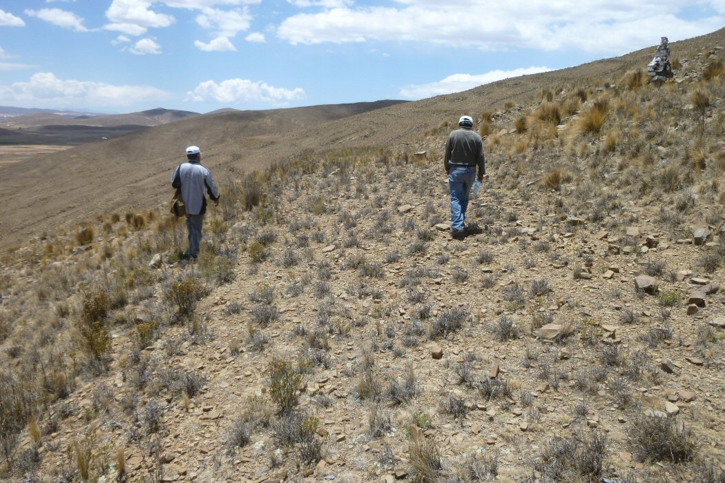
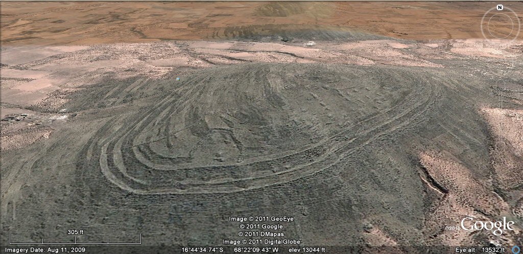
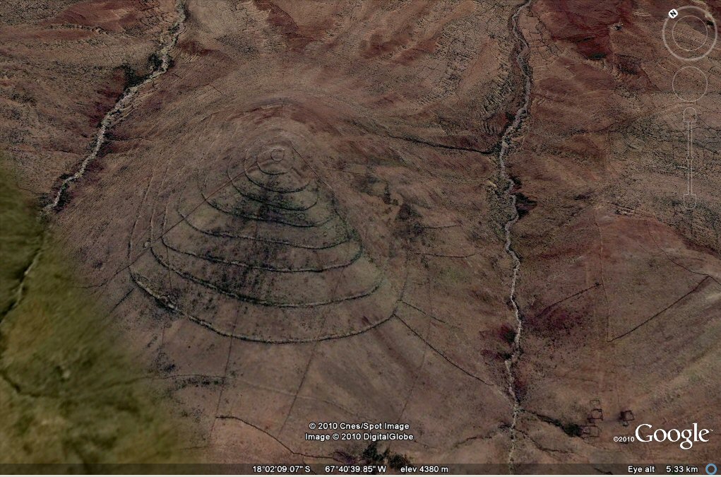
101 a, Above, ringed hilltop with "geoglyph" agricultural system in the Tiwanaku area. The "geoglyphs" are parallel lines of stones cleared from the original landscape.

Tiwanaku and La Paz area
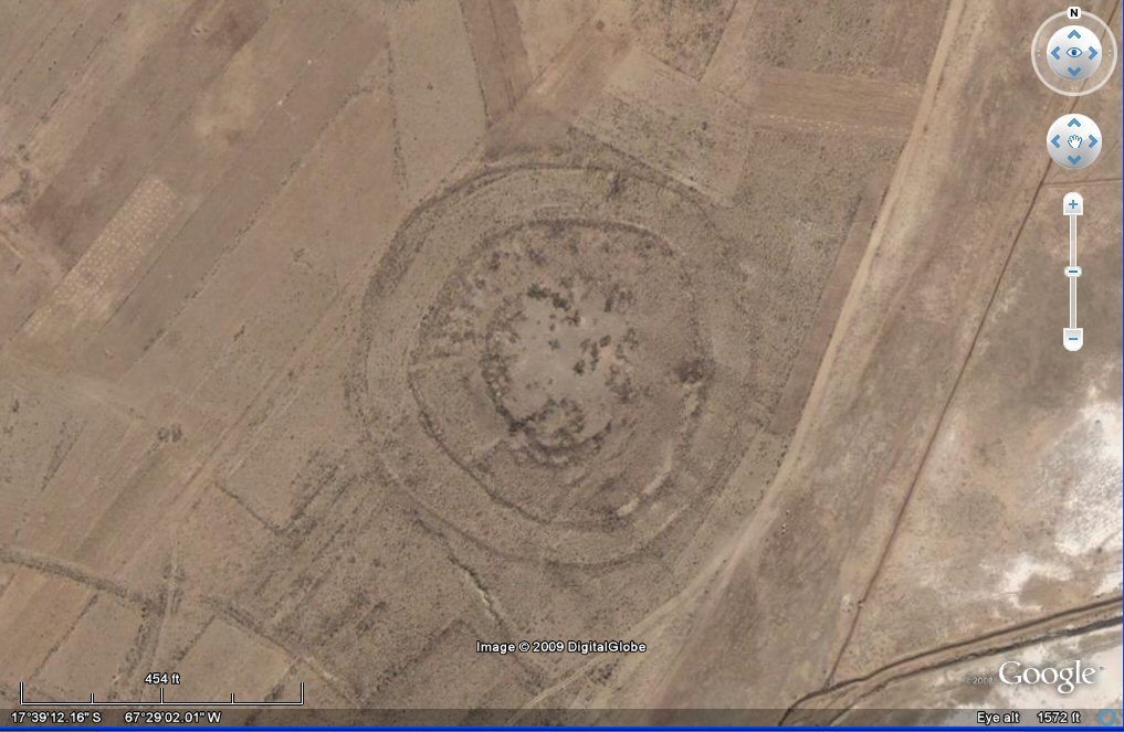
101 a, Above, ringed hilltop with "geoglyph" agricultural system in the Tiwanaku area. The "geoglyphs" are parallel lines of stones cleared from the original landscape.
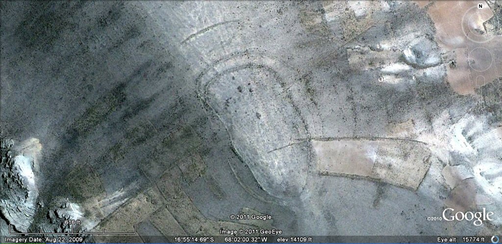
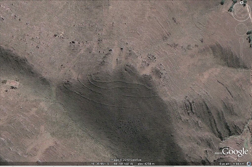
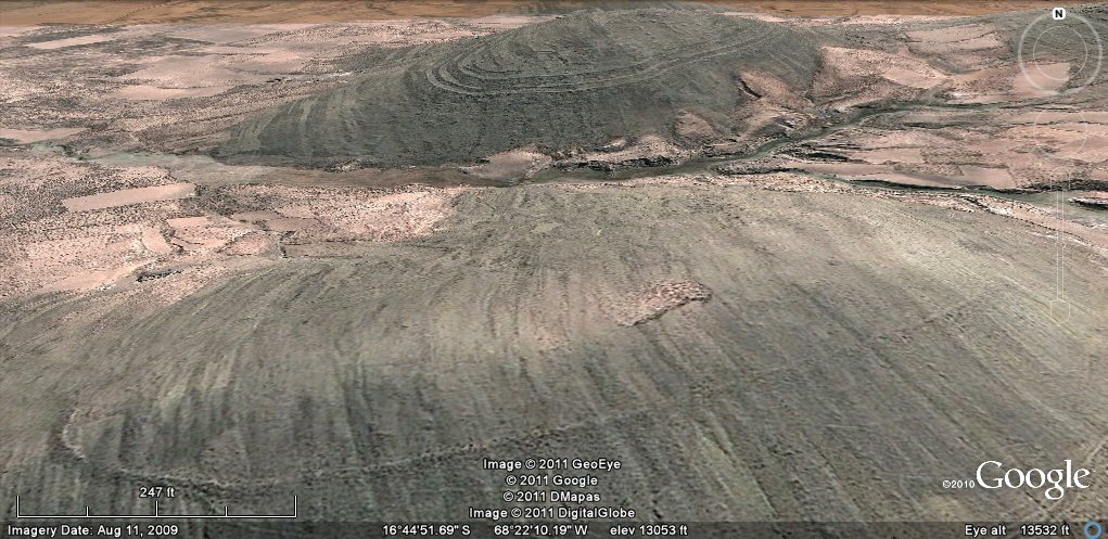
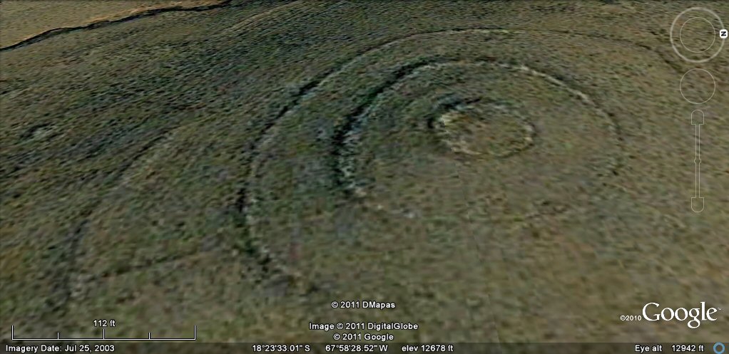
101 c, Above, ringed hilltop with apparant concentric irrigation
channels which proved to be walled terrace/roadways and "geoglyph" agricultural system
showing earthquake damage in the Tiwanaku/La Paz/Viacha area.
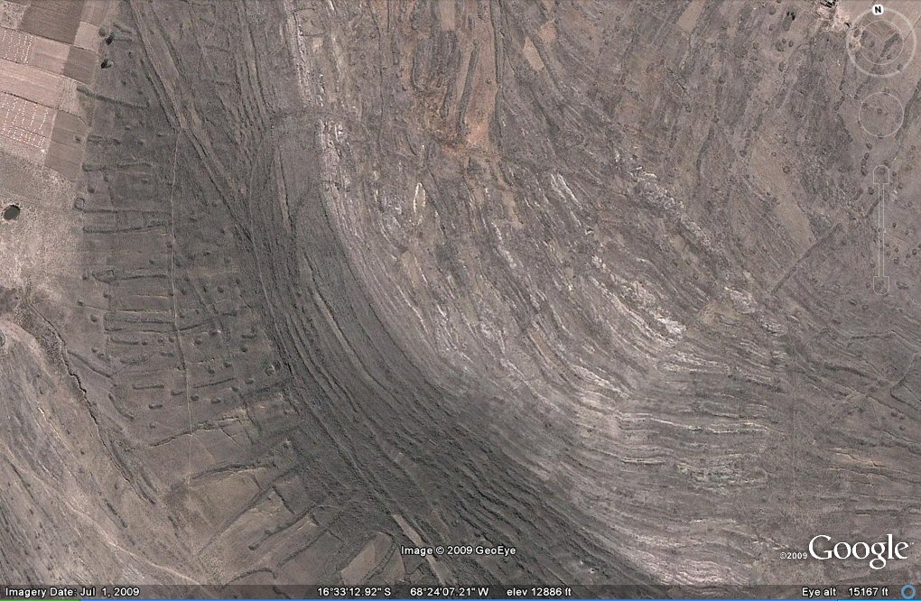
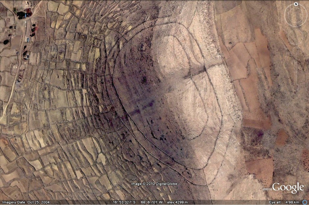
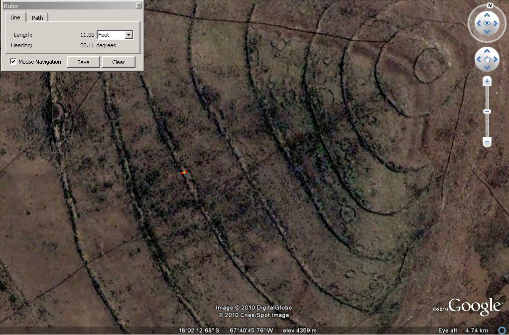
101 c, Above, closer view of ringed hilltop with concentric rings and "geoglyph"
agricultural system showing earthquake damage in the Tiwanaku area.
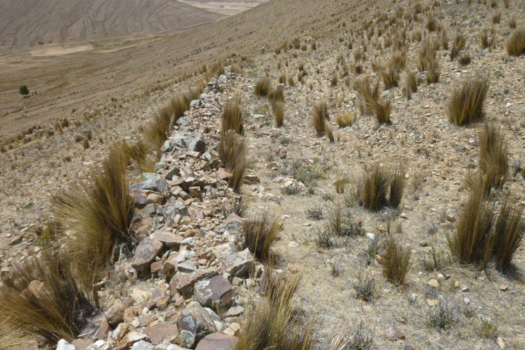
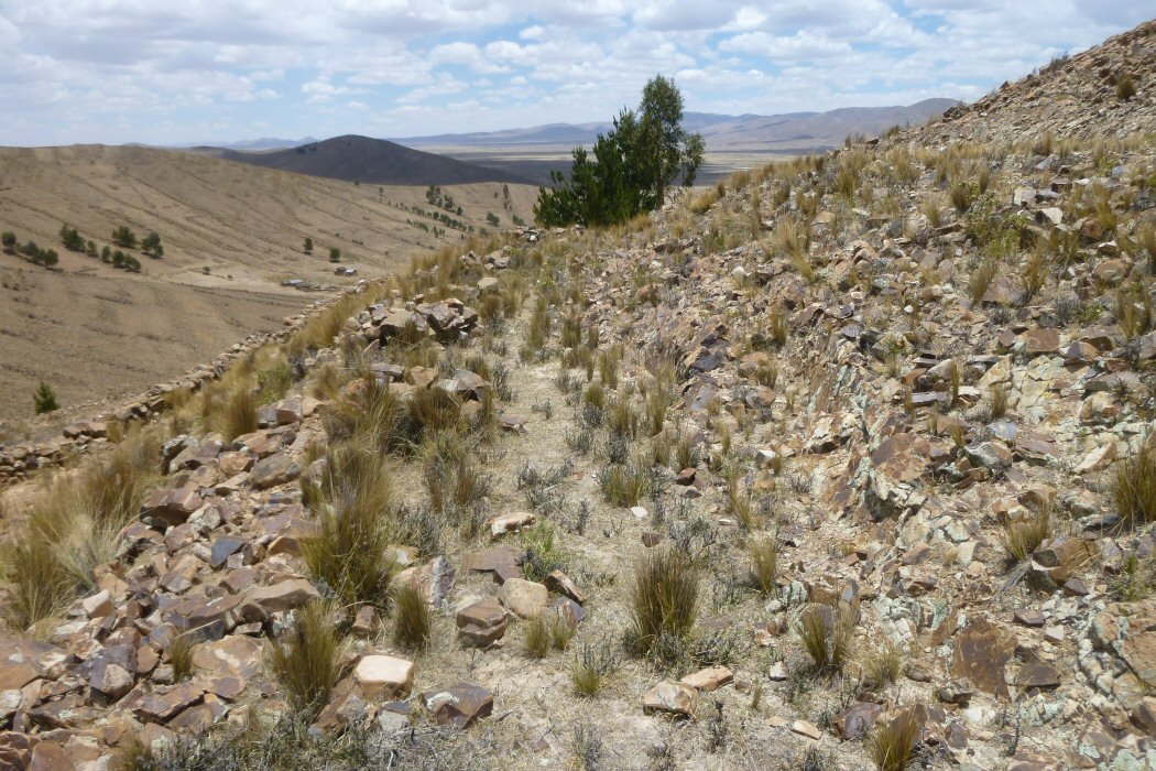
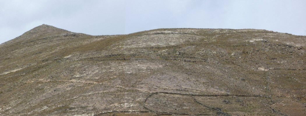
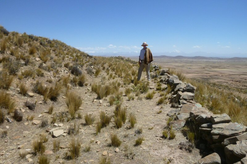
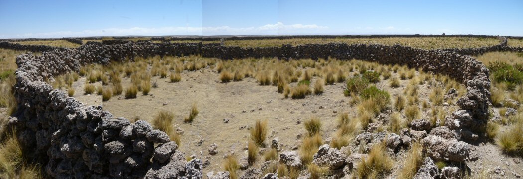
101 c, Above, ground view shows the rings to be concentric terraces/roadways faced with stone retaining walls.

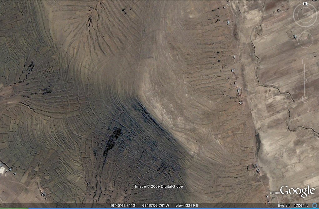
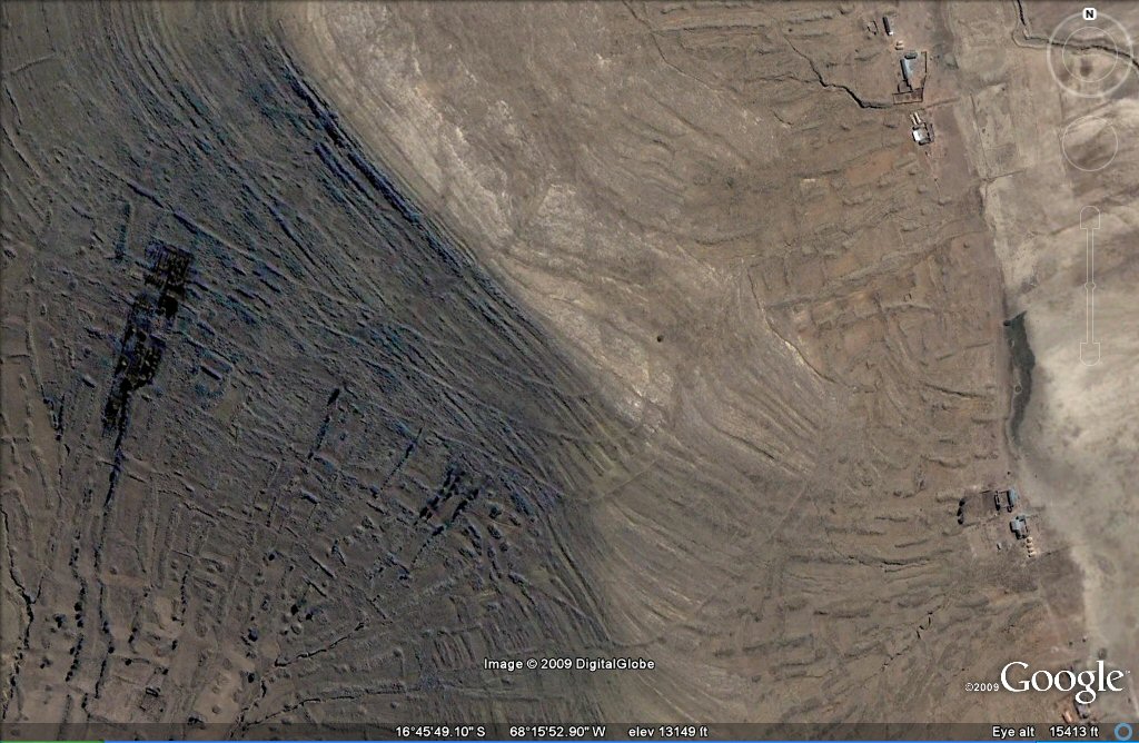
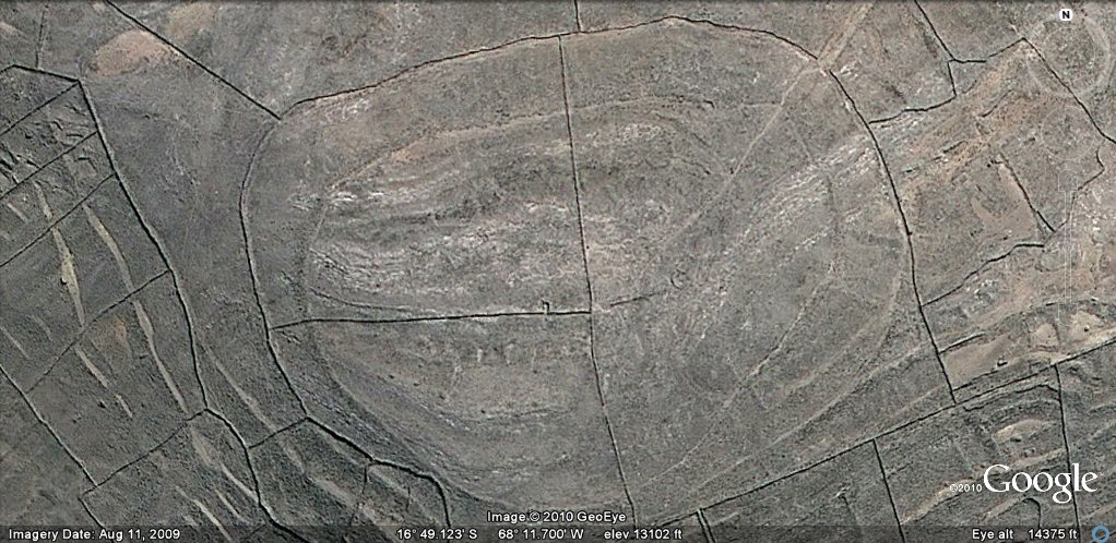
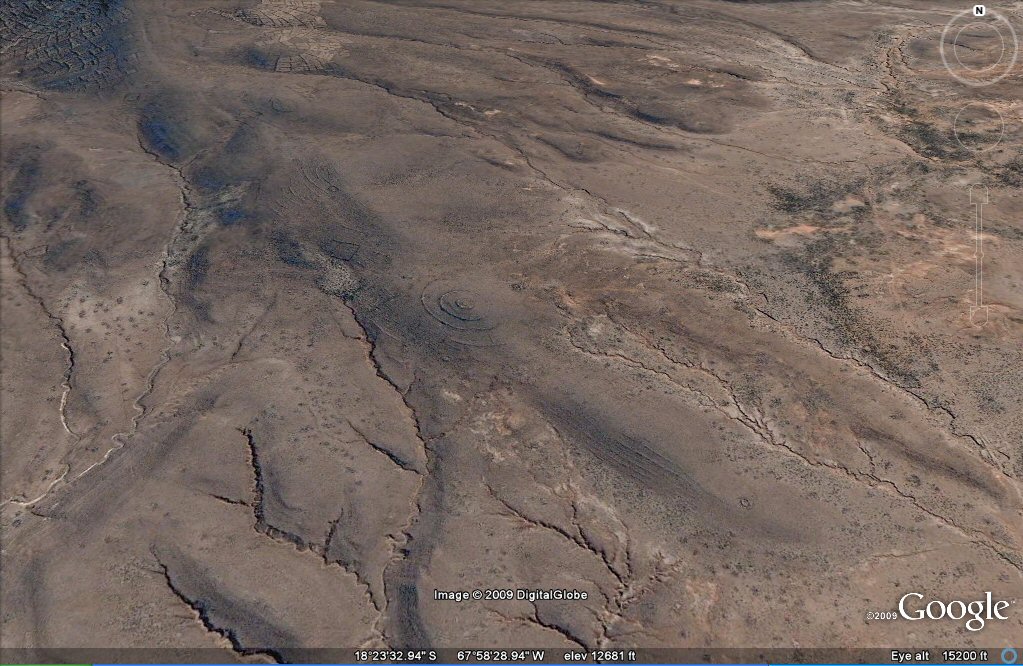
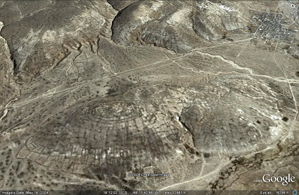
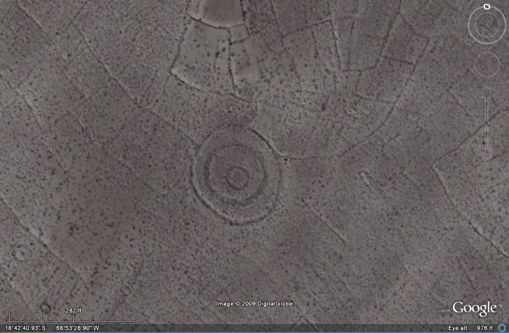
Above, 02 this ringed hill near SicaSica on the Bolivian
altiplano appears to be remains of a hillfort and has the same ovaloid shape
and distinctive shape as the hillfort at
Chankillo in Peru and an identical length of
about 990ft which is 900 Sumerian feet or 600 Sumerian cubits... also 180 double yards or
360 Sumerian yards
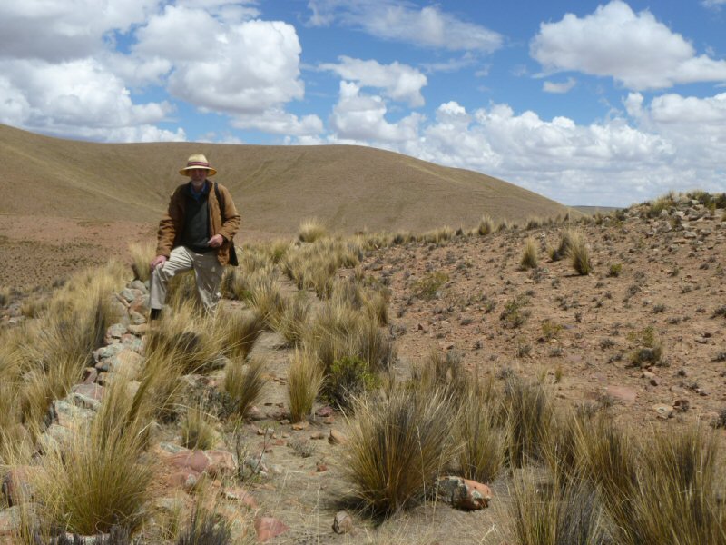
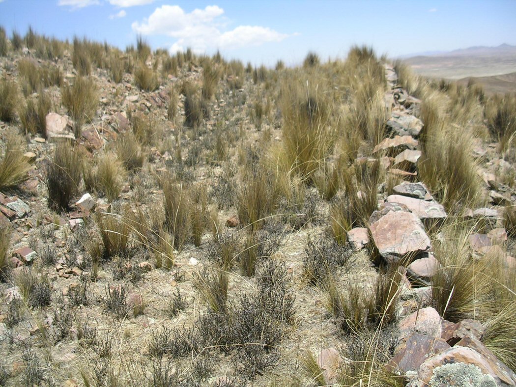
Above, ground view showing part of the outer wall.
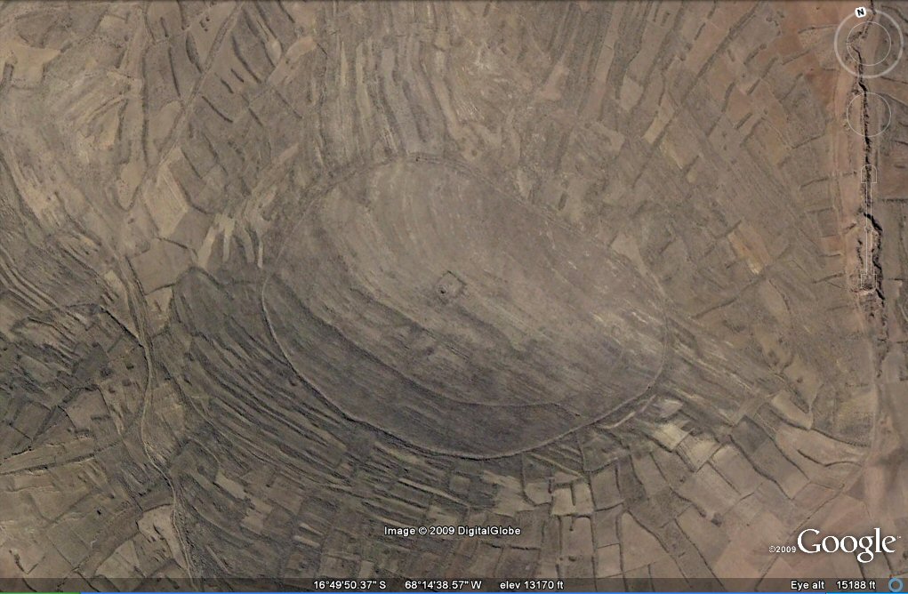
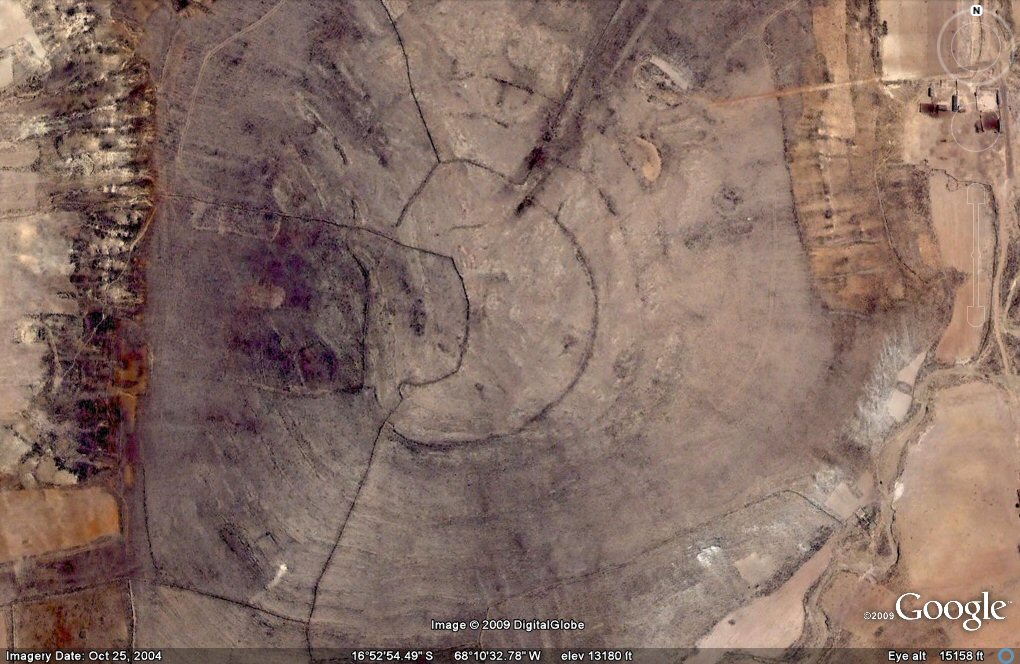
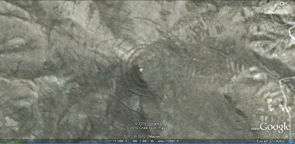
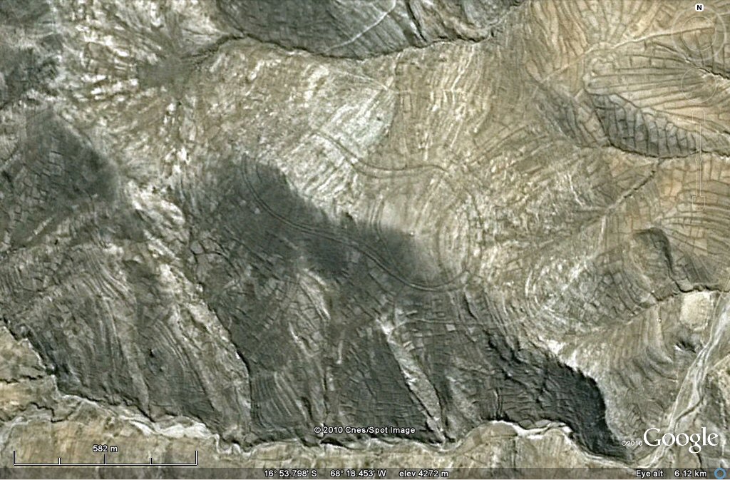
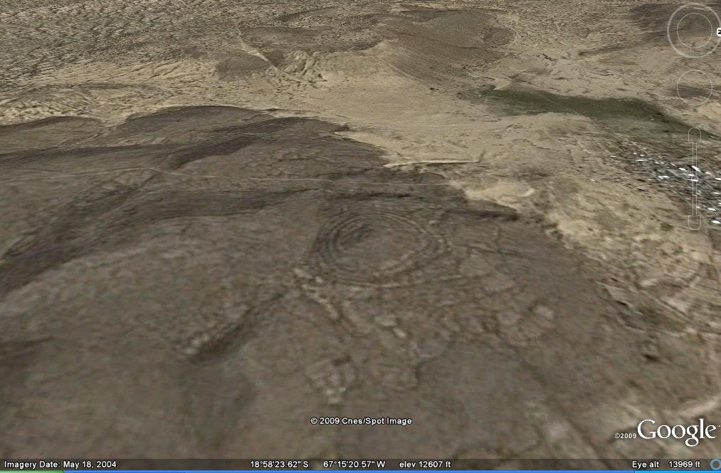
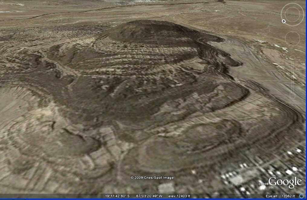
Above, 105 d and e oblique view showing remains of
concentric rings near Viacha, Bolivian Altiplano. -
At first it is difficut to tell whether the rings are remains of concentric irrigation channels or defensive works such as hill forts.
The ring in the foreground could have been irrigation canal or part of hillfort, but the concentric rings in the background site
are more similar to those of a hill fort.
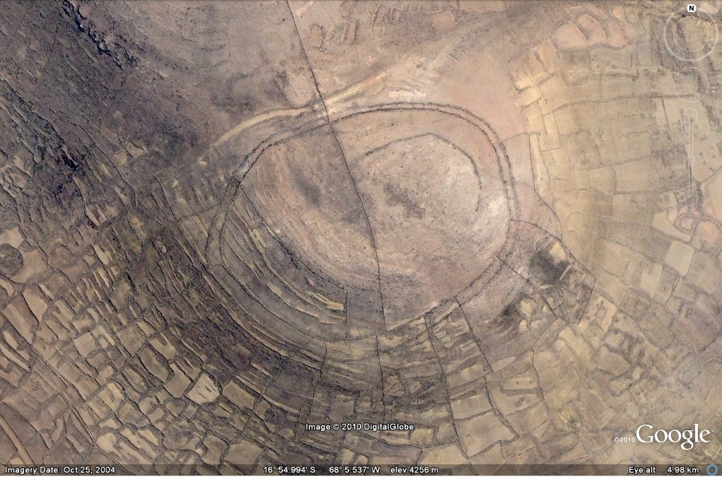
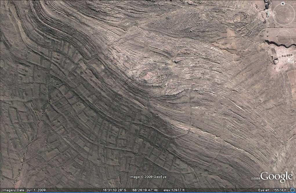
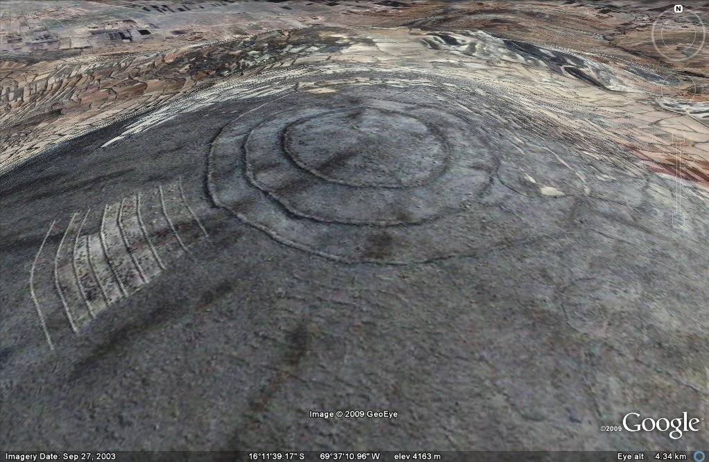
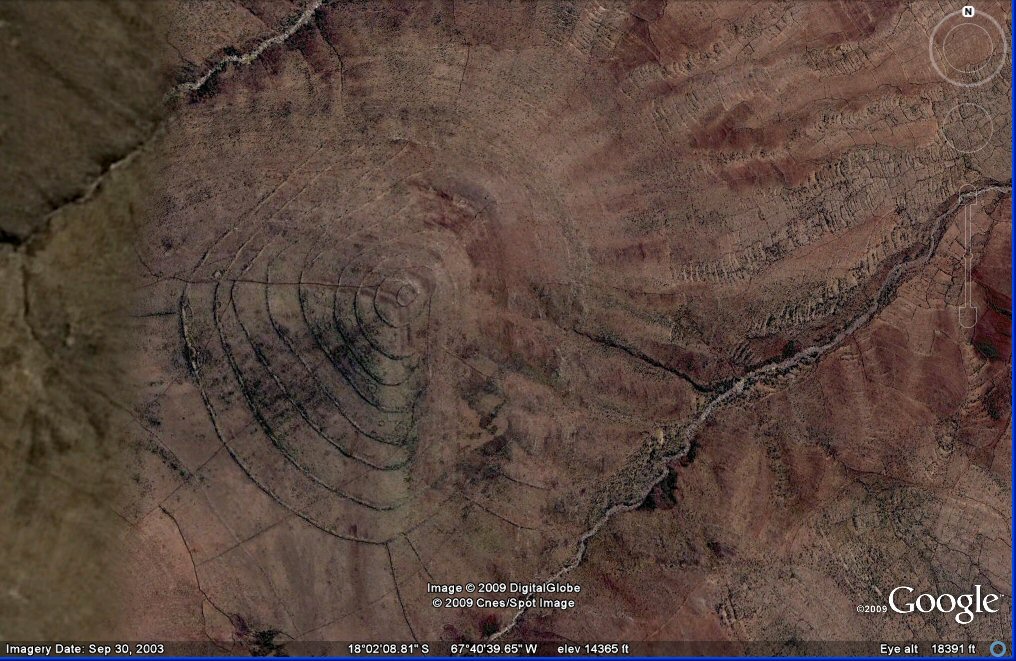
Above, 105e this set of concentric rings looks like it would have had a good capacity for
retaining water but turned out to be concentric walled terraces.
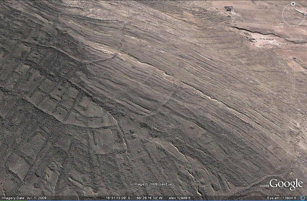
Above, 105e walled concentric terrace/roadways at the Viacha hillfort known as "cerro Pukara".
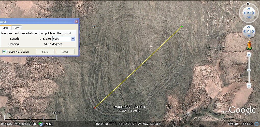
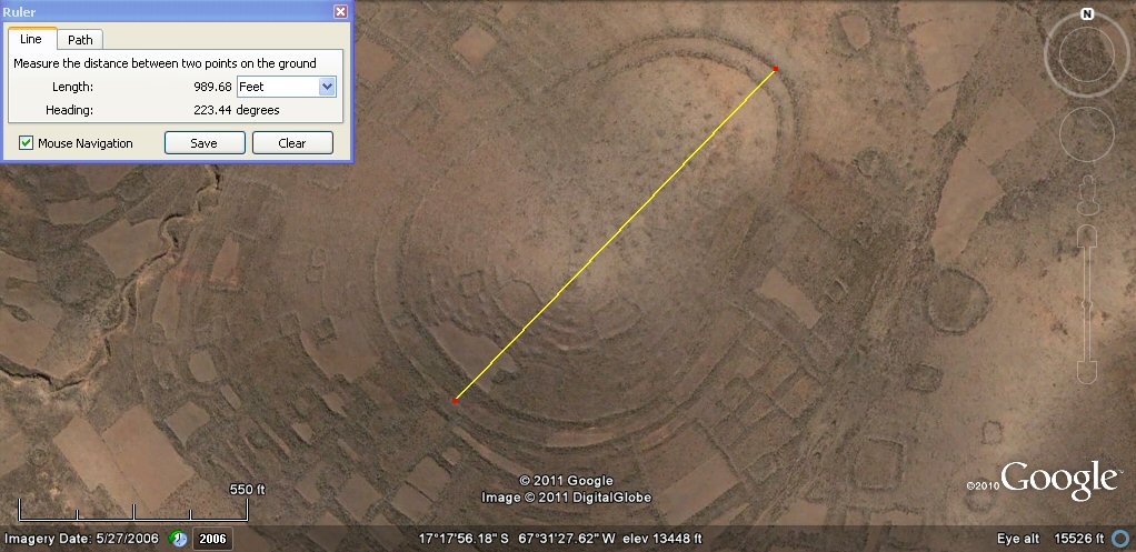
Above, 105e the overall length of the site is about 1332ft which is 1200 Sumerian feet
or 800 Sumerian cubits
or 480 Sumerian yards and the
the overall width is about 990ft which is 900 Sumerian feet or 600 Sumerian cubits or 360 Sumerian yards of 33.0".
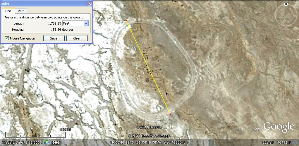
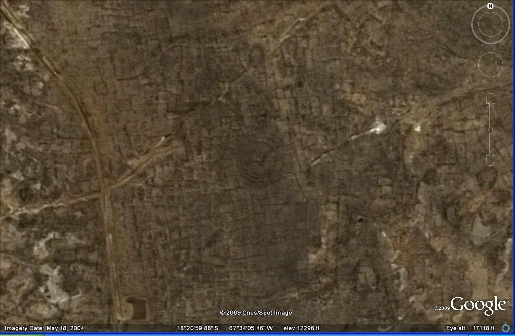
Above, this site near the village of Chipaya can hardly be called a "hillfort" since it is in the middle of the vast
Salar de Coipasa, yet it has similar characteristics to the "hillforts" of Chankillo and SicaSica, with
the same ovaloid shape but is even larger being around
1762ft long which is 1600 Sumerian feet.
Above, the site near the village of Chipaya is surrounded by a ditch and embankment and occupied by a modern "breakaway" village of Chipaya people.

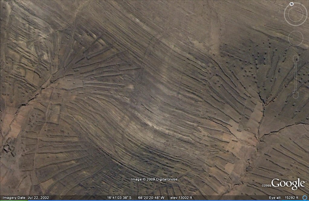
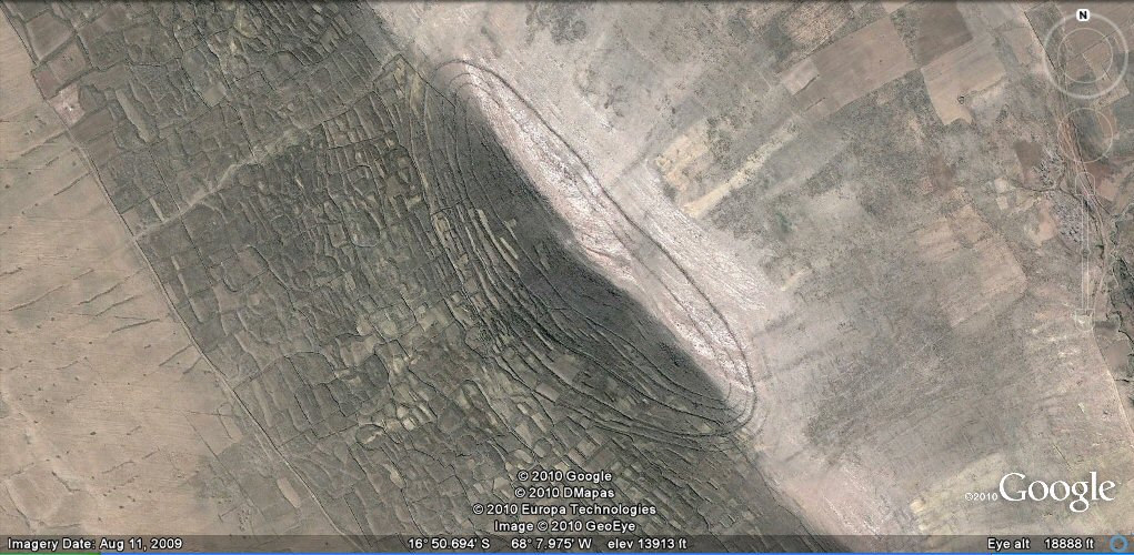
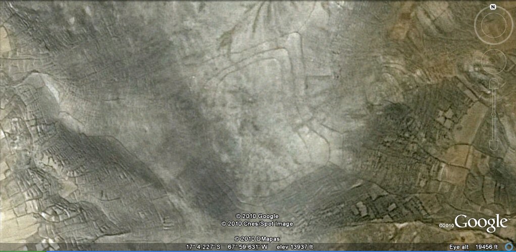
17, Above, closer view of ringed hilltop south of Turco. The terraces on the surrounding hillsides have been obliterated.
17, Above, close-up suggests the rings are remains of concentric irrigation channels, but a visit on site showed only concentric level pathways faced on the outside with the remains of stone walls.
14 Above, oblique view of ringed hilltop at Turco.
20, Above, oblique view of ringed hilltop at Andamarca.
12, Above, ringed feature north-west of Lake Poopo. A site visit showed this to be a circular walled enclosure.
12. Above, ringed enclosure at Copacabanita. The area was covered in thousands of square
or rectangular plots with these types of walls which are quite different to the retaining walls used in the construction of the concentric terraces surrounding many hilltops.
Above, ringed feature south of volcan Quemado.
Above, view from north-west showing rings of land and channels at Pampa Aullagas.
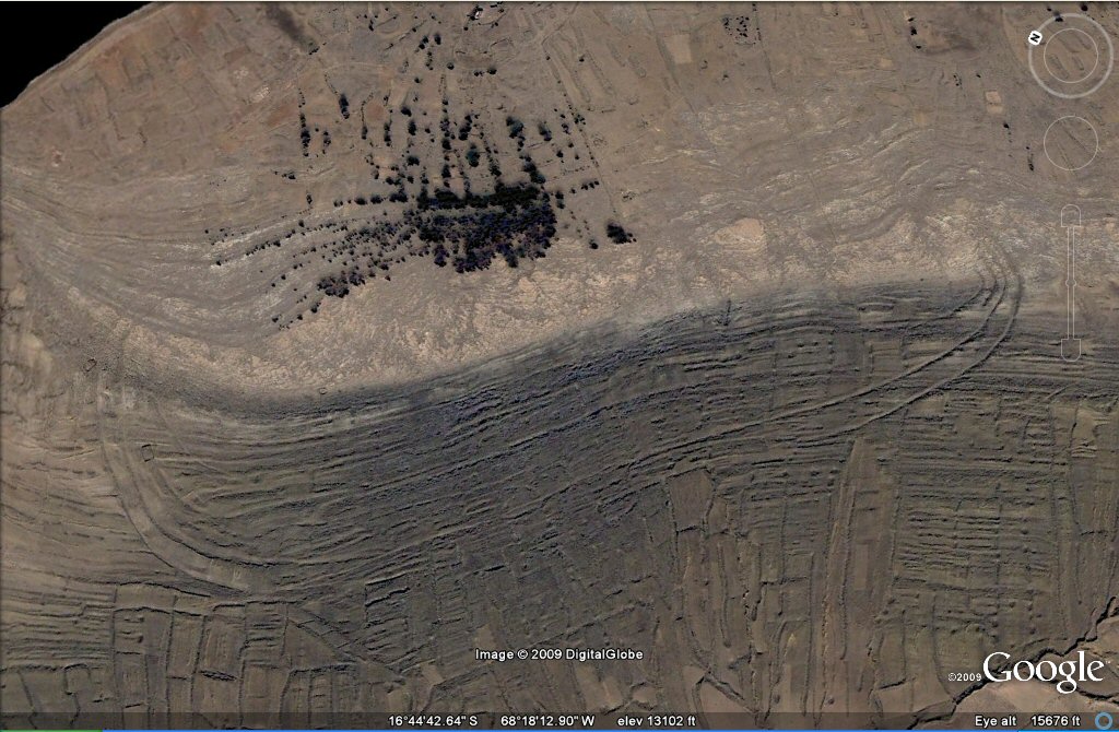
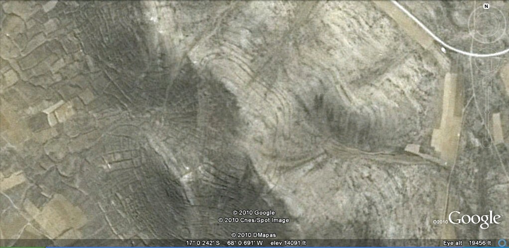
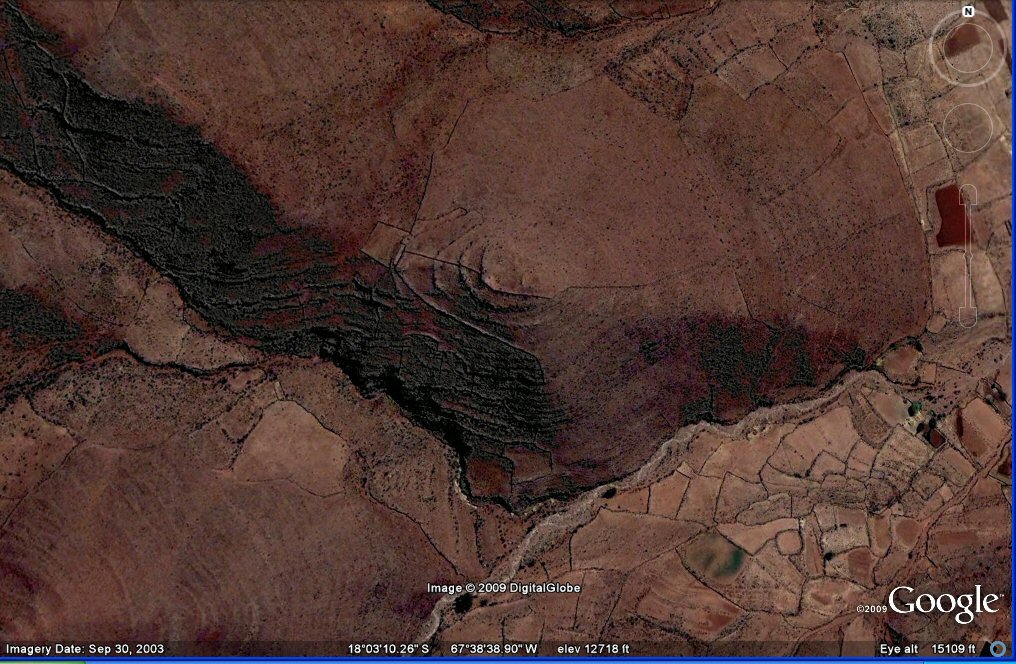
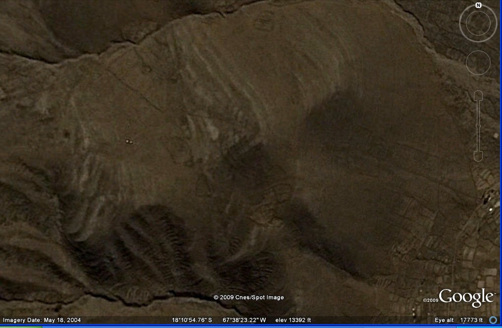
46 a, Above, ringed hilltop with considerable earthquake damage south-west of Oruro.
46 a, Above, another view of ringed hilltop with considerable earthquake damage south-west of Oruro.
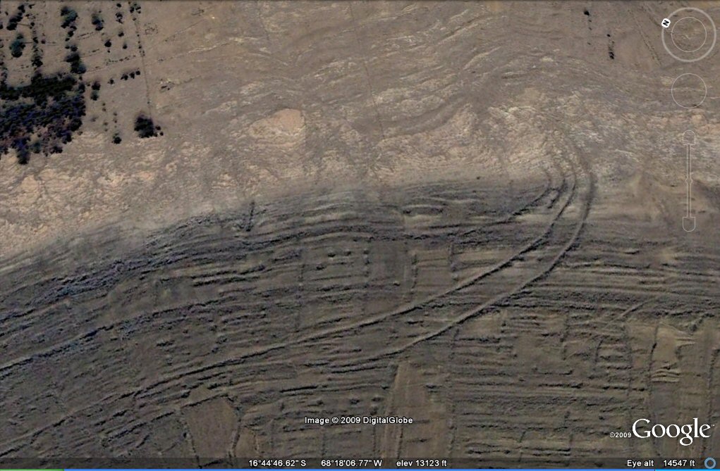
46 a, Enlargement of better resolution image suggests these were originally
concentric ringed irrigation canals or concentric terrace/roadways but later people have built enclosure walls alongside the original features..
46 b, Above, ringed hilltop with considerable earthquake damage south-west of Oruro.
46 c, Above, ringed hilltop with considerable earthquake damage south-west of Oruro.
49, Above, ringed hilltop at La Joya.
See Atlantis expedition La Paz Oruro 2011 for further photos.
See also additional studies,
hillforts
fossilised agriculture destroyed by earthquakes.
agricultural variations on the Altiplano
geoforms
earthquakes
contour forms/irrigation Peru
contourforms/irigation Bolivia
Bombo earthquake route
Bombo route oblique views
atlantis canals on the Altiplano
canals gallery
Chipaya canals gallery
canals in Peru
Caral, Peru containment canal
Paria, Oruro containment canals
canal to sea (lago UruUru)
Pantanal
Beni, Moxos gallery
rio Paraguay levees canals
rio Parana canals, ponds and islands
rio Parana delta canals
Corrientes
rio Amazon to Manaus
rio Amazon west from Manaus
rio Orinocco to Amazon canal
canals on the Louisiana seaboard
Tabasco, Mexico canals gallery
flooding dates on the Altiplano
Atlantis stones gallery
Atlantis stade - Egyptian and Sumerian cubits
Tiwanaku cubits
Peru cubits and calendar
cubits between altiplano canals
Teotihuacan measuring unit
Teotihuacan citadel measuring units
Chichen Itza and El Castillo measuring units
Monte Alban, measuring units
the Tiwanaku soli-lunar calendar
the Muisca calendar
Lost Calendar of the Andes
Decoding the quipu mathematics
J.M. Allen 14 nov 2009, updated 11 November 2011
webatlantis@hotmail.com