 Geoforms - agricultural formations on the Bolivian Altiplano
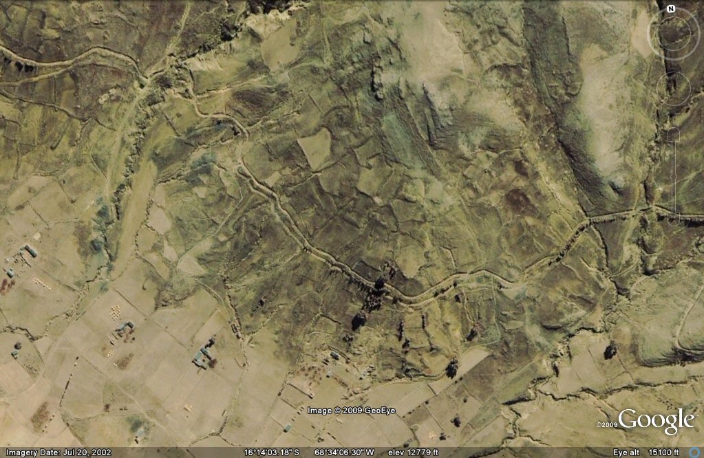
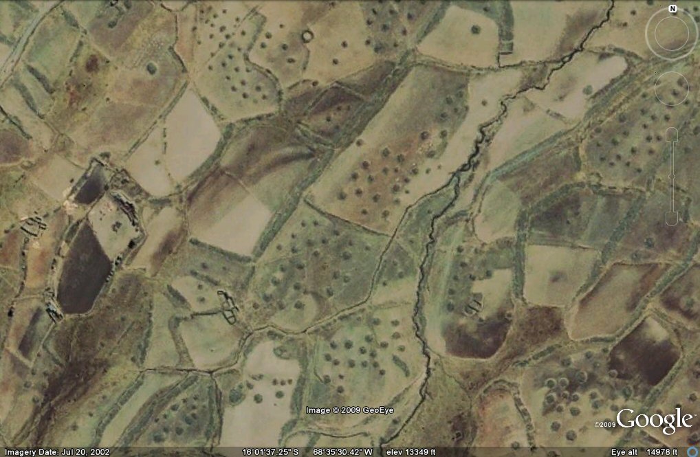
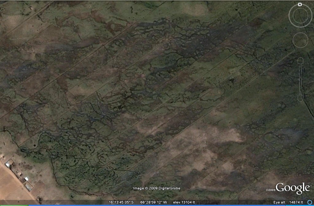
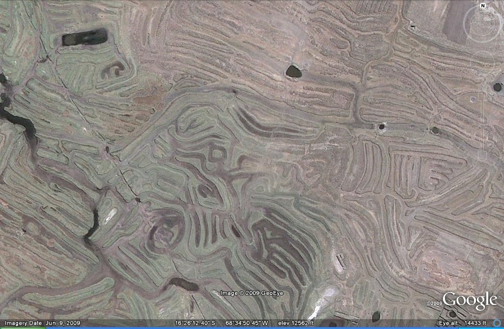
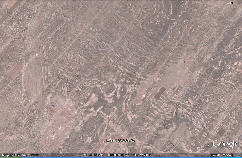
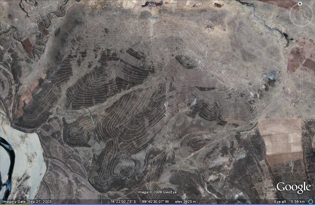
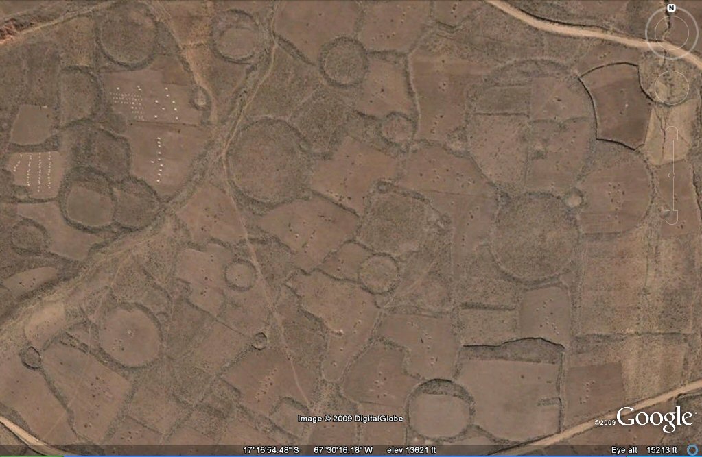
Some of the old patterns have been eliminated by later cultivations but many can be still detected on the satellite imagery, which also shows up extensive earthquake damage in places where old terraces have been virtually demolished and in others where ancient iregular walled fields have been buried beneath extensive sand dunes. Satellite imagery also shows an extensive system of long narrow embankments accompanied by small circular mounds which have been baptised as "geoglyphs" but which appear to be in fact remains of an ancient agricultural system which was brought to an end by extensive earthquakes. These "geoglyph" formations are also often accompanied by hilltops surrounded by concentric walled terraces/pathways which may also have served as ringed irrigation channels, again destroyed by earthquakes thus suggesting that an ancient and unknown civilisation was destroyed in some great cataclysm (see earthquakes page) and that what people see on the ground today is mostly the works of later peoples for example those that built walls for the enclosure of animals ("corrales") over the ancient sites. Some views from Google Earth
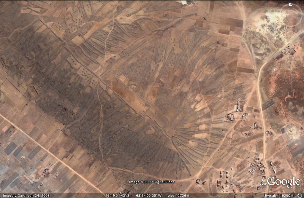
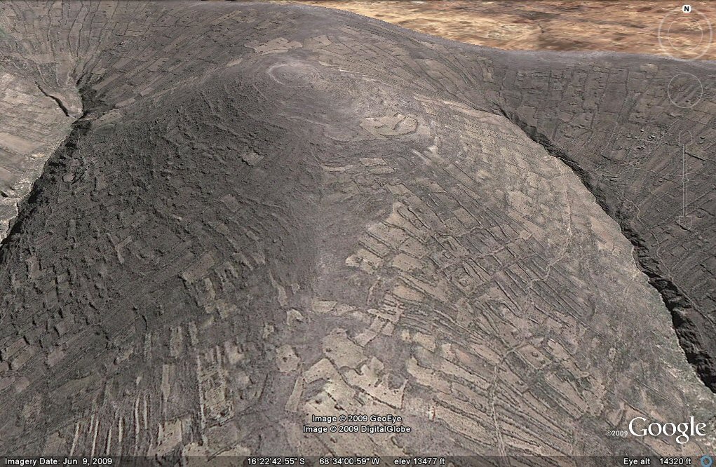
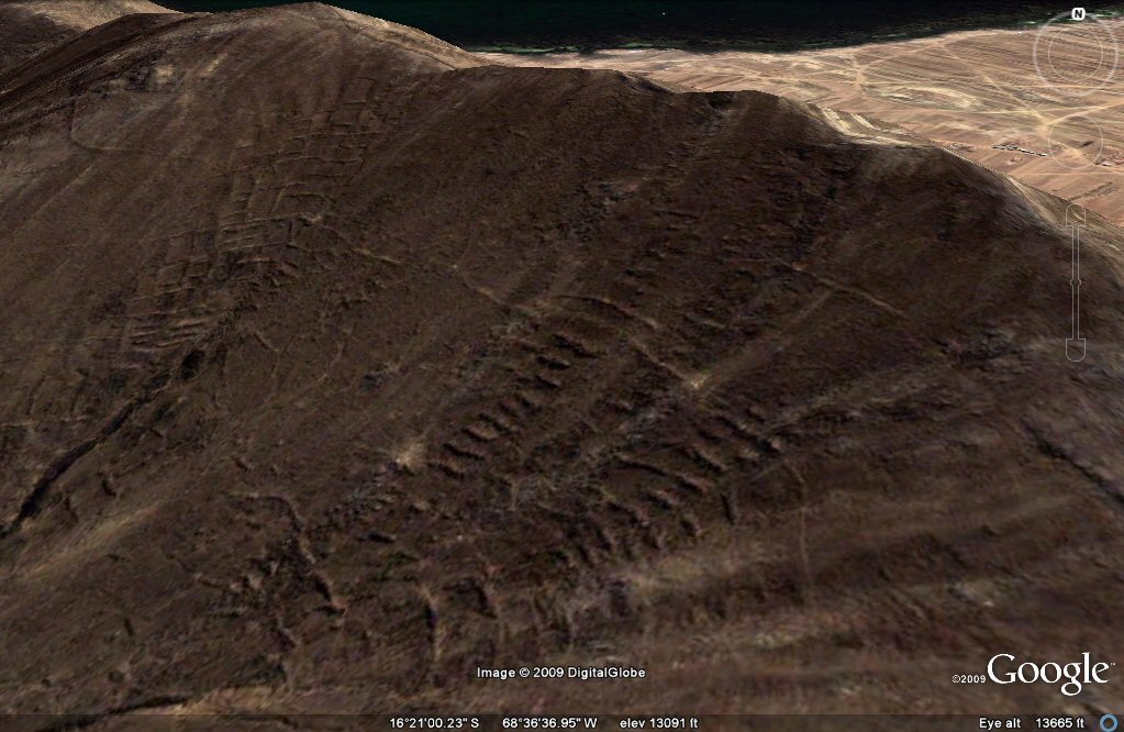
Above, geoglyphs north of Tiwanaku first brought to the public attention by David Flynn.
These are actually remains of a little known ancient system of agriculture which covered extensive areas north, east and south-east of Tiwanaku.
And who says Atlantis never existed?
See also additional studies,
atlantis canals on the Altiplano
canals gallery
Chipaya canals gallery
canals in Peru
Caral, Peru containment canal
Atlantis stade - Egyptian and Sumerian cubits
Tiwanaku cubits
Peru cubits and calendar
cubits between altiplano canals
J.M. Allen 5th Nov 2009
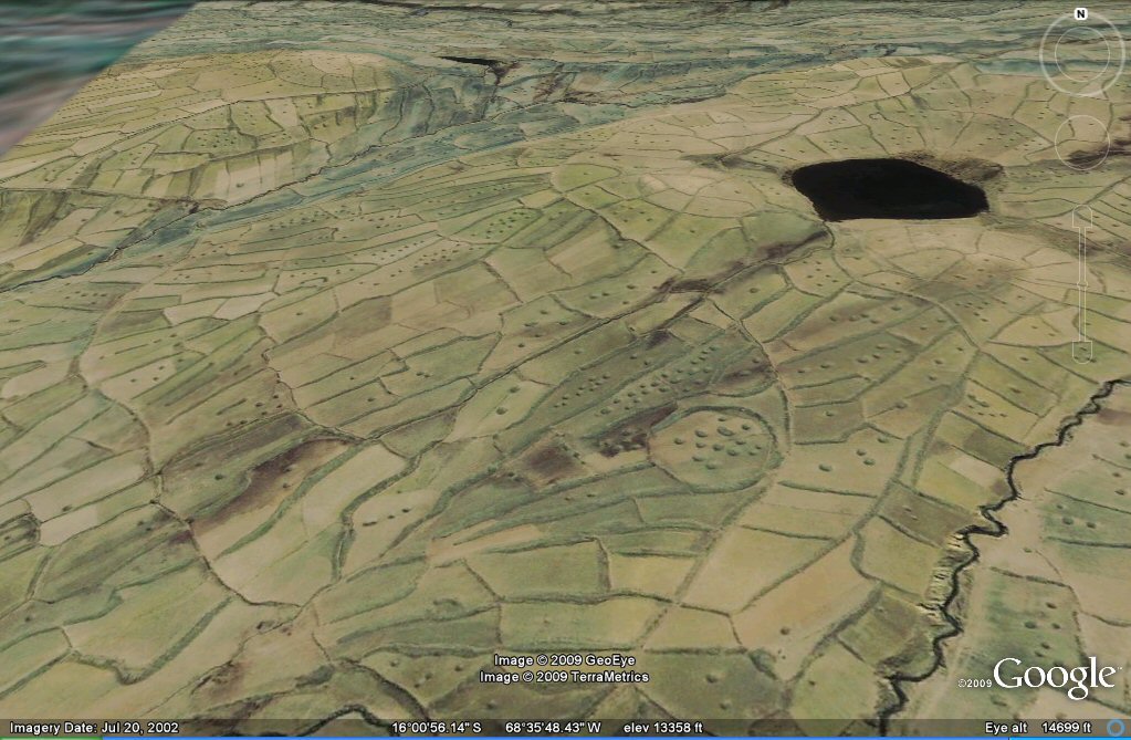
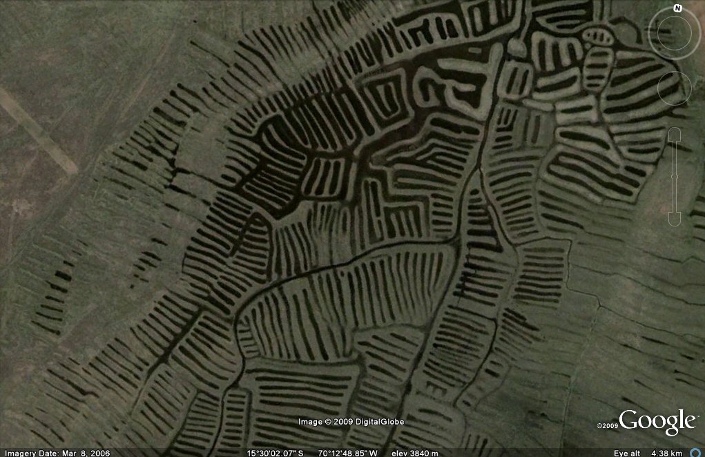
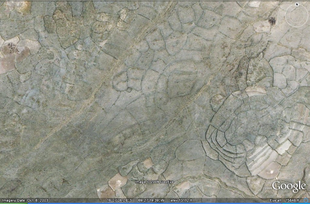
Above, oblique view shows the geoglyphs to be artificial land formations used for agricultural purposes.
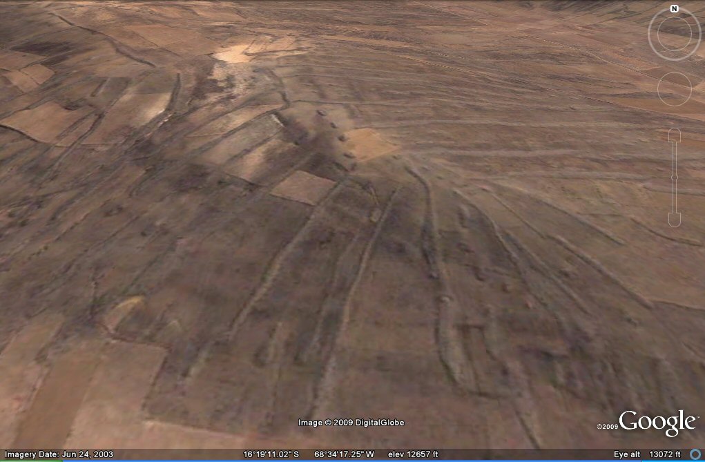
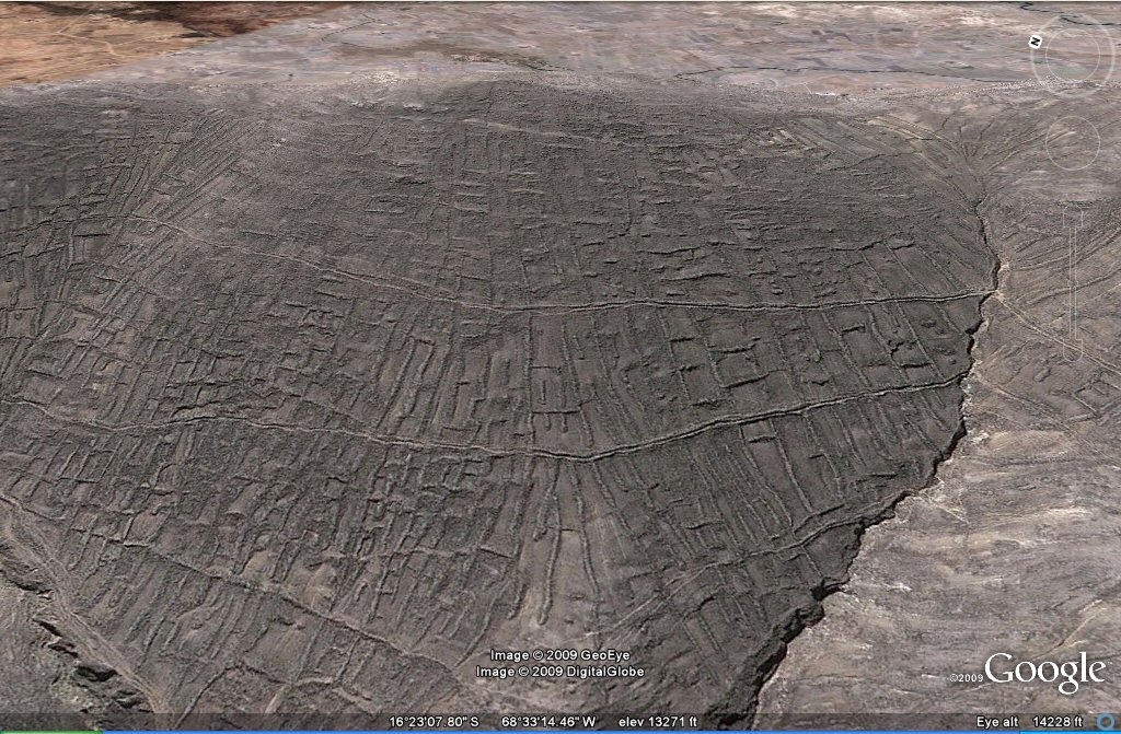
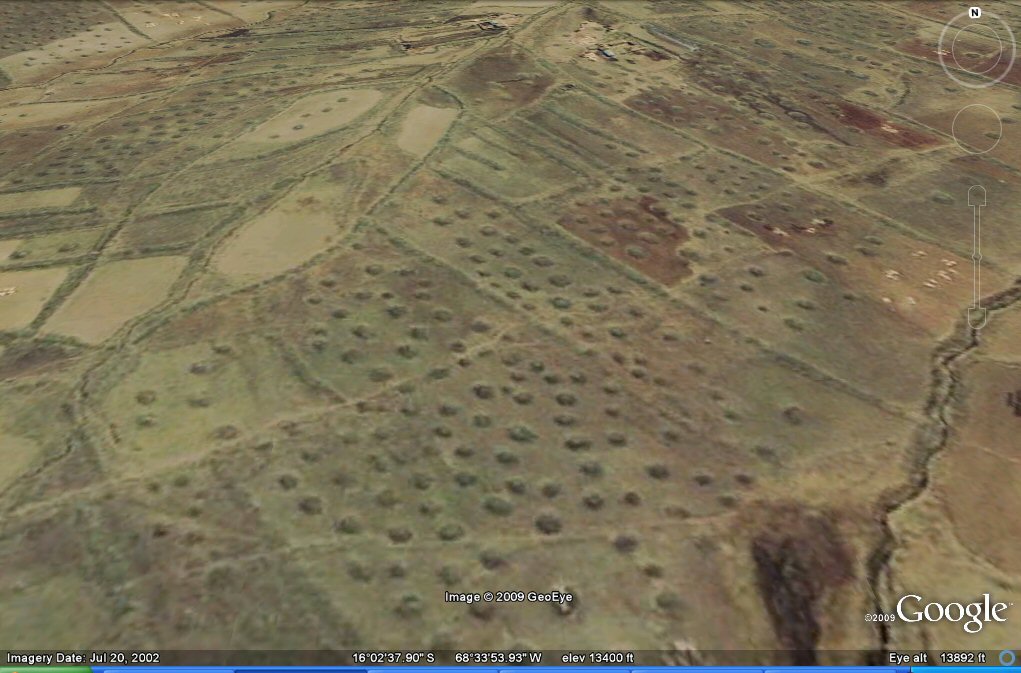
Above, close-up oblique view showing the "geoglyph" agricultural system with small mounds and
parallel embankments.
.
see geoglyphs agriculture page
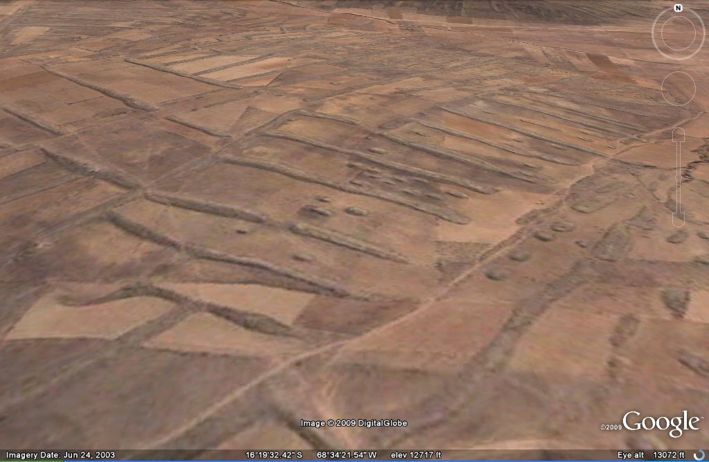
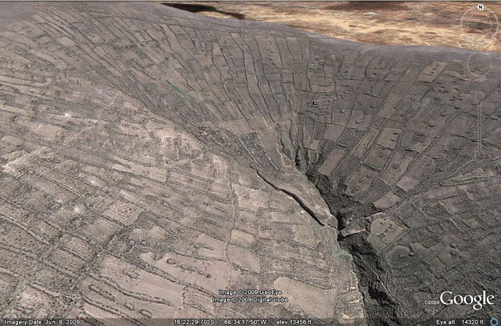
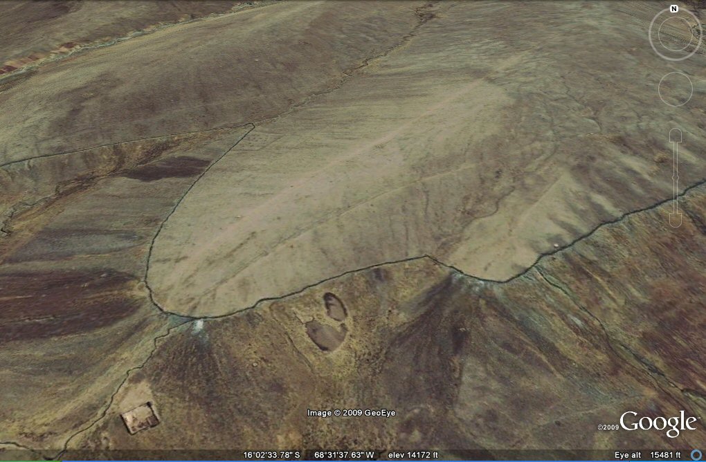
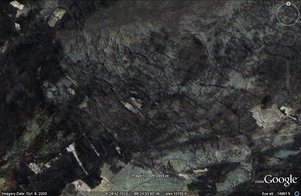
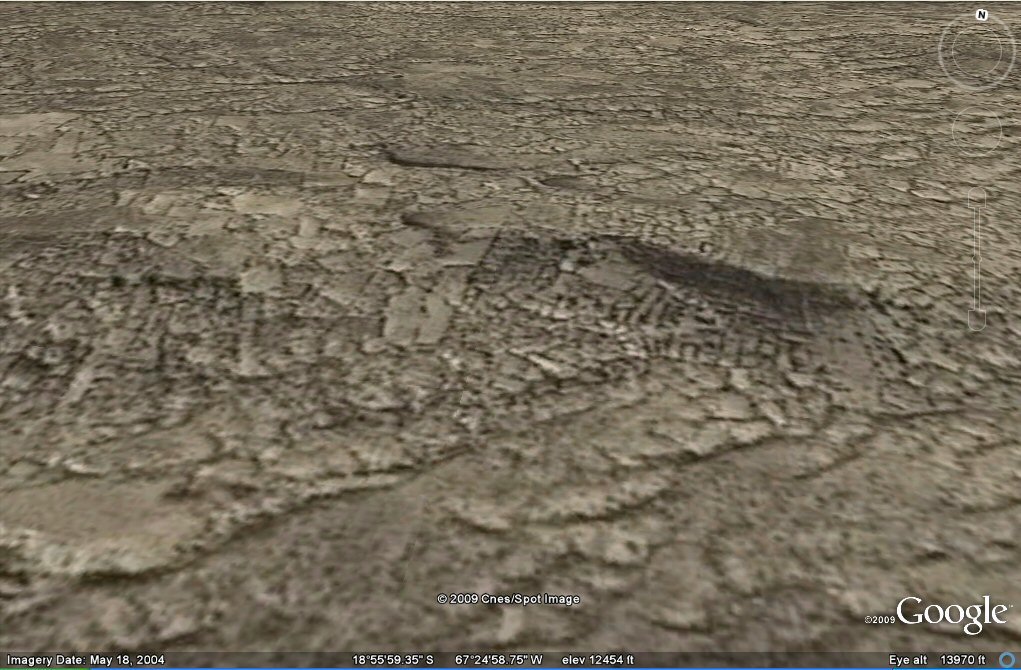
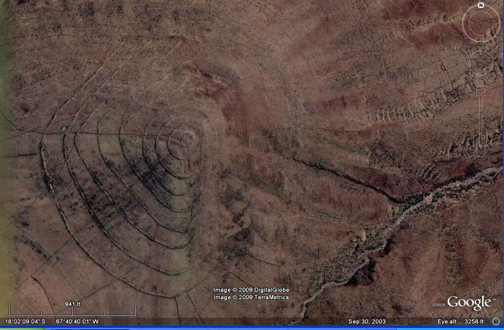
Above, high resolution close-up oblique view of another zone with this "fossilised" system of agriculture and hilltop struck by earthquakes.
Above, close-up oblique view.
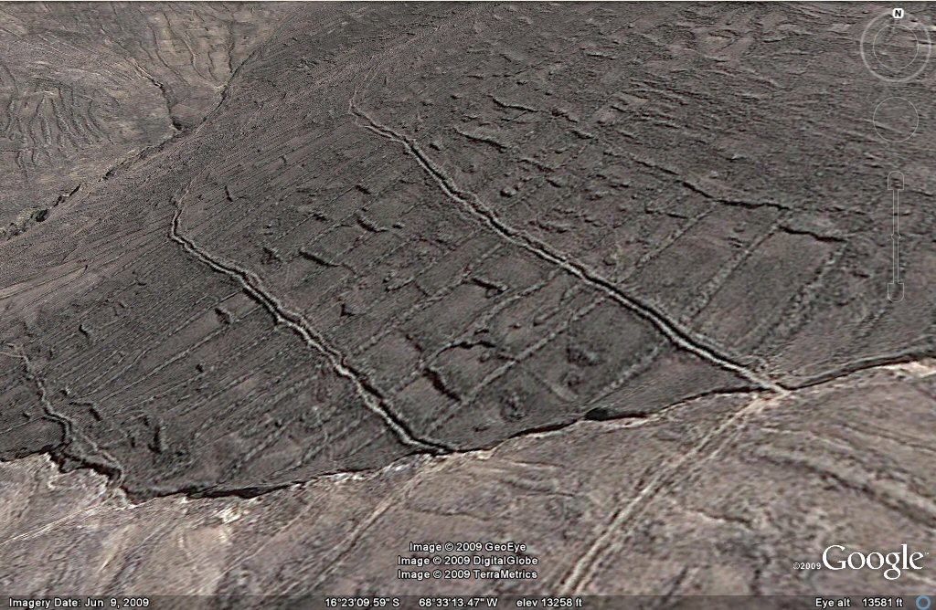
Above, close-up oblique view shows how the geoglyph field
system was supplied with water from horizontal channels fed by natural streams.
Above, close-up oblique view shows stream feeding irrigation channels.
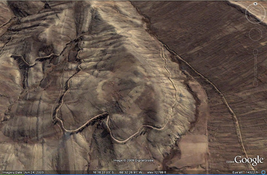
Above, an irrigation canal winds its way along the contours.
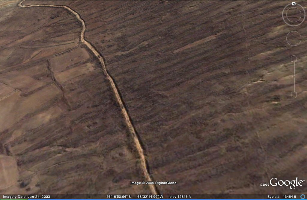
Above, this canal from a later period winds its way through
the "geoglyphs" or disused ancient agricultural patterns on right of photo.
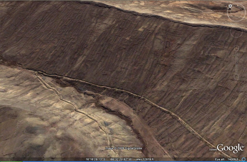
Above, close-up of the canal winding its way through the "geoglyphs" or disused ancient agricultural patterns.
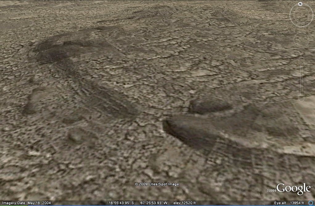
Above, the "geoglyph" agricultural system appears ancient and eroded here in this oblique view.
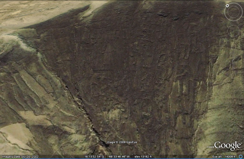
Above, this close-up shows damage and erosion after earthquakes in this oblique view.
Above, close-up oblique view showing remains of ancient terraces with probable earthquake damage.
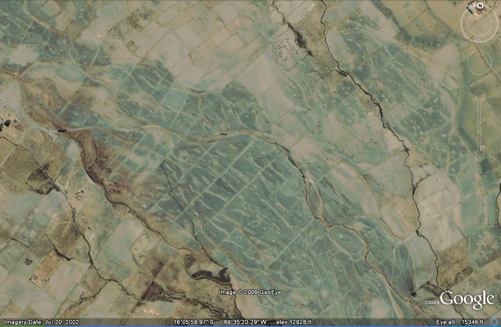
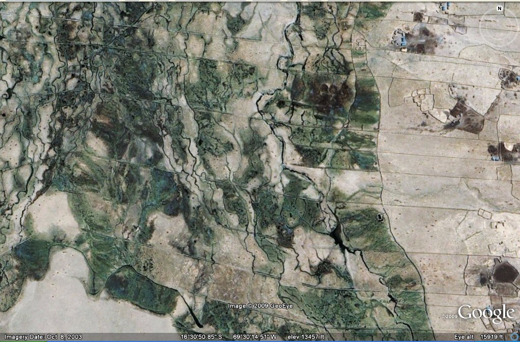
Above, in the same zone south-east of Lake Titicaca, some parallel canals for agriculture, now disused.
Above, in the same zone south-east of Lake Titicaca,
some irregular field boundaries.
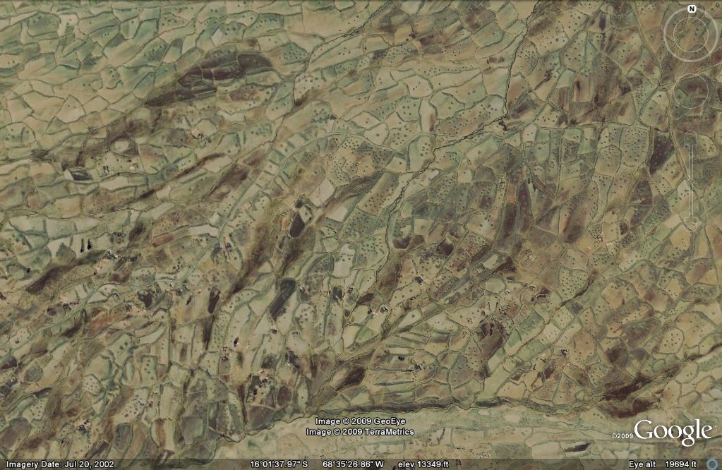
Above, close-up of some irregular field boundaries.
Above, some irregular field boundaries oblique view.
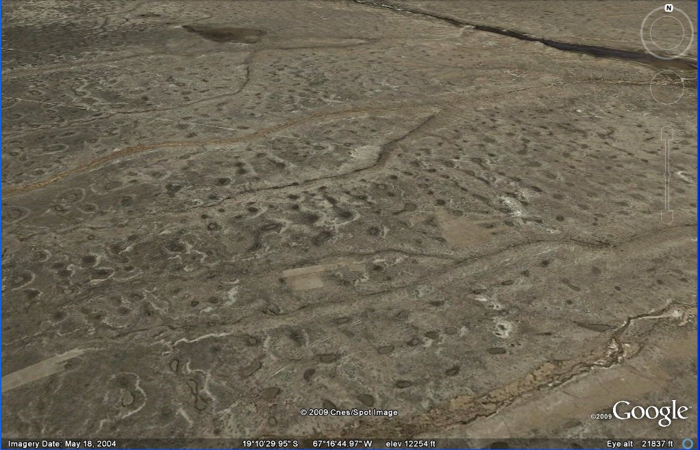
close-up of more "geoglyphs" or landforms in the same zone south-east of Lake Titicaca.
Above, this irrigation channel follows the contour around the mountains.

Above, still in the zone south-east of Lake Titicaca, some straight canals where the terrain is more suitable.
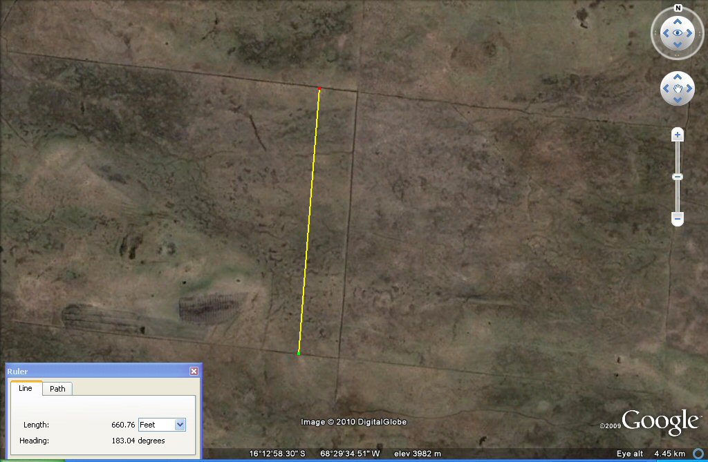
Above, the two horizontal parallel canals are 1 x furlong or 660 feet or about 200 metres apart
and they form plots of 200 x 250 metres
or 400 x 500 Sumerian cubits. Dating is important to establish which unit of measurement was originally used, see below.
Above, an underlaying system of canals forms a chequerboard pattern with squares of 600 sumerian cubits or
200 metres.

Above, the underlaying canals form blocks of 600 Sumerian cubits or 300 metres. It can be seen on this photo where older canals have been redug in modern times.
The metre was adopted by the French academy of Sciences
for universal use in 1793, so if these canals are more recent than 1793, or are modern, they could have been
set out in metres, however if they are pre-Columbian then they are probably set out in "Sumerian" cubits of 19.8" whilst if they date from after
the time of the Spanish Conquest they could still be in "Sumerian" units such as cubits and furlongs since these were also brought over by
the Spanish as the old Spanish vara was in fact the "Sumerian" yard of 33.0". Each block is 600 Sumerian cubits or 360 Sumerian yards square.
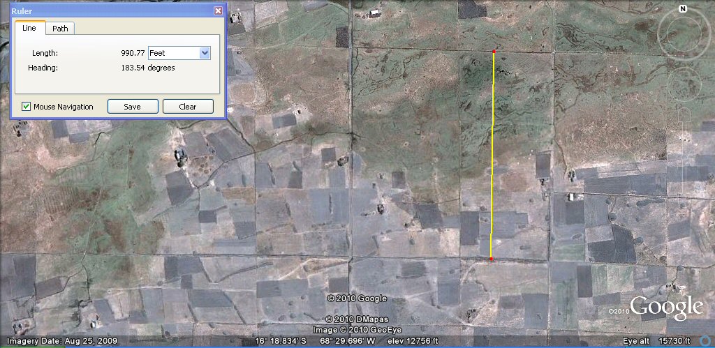
Above, the underlaying canals form blocks of 600 Sumerian cubits or 300 metres.
Above, close-spaced parallel canals in the same are, now disused.
Above, an example of the "sukakollus", irregular raised fields surrounded by water channels, now disused.
Above, some straight channels appear to have been built over with sukakollus while some of the sukakollus
are being eradicated by imposition of straight channels, hard to tell from the photo which is the later.
Above, sukakollus in region just north of Lake Titicaca.
Above, some parallel canals, now disused, in the region south-west of Lake Titicaca.
See Canals Peru page
contour-like irrigation channel patterns.
See Contours Peru page
Above, some irregular field boundaries, in the region south-west of Lake Titicaca.
Above, some irregular field boundaries, now under water, in the region south-west of Lake Titicaca.
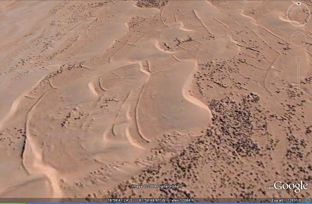
Above, these irregular sand formations IN THE LAKE POOPO AREA NEAR ANDAMARCA
may conceal irregular field boundaries, similar to those seen above in the Titicaca region
Above, oblique view showing irregular formations near Andamarca, Lake Poopo
which may conceal irregular field boundaries, similar to those seen above in the Titicaca region.
Above, oblique view showing irregular formations near Andamarca, Lake Poopo
which may conceal irregular field boundaries, similar to those seen above in the Titicaca region.
Above, oblique view showing old walls now beneath sand dunes on the edge of the Salar de
Coipasa, west of Andamarca, Lake Poopo region.
Above, oblique view showing artificial fish ponds with interconnecting channels near
Pampa Aullagas, Lake Poopo.
Above, landforms north of Oruro.
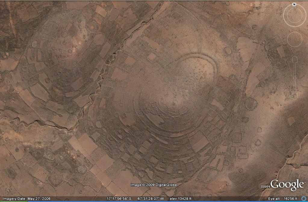
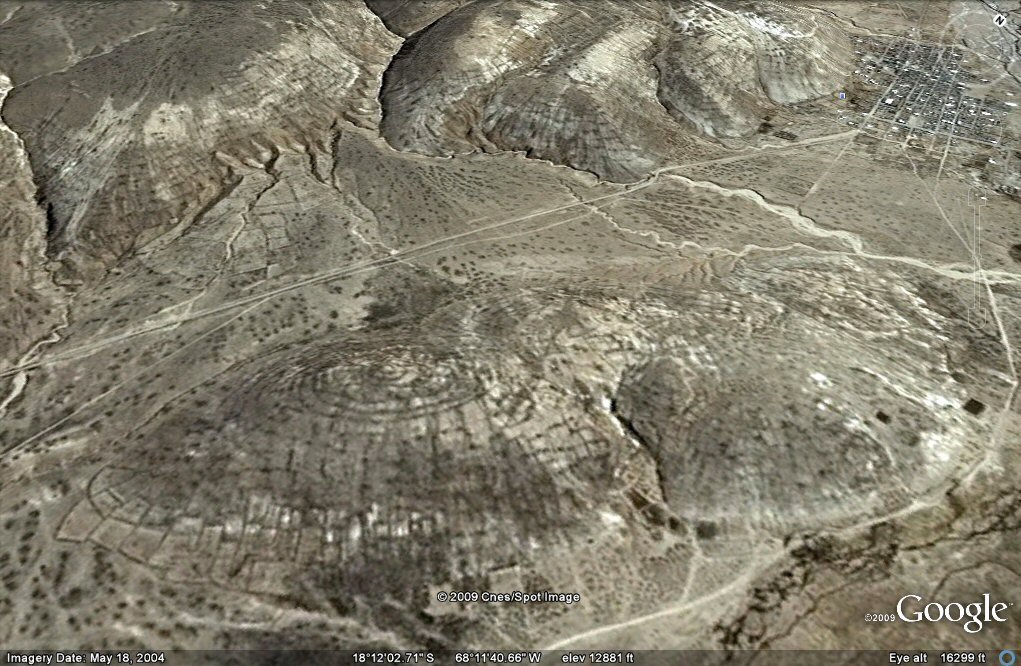
Above, oblique view of ringed hilltop with eastern half destroyed by earthquakes,
sw of Oruro, Lake Poopo zone.
The rings are remains of concentric ancient irrigation channels or walled terraces with stone walls for the enclosure of animals built alongside them at a later period.
Above, concentric enclosures north of Oruro. The rings are walled terraces and the site is similar to Chankillo in Peru.
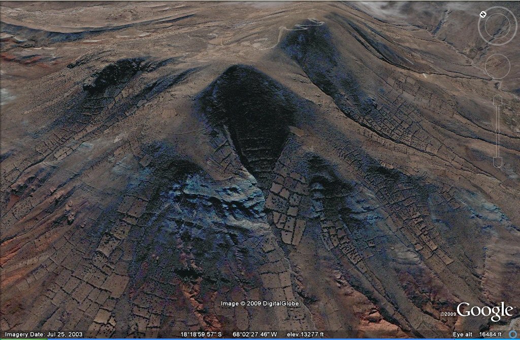
Above, fields on mountainside, oblique view near Turco/Carangas, Lake Poopo zone.
Above, oblique view ringed hilltop near Turco, Lake Poopo zone.
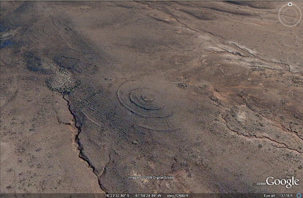
Above, oblique view ringed hilltop with earthquake damage south of Turco, Oruro/Lake Poopo zone.
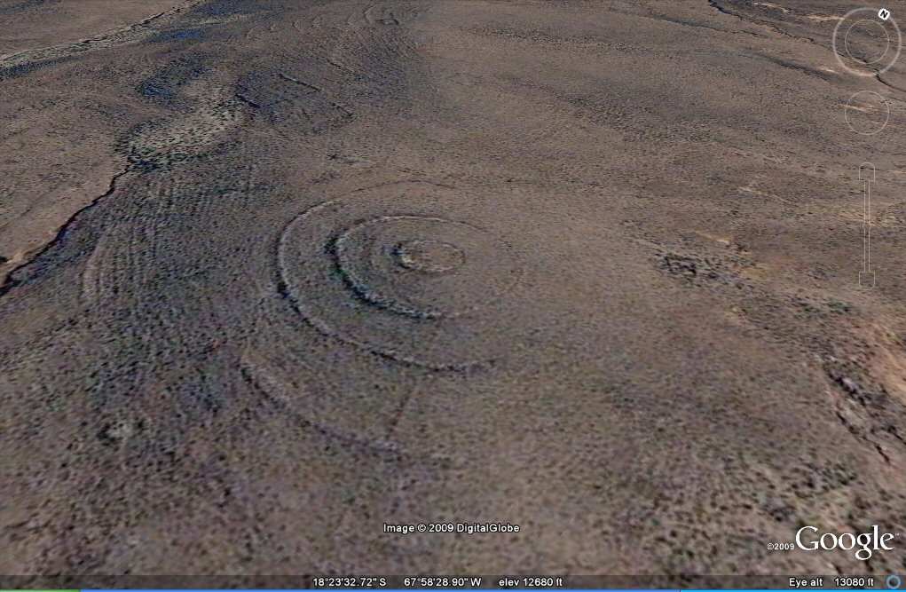
Above, close-up oblique view suggests that these rings are remains of concentric
ancient irrigation channels but in an onsite visit, only concentric walls could be seen. Hilltop south of Turco, Oruro/Lake Poopo zone. The surrounding terraces have been destroyed by earthquakes.
agricultural variations on the Altiplano
geoglyph fossilised agriculture
ringed hilltops
earthquakes
contour forms/irrigation Peru
contourforms/irigation Bolivia
Bombo earthquake route
Bombo route oblique views
Paria, Oruro containment canals
canal to sea (lago UruUru)
Pantanal
Beni, Moxos gallery
rio Paraguay levees canals
rio Parana canals, ponds and islands
rio Parana delta canals
Corrientes
rio Amazon to Manaus
rio Amazon west from Manaus
rio Orinocco to Amazon canal
canals on the Louisiana seaboard
Tabasco, Mexico canals gallery
flooding dates on the Altiplano
Atlantis stones gallery
Teotihuacan measuring unit
Teotihuacan citadel measuring units
Chichen Itza and El Castillo measuring units
Monte Alban, measuring units
the Tiwanaku soli-lunar calendar
the Muisca calendar
Lost Calendar of the Andes
Decoding the quipu mathematics
webatlantis@hotmail.com