cover illustration "Land without evil,
Utopian Journeys Across the South American Watershed ",
Richard Gott Verso Books; 1st edition (23 Dec 1992)
This page follows on from examples of canals and ponds in the Paraguay river which also included an explanation about levees and examples of canals and ponds in the Parana river.
This page looks at similar channels along the banks of the rio Amazon. Although Google earth satellite images cover most of South America, it is only faily recently that high resolution images have become available and only for a limited number of areas, however such imagery gives an amazingly clear view of certain terrains and reveals details that previously were undetectable.
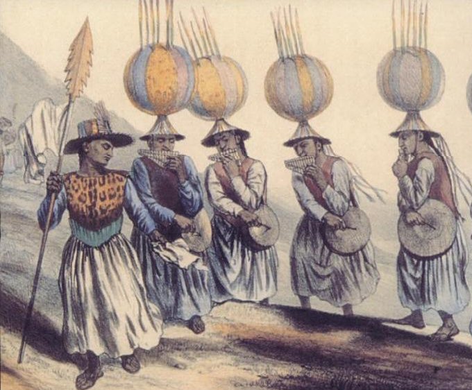
"The first Europeans to penetrate the Amazon basin was a Spanish expedition led by Francisco de Orellana in 1542. Hoping to find the fabled lands of El Dorado and La Canela, Orellana and his men set out from Quito, Ecuador, and descended the Napo River to its confluence with the Solimões, the Amazon’s upper section, and continued down the river for 1500 miles to where it pours into the Atlantic. At that time, several million people were living in the Amazon Valley. They belonged to some two hundred tribes and ethnic groups in four linguistic families— Gê, Tupi, Carib, and Arawak. Starting with the Omagua, an intelligent, orderly people of the Solimões, who farmed river turtles and wore cotton robes, the expedition passed one prosperous community after another along the banks of the river. So rich were the resources of the várzea, or floodplain, that some of the close-packed lines of houses went on without interruption for days, and the level of civilization of some of the riverine tribes was on a par with the Incas’, although the materials they built and worked with were perishable, and few artifacts, besides their extraordinarily refined ceramics, survive."
cover illustration "Land without evil,
Utopian Journeys Across the South American Watershed ",
Richard Gott Verso Books; 1st edition (23 Dec 1992)

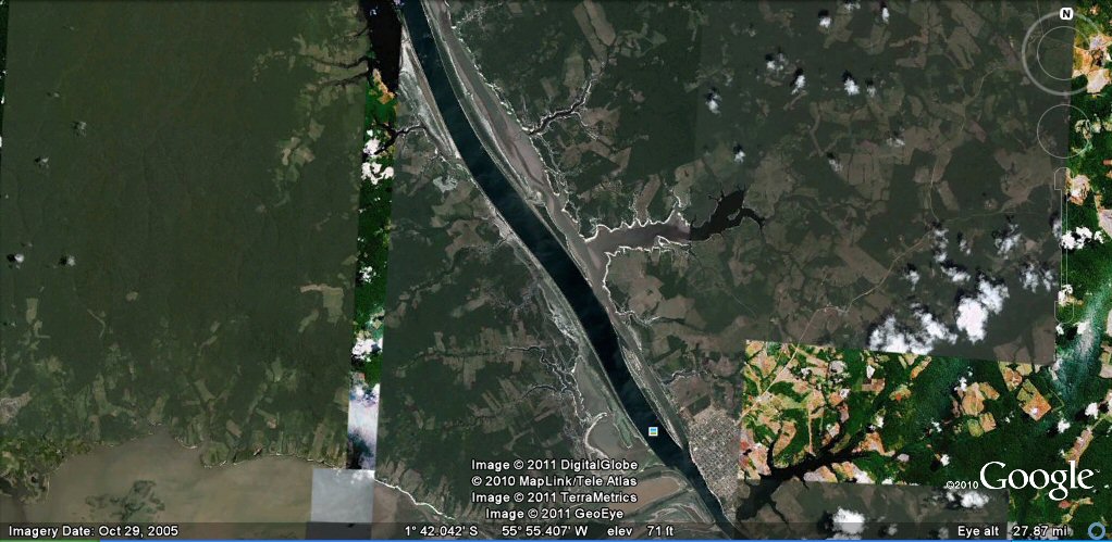
the rio Amazon to Manaus
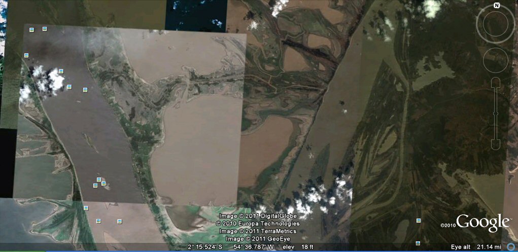
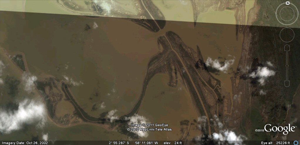
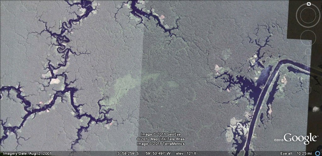
A general view of one of the regions of the Amazon covered by high resolution imagery
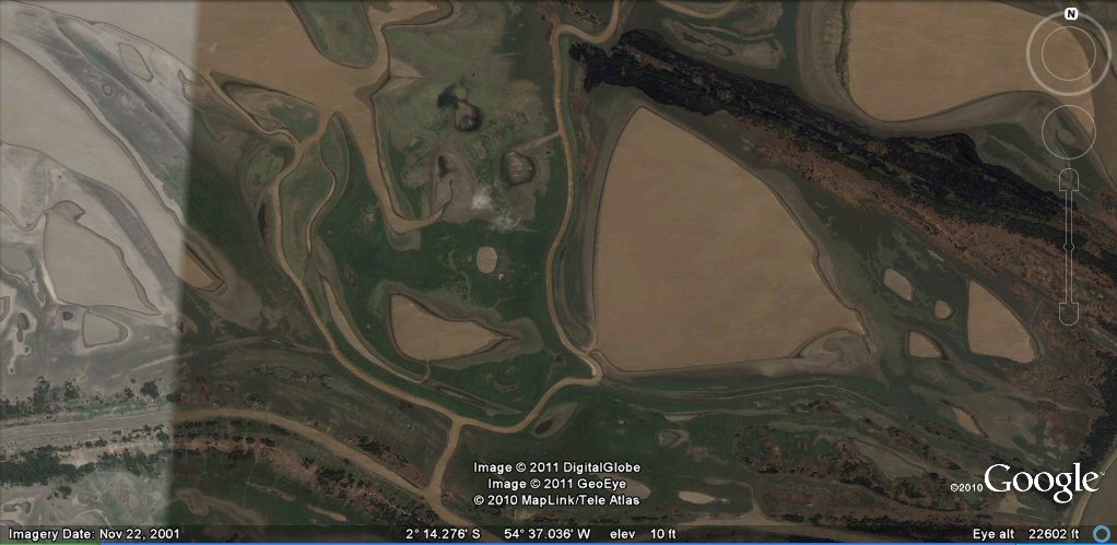
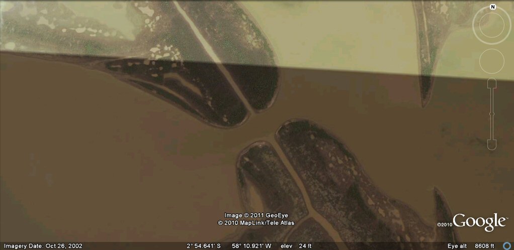
When we zoom in, we begin to notice that the ponds have an "artificial" feel to them,
such as the arrow head shaped pond on the right which is similar to ponds seen in the Beni region of Bolivia.
Another pond similar to those in the Beni. We begin to notice that many ponds are
linked by interconnecting channels and also supplied with water by what look like artificial feeder
canals. The above pond is supplied by a curved, entry channel diverting water from a natural channel.
That natural channel then ends where it has been cut across by a feeder canal running around the site.
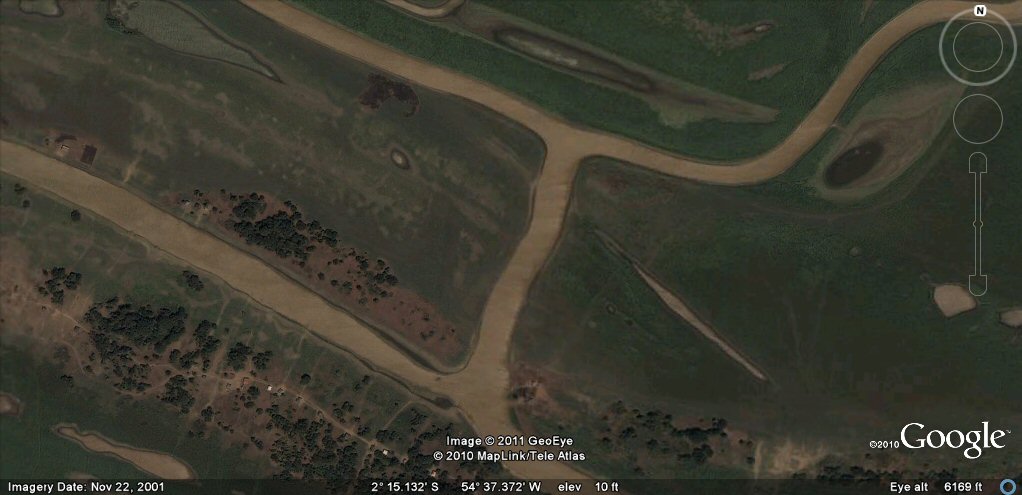
We also notice that these feeder canals run around entire comlpexes of ponds
and interlink with other canals and channels.

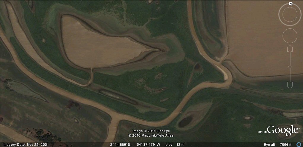
We notice that standard measurements are fairly common,
with canals often being 110ft which is 100 Sumerian feet wide.

Underneath the arrow shaped pond above, we notice a dried up canal.
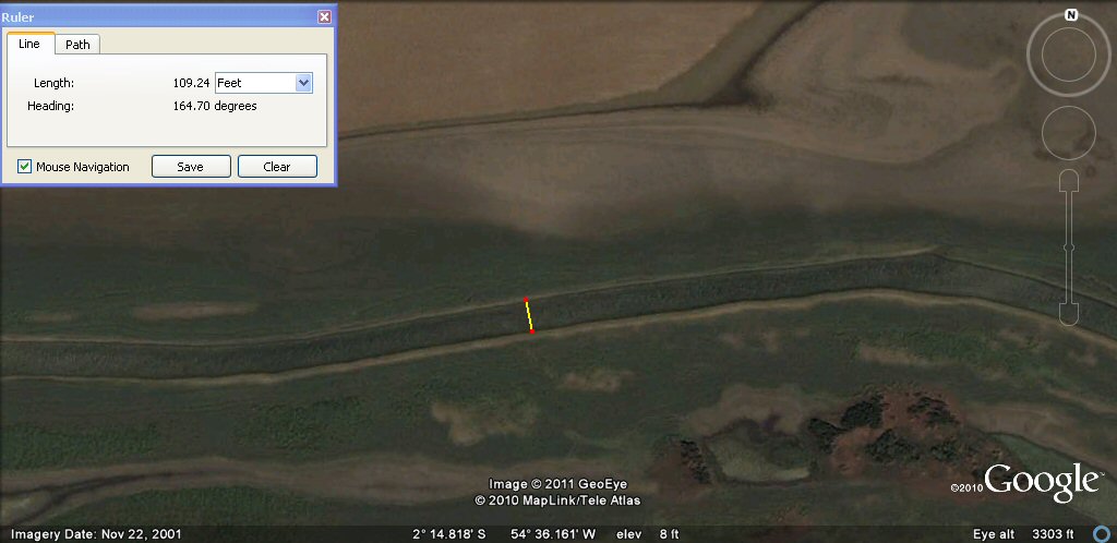
It also measures about 110ft or 100 Sumerian feet.

beneath this channel we notice another parallel canal.
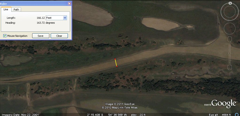
This time it measures about 165ft which is 100 Sumerian cubits another common measurement for these channels.

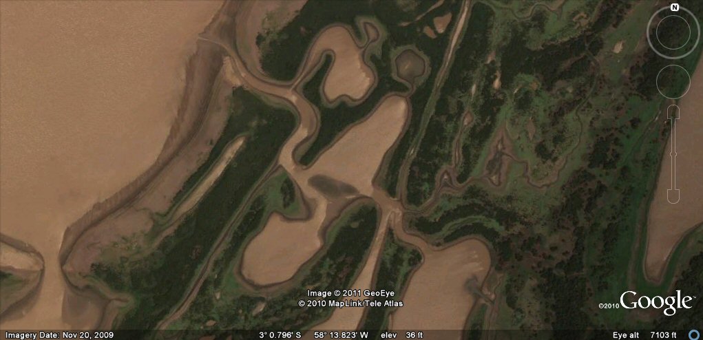
Another complex of canals and ponds.
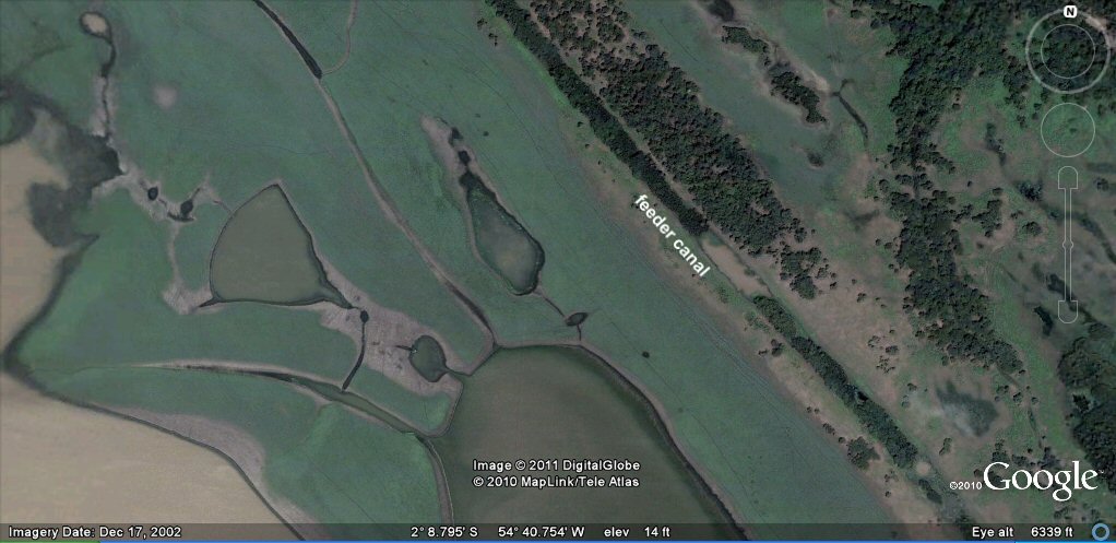
The ponds are interconnected by small channels and a a feeder canal passes nearby.

We can measure the feeder canal and it is about 165ft or 100 Sumerian cubits wide.
This pond is about 1650ft or 1000 Sumerian cubits wide.

This channel is about 100 Sumerian yards wide.
It is common to find round numbers in either Sumerian feet, cubits or yards.

Another complex of long natural channels originally formed by successive deposits from alternating river levels.
Looking closely we can see how the system works. Channels are cut transversely across the ponds so that water can be fed to them from the main river source.
Ponds fed by tiny channels from feeder canal..

a night on the lagoon..
a rather regular piece of river...

Measures about 4400 English feet which is 4000 Sumerian feet or 800 Sumerian double yards...

Another canal section of about 1100 English feet which is 1000 Sumerian feet....

This section of about 330 English feet would be 300 Sumerian feet or 200 cubits or half furlong....

It is little known that the Amazon regularly floods, covering vast areas with water...

Transverse channels connecting two systems are common, like this one.

Example of long natural channels formed by accumulated river deposits being fed by an access channel from the river.
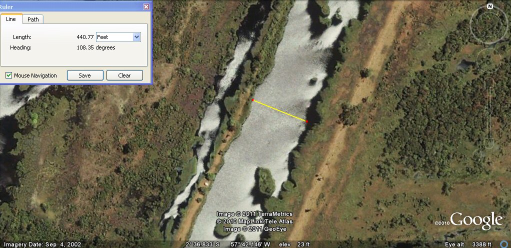
Example of channel 440 English feet or 400 Sumerian feet wide.

Example of channel 297 English feet or 180 cubits wide. Modern researchers may be struck by the
number of
measurements which come to round numbers in metres, but that may be because 1 metre is virtually 2 Sumerian cubits.
When we think in Sumerian units, we find other examples such as this one which would be around 90 metres
which would have no significance in metres, but could be significant as 180 cubits.

A feeder channel cut across longitudinal channels.
A feeder channel running around system of ponds.
It continues on the other side of a main pond entrance.

Another example.
Ponds with access channels.

a feeder channel with access cut over from main channel.
An example of natural river on the left and canalised river on the right with a right hand bend.
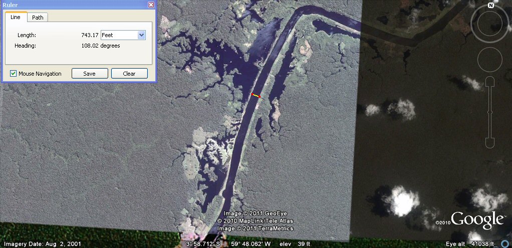
it measures about 450 cubits wide.
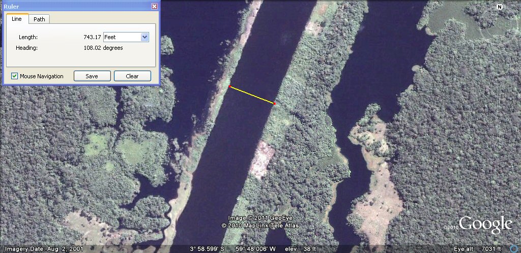
it measures about 450 cubits wide.
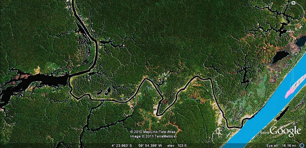
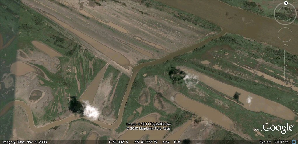
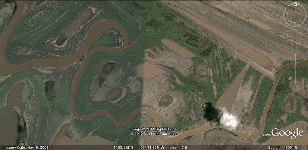
Many rivers are linked to other rivers and show signs of canalisation such as this one.

This tributary rio Aripuana off the rio Madera itself a tributary of the Amazon looks like it has been canalised.

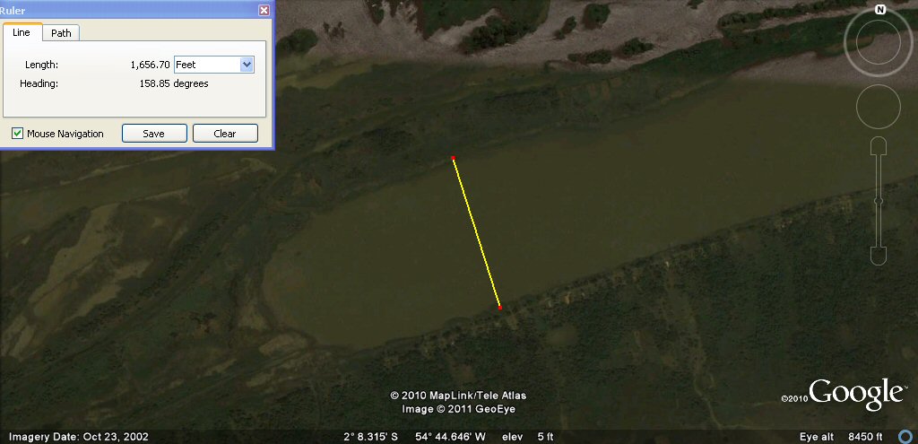
This section measures about 1110ft or 1000 Sumerian feet wide, or has the river just scoured out natural channels and built up natural levees?

This sub channel measures about 660ft or 600 sumerian feet, 400 sumerian cubits or 1 furlong.
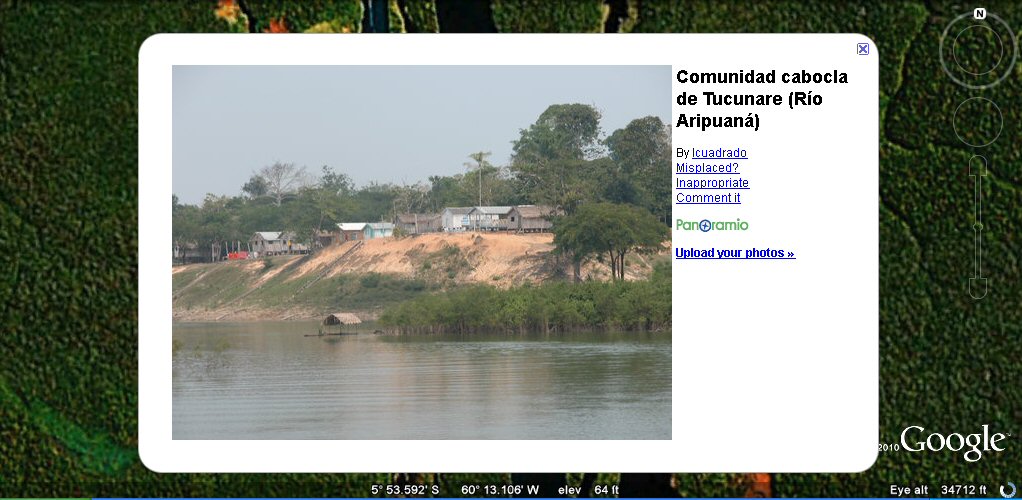
These days a few villagers live in houses along the banks of the rivers.
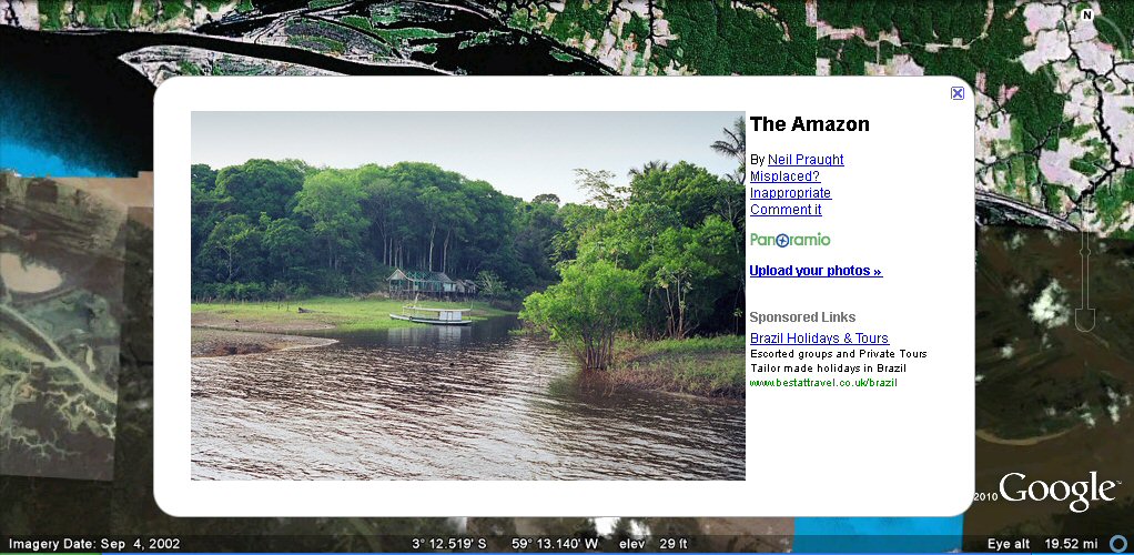
Life on the Amazon.

from "Land without evil", Richard Gott Verso Books; 1st edition (23 Dec 1992)
J.M. Allen, January 2011
webatlantis@hotmail.com
