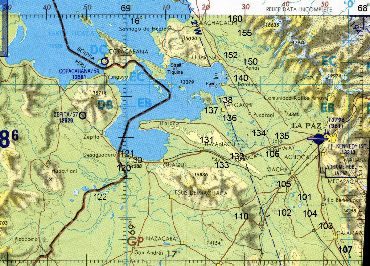
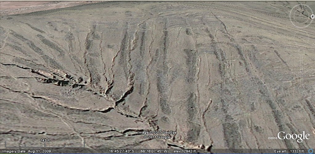
Map showing zones of "geoglyph" fossilised agricultural systems.
 Geoglyph fossilised agriculture on the Bolivian Altiplano
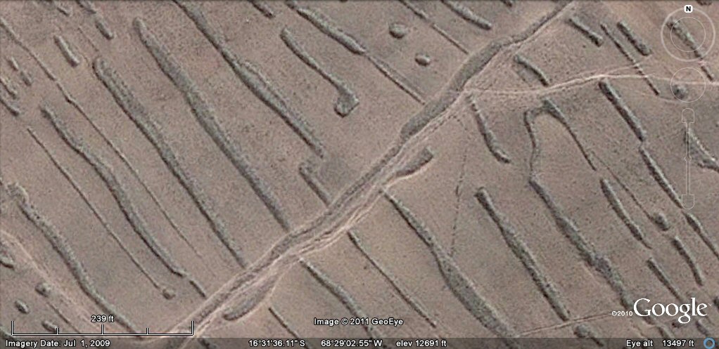
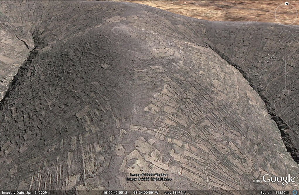
Satellite imagery of areas of the Bolivian Altiplano north east and south east of Tiwanaku shows an extensive system of long narrow embankments accompanied by small circular mounds which have been baptised as "geoglyphs" but which appear to be in fact remains of an ancient agricultural system which was brought to an end by extensive earthquakes. These "geoglyph" formations are also often accompanied by hilltops surrounded by concentric ringed irrigation channels or walls, again destroyed by earthquakes thus suggesting that an ancient and unknown civilisation was destroyed in some great cataclysm. (see earthquakes page) Many of these sites appear disused today although in some places later peoples have built walls for the enclosure of animals ("corrales") over the ancient sites.
Map showing zones of "geoglyph" fossilised agricultural systems.
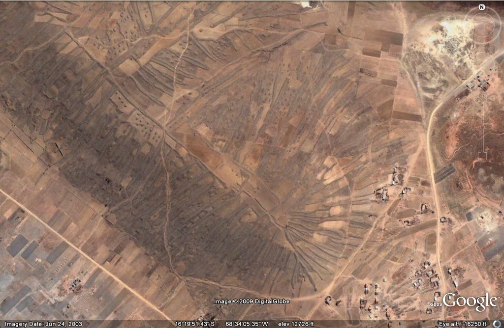
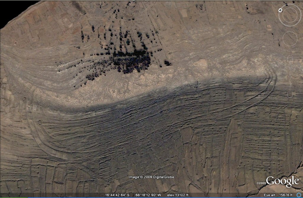
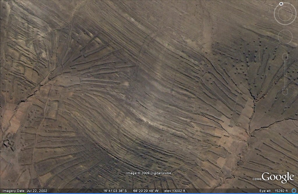
Above, zone138, geoglyphs north of Tiwanaku first brought to the
public attention by David Flynn. Although David called them "geoglyphs", a geoglyph
usually refers to a giant sized earthwork where parts of the surface have been removed to make an artistic pattern.
They may have that initial appearance today due to erosion over long periods of time, but
these patterns appear to be more probably the result of agricultural fieldworks. In many cases,
the fields which previously existed between the artificial parallel embanksments have now disappeared, leaving only the
substantial embankments themselves, which give the appearance of "geoglyphs".
These remains of a little known ancient system of
agriculture cover extensive areas north, east and south-east of
Tiwanaku.
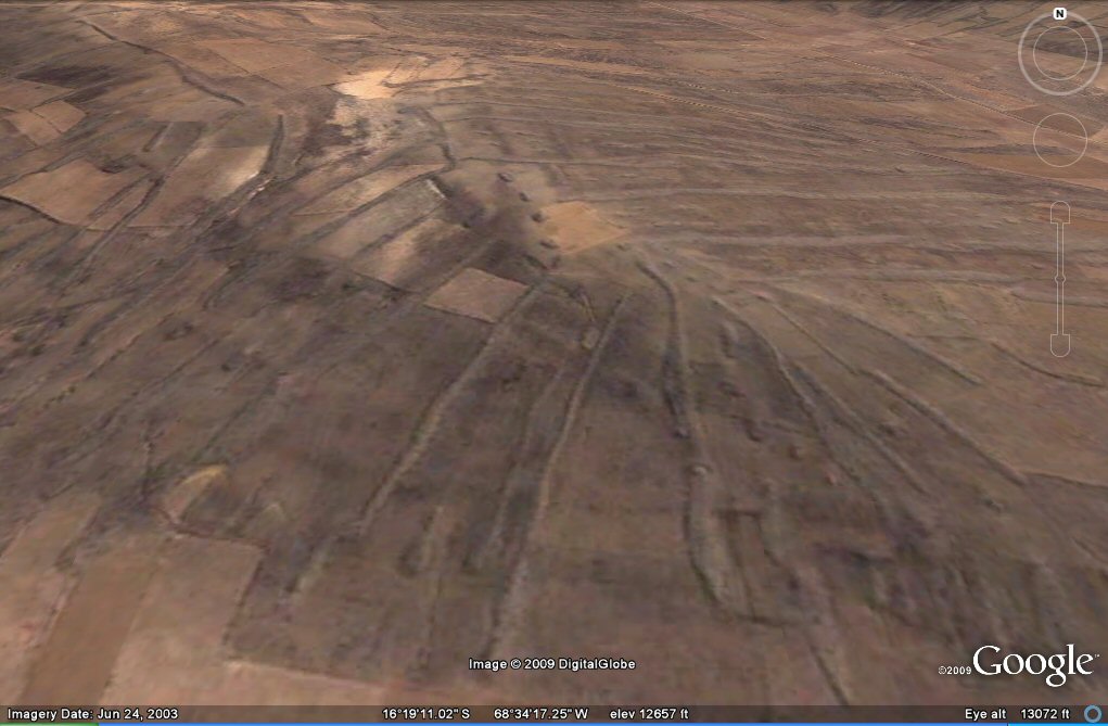
Above, oblique view shows the geoglyphs to be artificial land formations used for agricultural purposes.
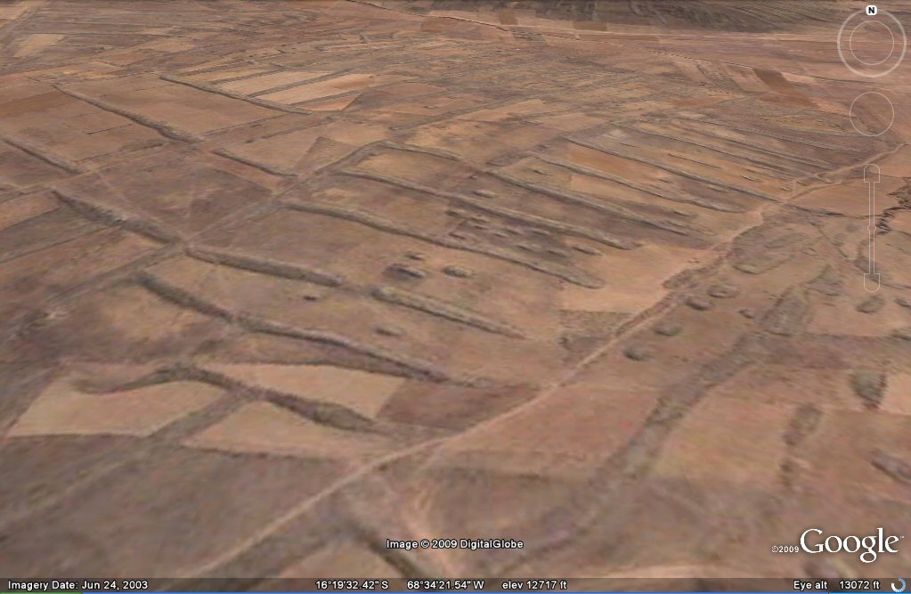
Above, close-up oblique view showing the "geoglyph" agricultural system with small mounds and
parallel embankments.

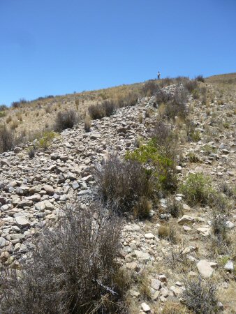
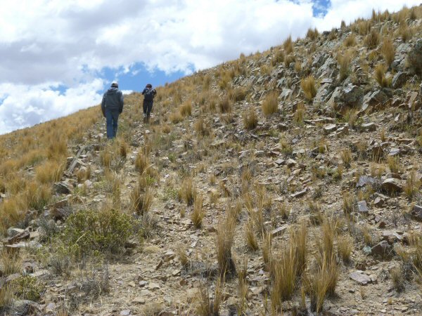
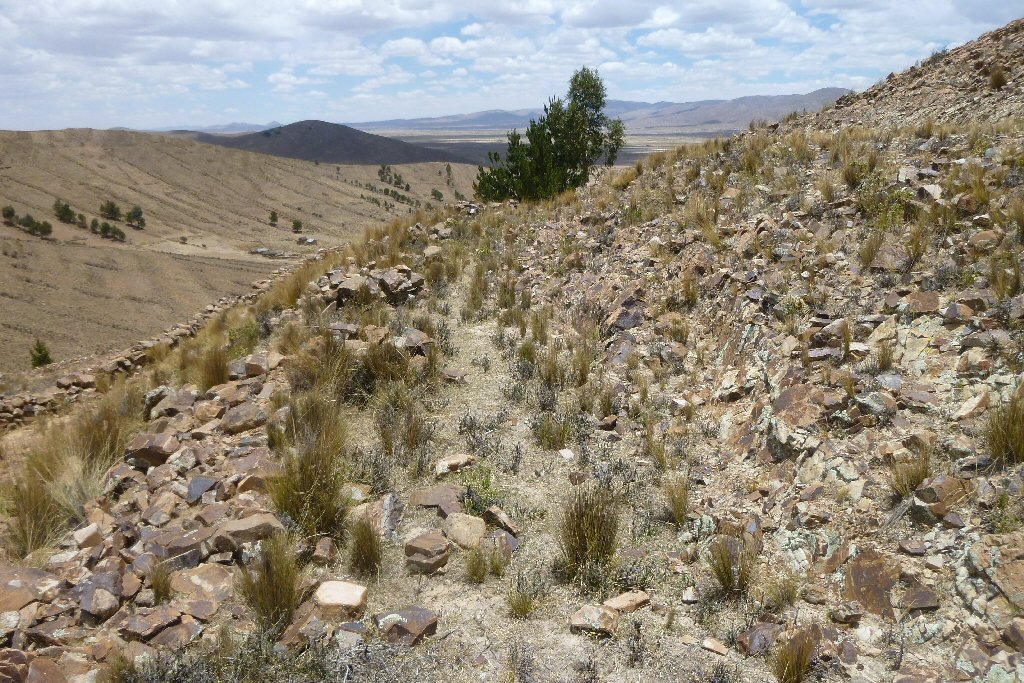
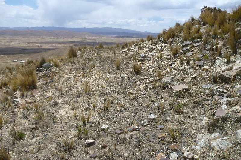
Above, ground view of previous zone of "geoglyph" agriculture.
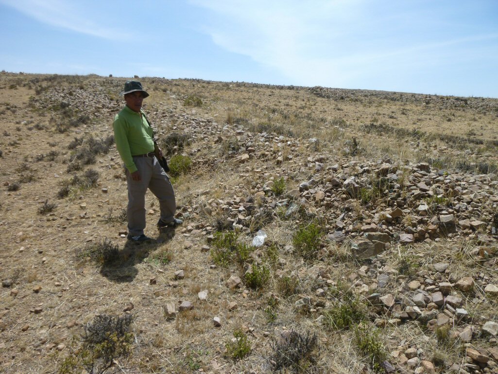
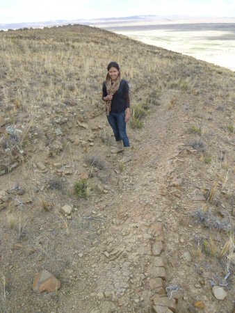
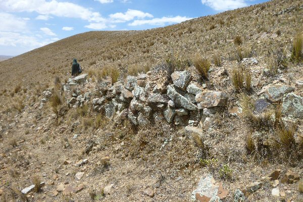
Above, Porfirio Limachi besides one of the columns of stones.
Above, Porfirio Limachi besides one of the mounds of stones.

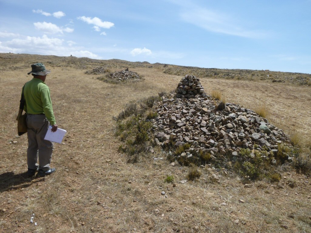
Above, the space between the stone columns was used for agriculture as in this restored example.

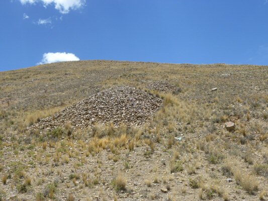
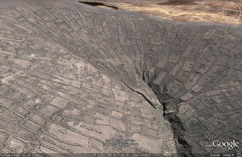
Above, 132 example of geoglyph agriculture brought to an end by earthquake. The fissures can be clearly seen amongst the embankments and mounds.

Above, 132 example of stones arranged in columns with accompanying mounds seen on preceeding photo.

Above, 132 example of restored agriculture between the stone columns. The columns help provide shelter from the winds and accumulate heat from the sun in daytime.

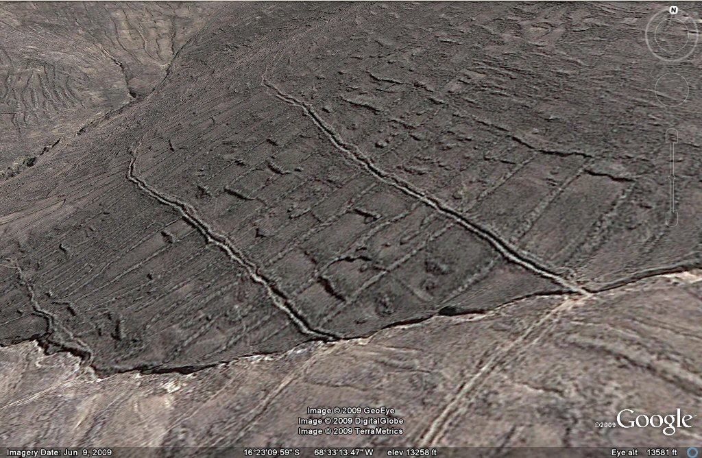
Above, 101dn close-up of north side of hill showing remains of embankments and mounds in parallel rows.

Above, 101dn close-up of north side of hill showing remains of embankments in parallel rows.
Above, 101dn another close -up view of north side of hill showing remains of parallel embankments. The fissures opened up by earthquakes can be clearly seen

Above, 101dn close-up of north side of hill, embankments are about 100 to 110ft apart.
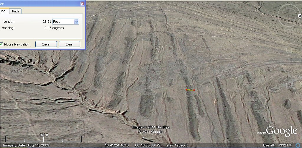
Above, 101dn this typical embankment is about 25ft wide.
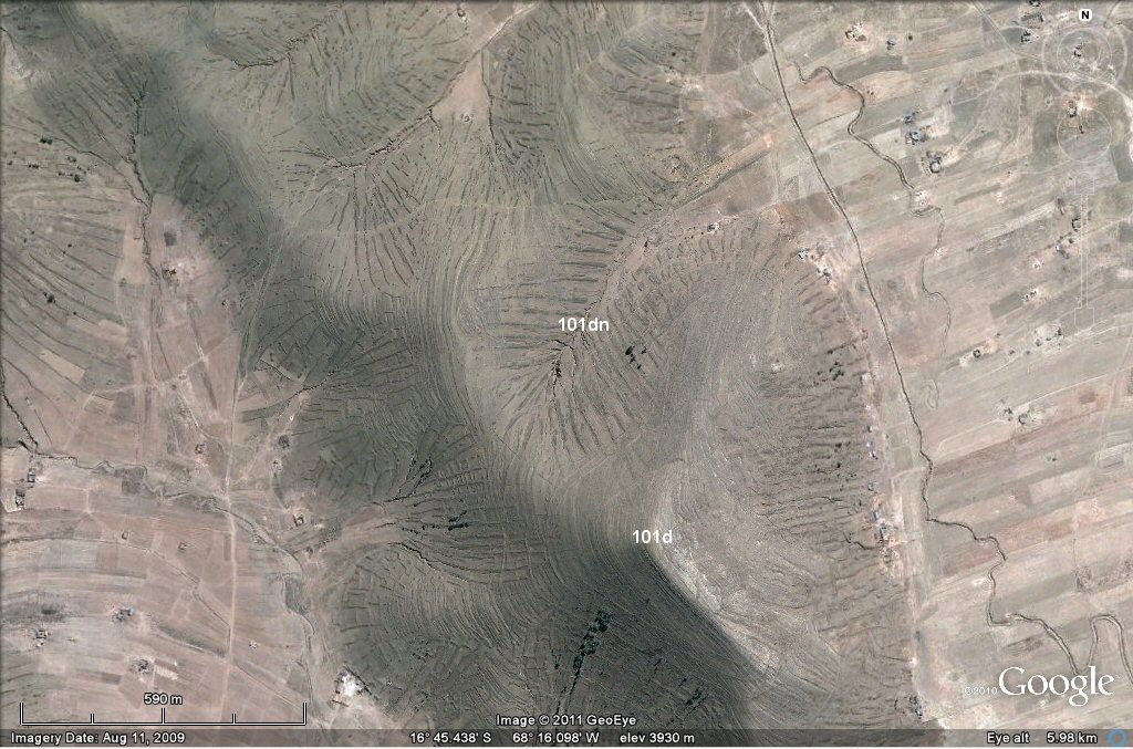
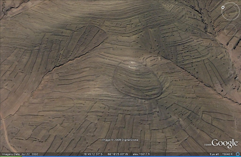
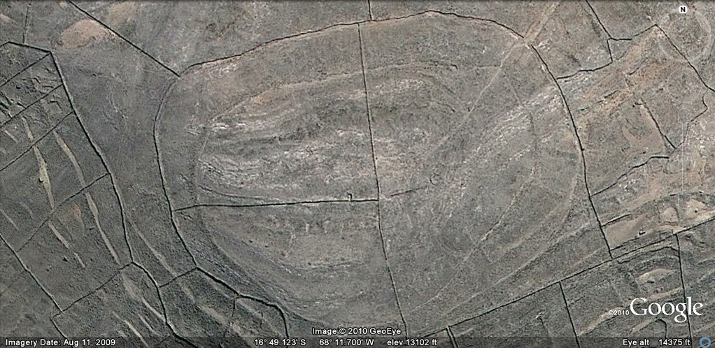
Above, zone 101d, geoglyph type of agriculture and hill with concentric rings surrounding 101d and parallel embankments at 101dn
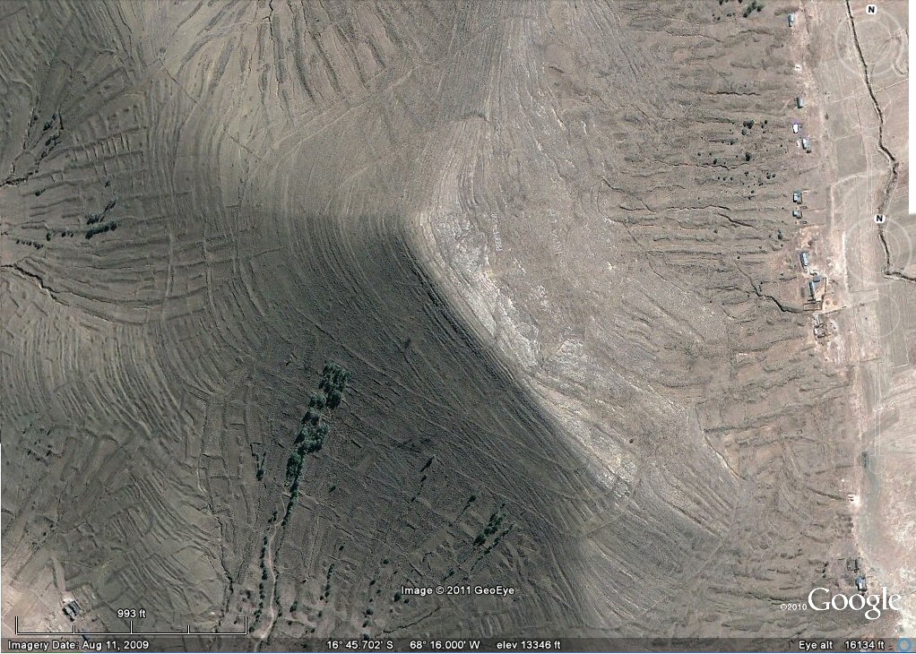
Above, zone 101d, hill with concentric rings.
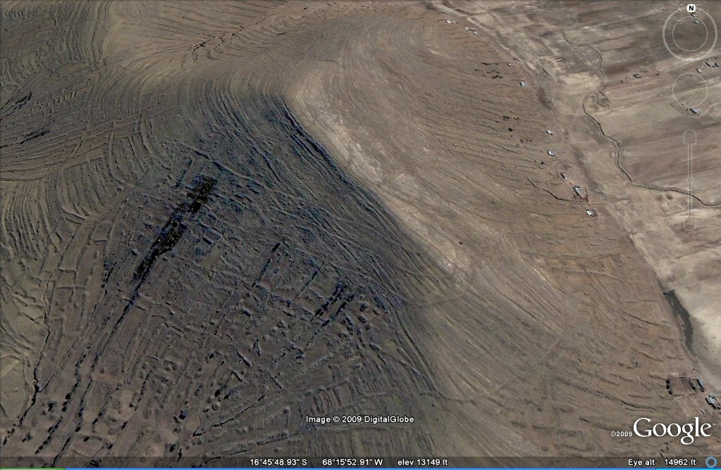
Above, 101d this oblique view suggests this mountain top originally had
concentric irrigation channels feeding the
agricultural system but they may possibly have been concentric terraces, walls or even footpaths.

Above, 101d oblique view.

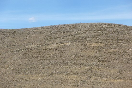
Above, the hill at 101d had vertical terracing (columns of stones) on the lower levels and horizontal terracing on the upper levels.

Above, columns and mounds of stones at above site
Above, the site had many constructed terraces as well as a type of road (left) and channel (right) both at oblique angles.

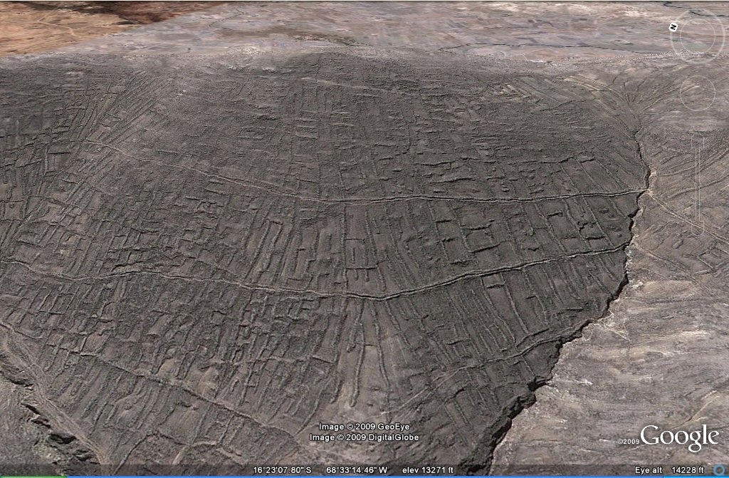
Above, 132b the satellite imagery detects remains of former embankments and mounds.
Above, 132bz others are in better condition.
Above, 138b high resolution close-up oblique view of another
zone with this "fossilised" system of agriculture and hilltop struck by
earthquakes.
Above, close-up oblique view.
Above, close-up oblique view shows how the geoglyph field
system was supplied with water from horizontal channels fed by natural streams.
Above, close-up oblique view shows stream feeding irrigation channels.
Above, 101a remains of a circular walled terrace/pathway amongst eroded
"geoglyph" agricultural system.

Above, 101a - example of the vertical columns of stones accompanied by circular heaps of stones.
Above, 101a - the circular feature turned out to be a walled terrace.
Above, 101c another example of remains of concentric walled terraces/pathways amongst eroded
"geoglyph" agricultural system.

Above, 101c eastern end example of remains of concentric ringed walled terraces amongst eroded
"geoglyph" agricultural system.

Above, 101c - ground views of above site with vertical columns of stones cleared from ground (left) and
remains of walled horizontal terraces running round the site (right).

Above, 101c - the concentric bands are remains of walled terraces which ran like pathways around the site.

Above, 101c - the terraces have reinforcing walls on the outside, forming a sort of pathway or channel on the inside.

101c - ground view.


Above, 101c - columns of stones cleared from the land forming "vertical terraces" the top soil has now disappeared leaving mostly stony ground..
Above, 105a another example of remains of concentric walled terraces or irrigation channels amongst eroded
"geoglyph" agricultural system.

Above, 101b these are concenric irrigation channels accompanied by terraces and walls.....
Above, later peoples have reoccupied this site and built enclosure walls over the
original fossilised agriculture system and what look like ringed irrigation channels or terraces
See also additional studies,
ringed hilltops
earthquakes
agricultural variations on the Altiplano
geoforms
contour forms/irrigation Peru
contourforms/irigation Bolivia
Bombo earthquake route
Bombo route oblique views
atlantis canals on the Altiplano
canals gallery
Chipaya canals gallery
canals in Peru
Caral, Peru containment canal
Paria, Oruro containment canals
canal to sea (lago UruUru)
Pantanal
Beni, Moxos gallery
rio Paraguay levees canals
rio Parana canals, ponds and islands
rio Parana delta canals
Corrientes
rio Amazon to Manaus
rio Amazon west from Manaus
rio Orinocco to Amazon canal
canals on the Louisiana seaboard
Tabasco, Mexico canals gallery
flooding dates on the Altiplano
Atlantis stones gallery
Atlantis stade - Egyptian and Sumerian cubits
Tiwanaku cubits
Peru cubits and calendar
cubits between altiplano canals
Teotihuacan measuring unit
Teotihuacan citadel measuring units
Chichen Itza and El Castillo measuring units
Monte Alban, measuring units
the Tiwanaku soli-lunar calendar
the Muisca calendar
Lost Calendar of the Andes
Decoding the quipu mathematics
J.M. Allen 30th Aug 2011, updated 30th Oct 2011.
webatlantis@hotmail.com
