the rio Parana from its junction with the rio Paraguay south to Buenos Aires
This page follows on from examples of canals and ponds in the Paraguay river before it joins with the river Parana which also included an explanation about levees.
This page looks at similar channels and artificial ponds along the banks of the rio Parana from its junction with the rio Paraguay, south to 32º 39' just north of Rosario. From 32º 40' to its delta near Buenos Aires is shown on canalsparanadelta.htm Images show canals, ponds and islands which appear to be man-made or enhanced by man to utilise the natural environment as a habitat.
the rio Parana from its junction with the rio Paraguay south to Buenos Aires

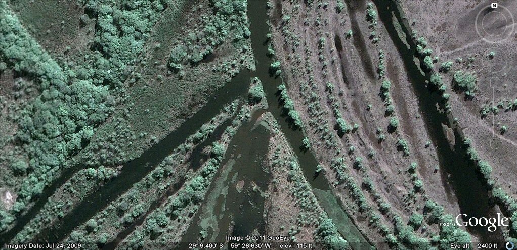
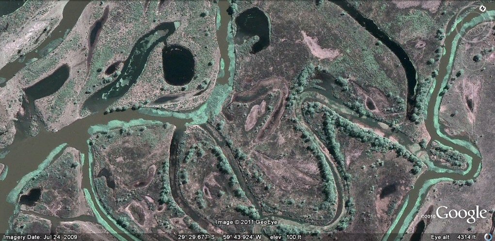
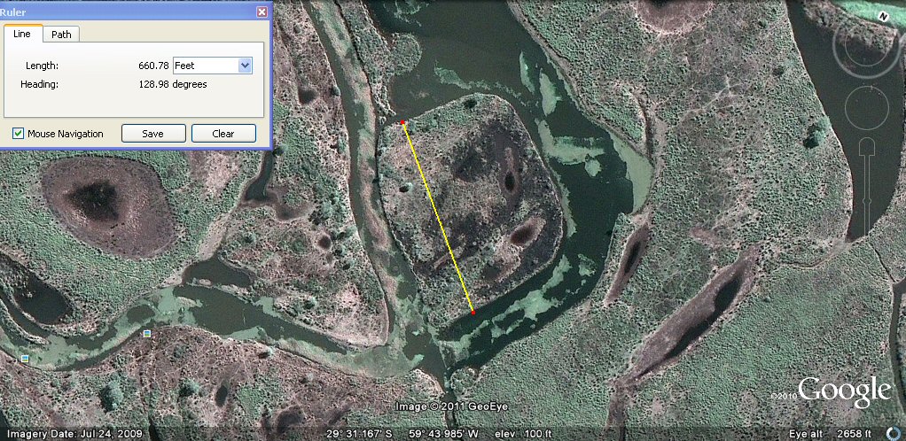
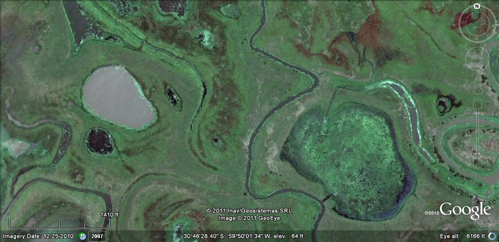
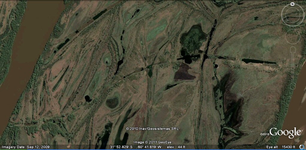
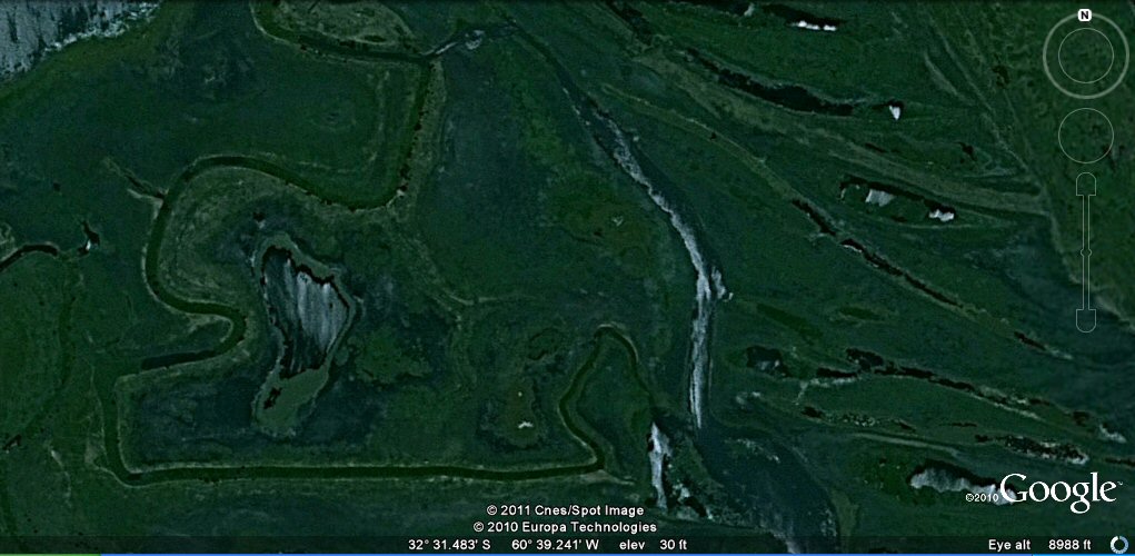
Junction of the rio Paraguay and the rio Parana. A channel from the rio Paraguay at
the top of the photo enters the land formations built up by
accumulated river deposits seen on left hand side, winds around the site and eventually
discharges into another channel from the rio Parana at the southern end. Note the large, circular lagoon.

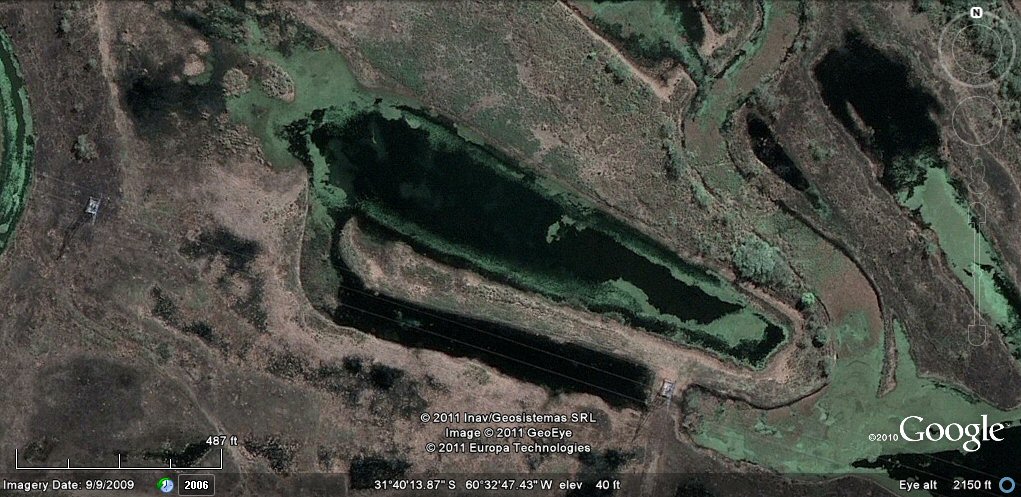
A former canal crosses diagonally the circular lagoon.
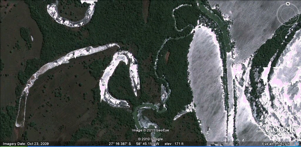
Immediately west of the circular lagoon is a complex of linked ponds whilst a feeder canal transverses the lagoon to the right.

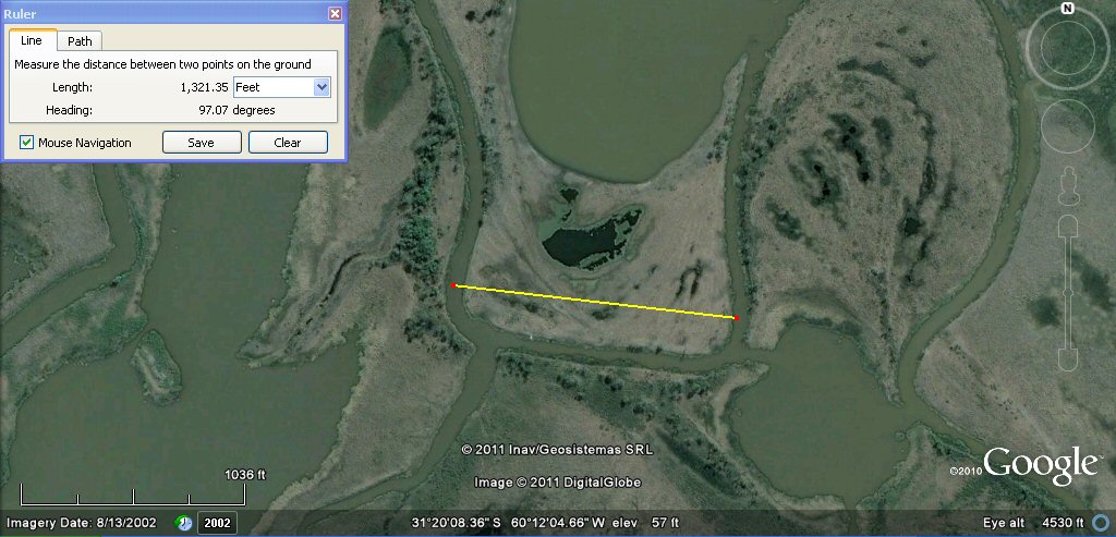
This section of canal crossing the circular lagoon measures about 165ft which is 100 sumerian cubits.

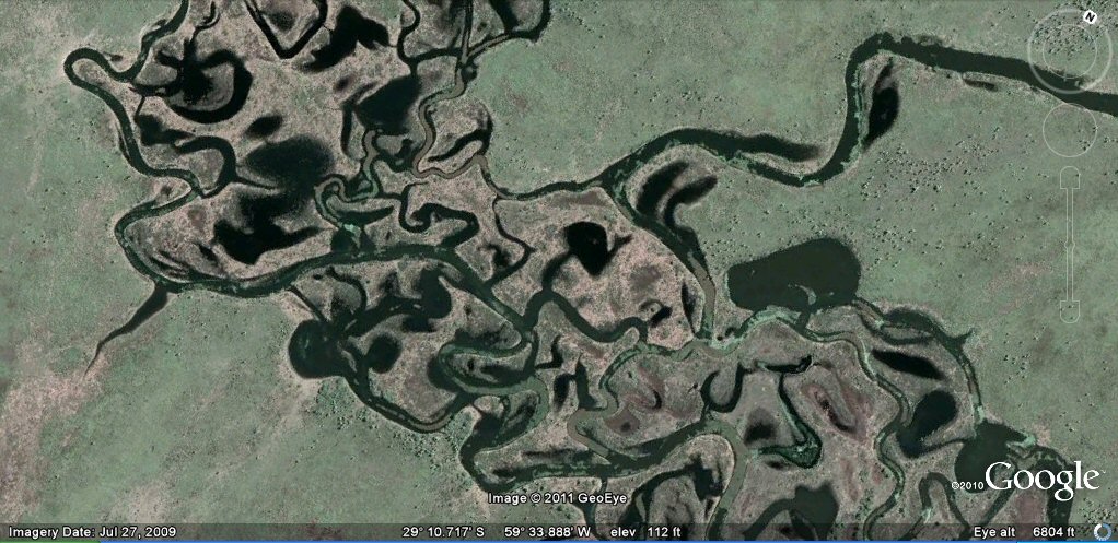
Sunlight refecting from the water shows how cuts have been made from one pond to another.

Sunlight refecting from the water shows many ponds are interlinked often with cut passages.
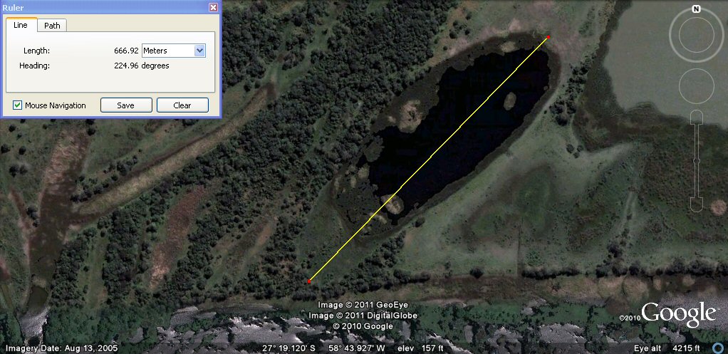
This artificial pond has a length of 400 Sumerian double yards.
one channel joins another.
a ground view of one of the channels.

a channel (top centre) is cut into by the curved feeder channel.
ponds have entry/exit channels from the feeder canals.
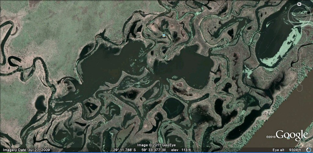
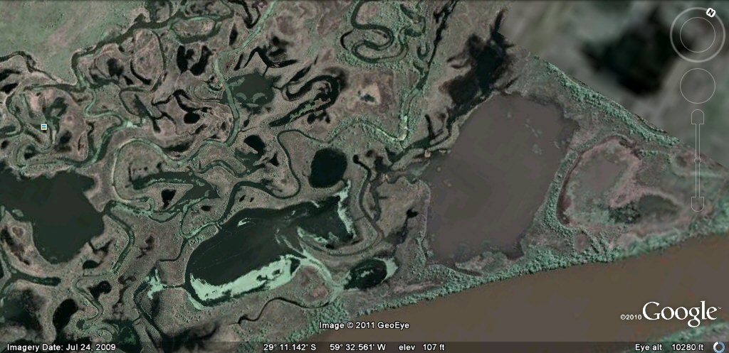
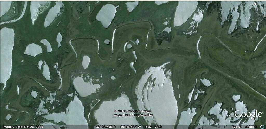
Another area of artificial ponds, islands and channels...

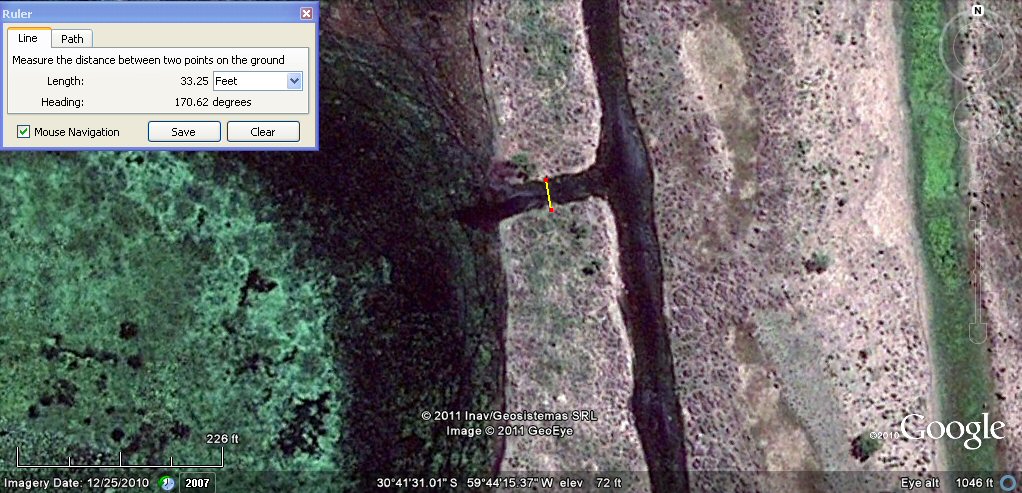
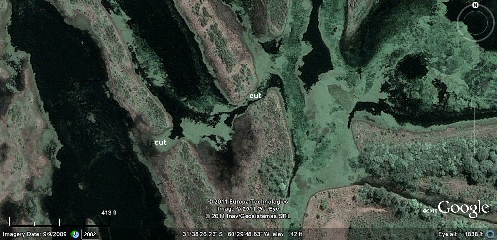
In this example, the cut shown measures about 110ft which is 100 Sumerian feet wide.
Example of ponds complex showing how ancient curved levee deposits have been adapted into artificial lagoons.
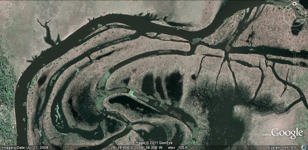
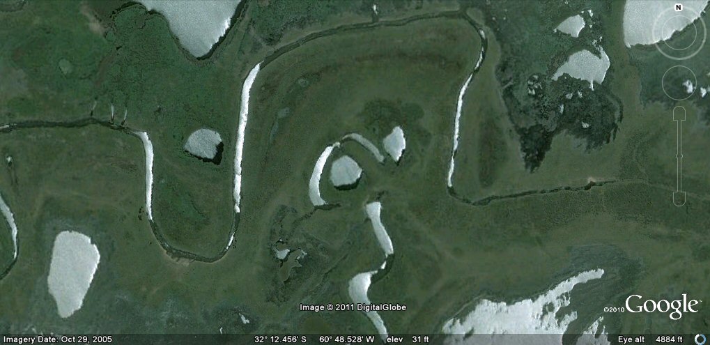
ponds and modified river channels.
This tributary running down into the rio Parana has been heavily modified with canals,
islands and ponds.
The large pond on the right is about 500 metres (1000 Sumerian cubits) wide, and 1000 metres (2000 Sumerian cubits) long.

Another artificial pond.
Complex with ponds, islands and canals.
This island is 660 English feet or 600 Sumerian feet, or 400 Sumerian cubits or 1 furlong wide.

Complex of ponds, islands and canals.
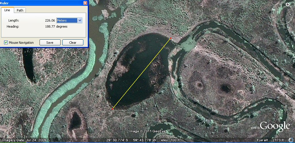
The oval pond is about 225 metres or about 450 Sumerian cubits long.

Pond with artificial canals.

Another example of an oval pond.

Note the interlinking canal (curved at top) joining two longitudinal canals.

Closer view of interlinking canal (curved at top) joining two longitudinal canals. Note also the ponds (dark shades).
Another zone where a canal loops back forming an island with a tee-off from the lower loop.

Tear shaped pond and section of dried-up, straight canals.
Tear shaped island.

This artificially contrived island has a channel of 100 Sumerian cubits and a
width of 400 sumerian cubits, i.e. one furlong.

Another example of an artificial headland 1 furlong or 400 sumerian cubits by 600
Sumerian cubits long.
Note the entry and exit channels to the pond on the left.
It is part of a complex fed by artificial channels.

The artificial canals are easier to see when in straight lines like this one.
The entrance channel to the pond is about 33ft wide which is 30 Sumerian feet or 20 Sumerian cubits.

An example of a lateral canal connecting ponds and feeder canals.

Pond supplied from feeder canal taking water from river.

Feeder canals linked by cut.

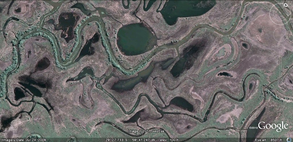
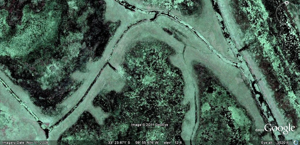
The naturally formed curved ponds have been opened up to the river by man-made access channels.
The naturally formed curved ponds have been opened up to the river by man-made access channels.

This typical complex near Santa Fe has been developed by cutting feeder canals and opening up ponds.
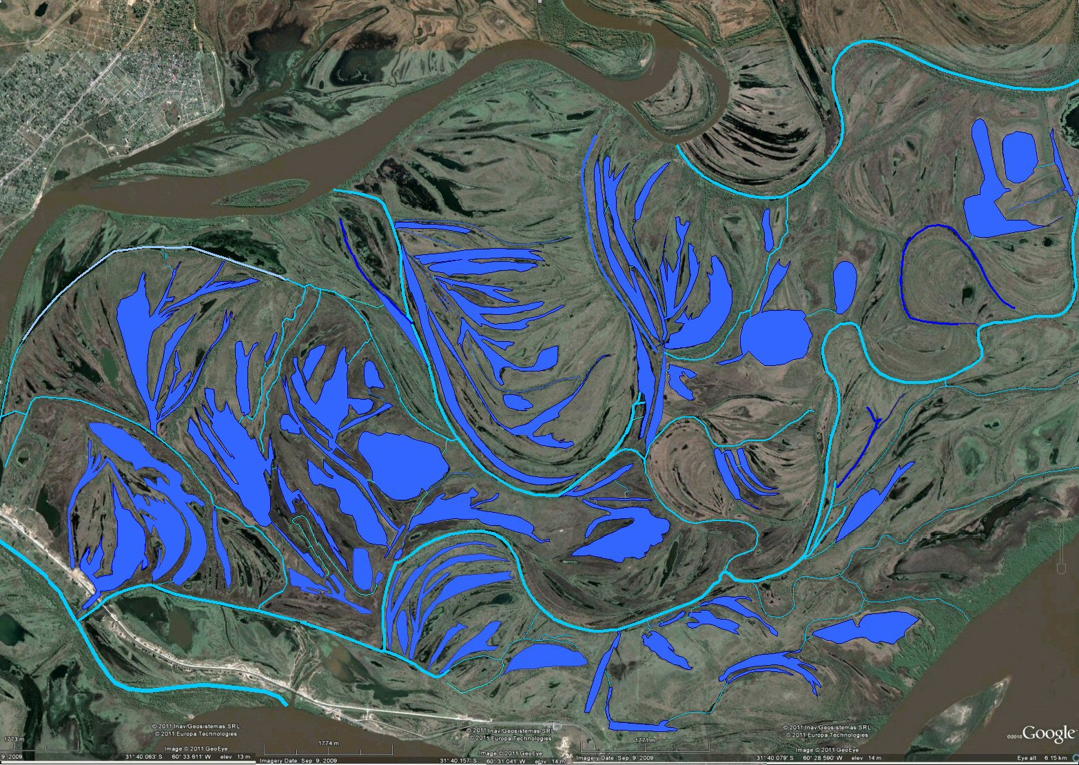
The feeder canals and access channels have been highlighted light blue in this overview.

This enlargement shows how all the ponds have been linked to the feeder canal system.

A close-up study shows that what were at one time natural bends in the river
have been adapted and extended by
cutting feeder canals which convey water to ponds throughout the site.

This typical pond complex within the Santa Fe site has been developed by cutting feeder canals
with smaller access
channels drawing water from the feeder canals.
Enlargement of one of the ponds from previous photo.

This nearby pond measures 600 metres or about 1200 Sumerian cubits, note the access channel from the feeder canal.

This curved feeder canal links one part of the complex to another.

It measures about 165ft or 100 Sumerian cubits.

Access channels have been cut through the natural ridges of land.
Close-up showing cuts giving water access through the natural island ridges.

Another zone of ponds and channels. The headland is about 660ft, 600 Sumerian feet, 400 Sumerian cubits or 1 furlong.
This entry canal is about 120 Sumerian feet wide.

Complex of ponds, islands and channels with cuts.

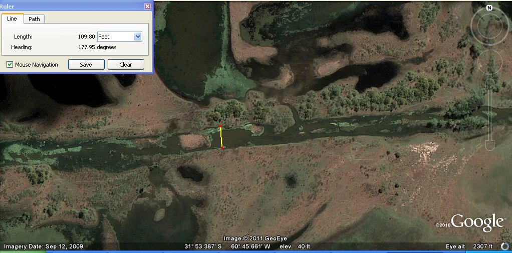
Complex of ponds and channels. The transverse feeder canal is 66ft or 60 Sumerian feet wide.

Pond 100 Sumerian yards of 33" (50 shusi) wide.

Complex of ponds and channels.

Complex of ponds and channels.

This pond is about 500 Sumerian feet or 100 Sumerian double yards wide.

Note the straight diagonal canal.

The straight diagonal canal and the artificial ponds beneath.
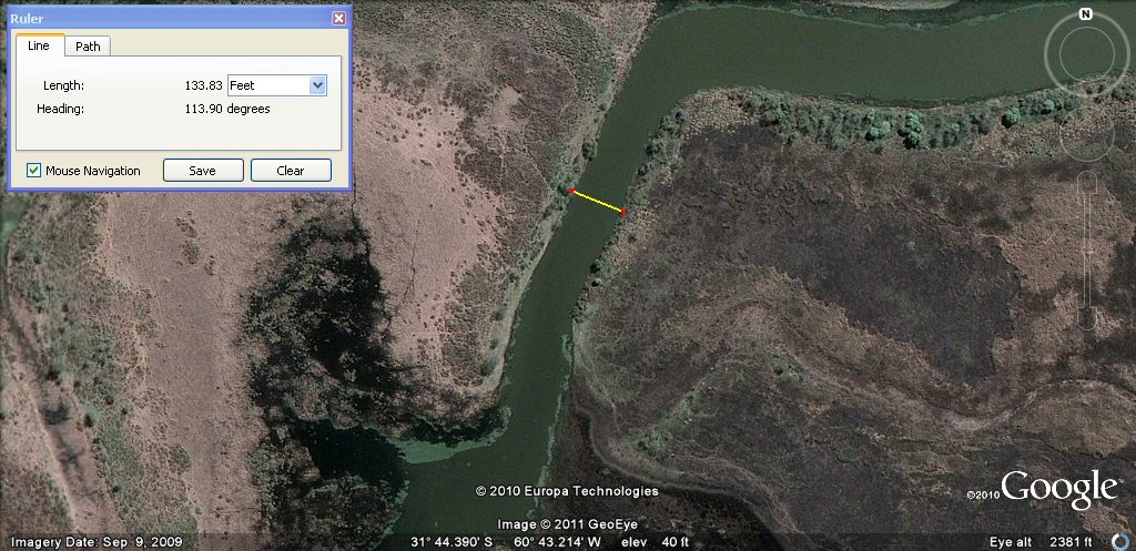
The canal measures about 110 English feet or 100 Sumerian feet wide.
The canal continues on the other side of the river rising up into a curve.

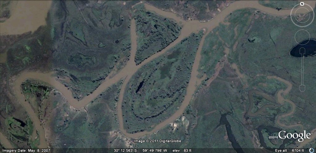
Another complex of artificial ponds.

Another complex of artificial ponds.

canals with right-angled corners.

more canals with right-angled corners.

This channel with squared corners is 1200 Sumerian feet, 800 Sumerian cubits or 2 furlongs deep.
this squared off headland measures about 2 furlongs or 800 Sumerian cubits.
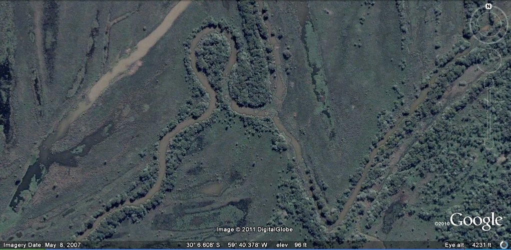
A natural or contrived zigzag?.
Ponds within the zig, or is it the zag....
More re-routed canals, note the right-angled bends....

ground view of one of the channels....

section of canal 300 to 330ft wide.
A remarkable book Letter to a King [14]
a petition by one of the few remaining Inca noblemen Huaman Poma (1567-1615) to the King of Spain records the details
of the ancient pre-Hispanic and pre-Inca Andes...
"In every village in this country there are watercourses, constructed in ancient times, into which the water is diverted from rivers, lakes or ponds. So much labour was involved that the cost . . . These works date back to the time before the Incas, when there was a large population under a single king. Not only watercourses were constructed but also terraces for the planting of crops on the hillsides. These were built up laboriously by hand, without tools, by Indians who each placed a single stone at a time to make long heaps. The number of workers was so vast that these projects were rapidly completed. Thus the terrain was made to bear cereals to feed the people, even in the sandy coastal plains and the rugged scenery of the Andes. Bridges and aqueducts were built and the marshes drained by order of these early kings.
Then came the Incas, who ordained that existing custom and law should be preserved. There was to be no interference with the irrigation of the orchards and pastures which reached as far as the mountain peaks and gorges. They knew that these works, constructed by so great a labour force, could never in all probability be repeated."
"The Indians multiplied like ants or like the sands of the sea until they could no longer find room to live. Then they populated the lower levels of the land, where the climate was temperate and warm. The population was so numerous that it was able to survive a plague which once raged for six months throughout the kingdom. During this period the condors gorged themselves on the human corpses scattered about the fields and villages."
Continue to
delta area for more canals and formations....
Selection of related studies,
Pantanal canals, ponds and islands
rio Paraguay levees canals
rio Parana canals, ponds and islands
rio Parana delta canals
rio Amazon to Manaus
rio Amazon west from Manaus
rio Orinocco to Amazon canal
Corrientes
flooding dates on the Altiplano
atlantis canals on the Altiplano
canals gallery
Chipaya canals gallery
canals in Peru
Caral, Peru containment canal
Tabasco, Mexico canals gallery
canals Louisiana
Paria, Oruro containment canals
canal to sea (lago UruUru)
Beni, Moxos gallery
geoforms - Bolivian altiplano
agricultural variations on the Altiplano
ringed hilltops
earthquakes
contour forms/irrigation Peru
contourforms/irigation Bolivia
Bombo earthquake route
Bombo route oblique views
Atlantis stade - Egyptian and Sumerian cubits
Tiwanaku cubits
Peru cubits and calendar
cubits between altiplano canals
Teotihuacan measuring unit
Teotihuacan citadel measuring units
Chichen Itza and El Castillo measuring units
Monte Alban, measuring units
Atlantis stones gallery
the Tiwanaku soli-lunar calendar
the Muisca calendar
Lost Calendar of the Andes
Decoding the quipu mathematics
