
"The earliest European accounts of Maya wetland fields come from Spanish reports, such as that of the Battle of
Cintla (maize in Nahuatl) in 1519 in Tabasco, Mexico, in which Cortes’s army followed their indigenous foes
into a maze of ditches and steep banks (Puleston 1977; Freidel and Scarborough 1982, citing Lopez de Gomara
in Simpson 1966:46). Herein, Europeans encountered America’s millennia old management of wetlands. Today,
we value wetlands for their myriad of ecosystem services, aesthetics, and long history of human interactions
and ecosystem change preserved within their soils and relict geometry (Barber 1993). They also have unique
and little studied soils and ecosystems (Amundson et al. 2003) that are being lost at high rates in Central
America and around the world (Ellison 2004). Some of these complex systems also contain evidence of ancient
knowledge and adaptations to environmental hazards, and thus represent cultural and ecological heritage in
humankind’s adaptation to changing landscapes and demographics (Luzzadder-Beach and Beach 2006; Smardon 2004).
For understanding wetlands, the history of the Maya Lowlands includes agricultural evidence as early as
4600 BP, possible evidence for wetland management in the Archaic by 3500 BP, clear evidence of wetland
management in the Preclassic, from 3200 to 1700 BP, and in the Classic 1700-1100 BP."
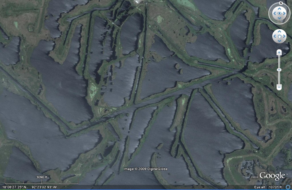
The above canals appear at first sight to have been drowned by
rising sea levels similar to
canals in Louisiana,
but this area of wetlands in Tabasco has been used for oil exploration
making the above examples more likely to be well access channels, see
Tabasco oil exploration canals
for an update on oil exploration in Tabasco.

On this later image, an oil facility can be seen in the centre of the canals formation.

other canals may be more ancient, Google earth is an
ideal tool for identifying sites of interest but it remains difficult to tell whether canals are ancient or more recent!
These parallel fine channels appear to be more ancient.


The parallel irrigation channels appear to be crossed diagonally but what mey be 2 x modern oil pipeline channels.

Other fine channels at right angles can be clearly seen.

These clearly defined plots bounded by small water channels make a chequerboard pattern.

The plots measure 10 x 10 stades of 100 cubits i.e. 10 x 10 of 165 feet per side.

Some plots are 10 x 10 stades of 200 cubits per side which would be a block which could contain 4 of the 100 cubits plots.
This chequerboard pattern of plots contains squares
of 10 x 10 "stades" of 100 Sumerian cubits
making them similar to the allotments Plato described in Atlantis.


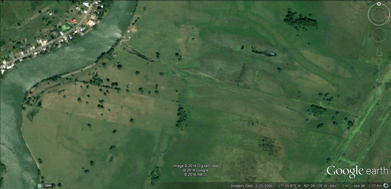
Chequerboard pattern of plots containing squares
of 10 x 10 "stades" of 100 Sumerian cubits.

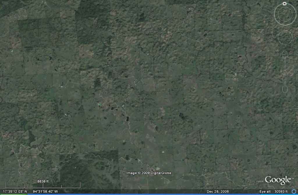
Chequerboard pattern of plots containing squares
of 10 x 10 "stades" of 100 Sumerian cubits.

Chequerboard pattern of plots containing squares
of 10 x 10 "stades" of 100 Sumerian cubits.
J.M. Allen, updated 25 November 2016

This plot measures 1650 feet per side which would be 1000 Sumerian cubits of 19.8" per side
or 10 x 10 "stades" of 100 Sumerian cubits per side.

This plot measures 1650 feet per side or 10 x 10 "stades" of 100 Sumerian cubits per side.
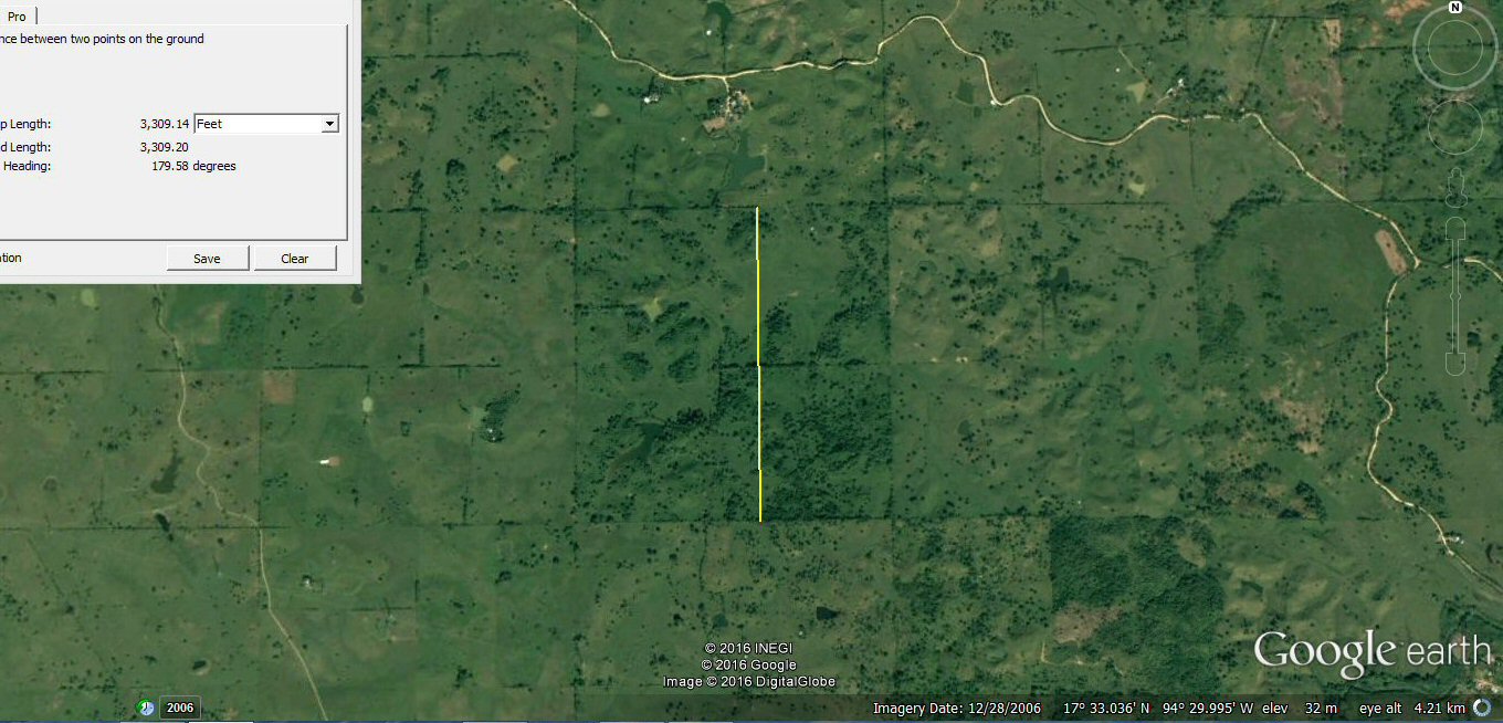
This plot measures 3300 feet per side so contains 4 of the previous 100 cubits square plots
and the 330 foot stade is the stade of 200 cubits used to describe the
rectangular plain on the Bolivian Altiplano.

This plot measures 3,300 feet square, making it 10 x 10 "stades" of 330ft - same as plots found on
the Bolivian Altiplano.
Notice how the blocks can be divided into a variety of different strips or smaller plots.
see atlantis stade page


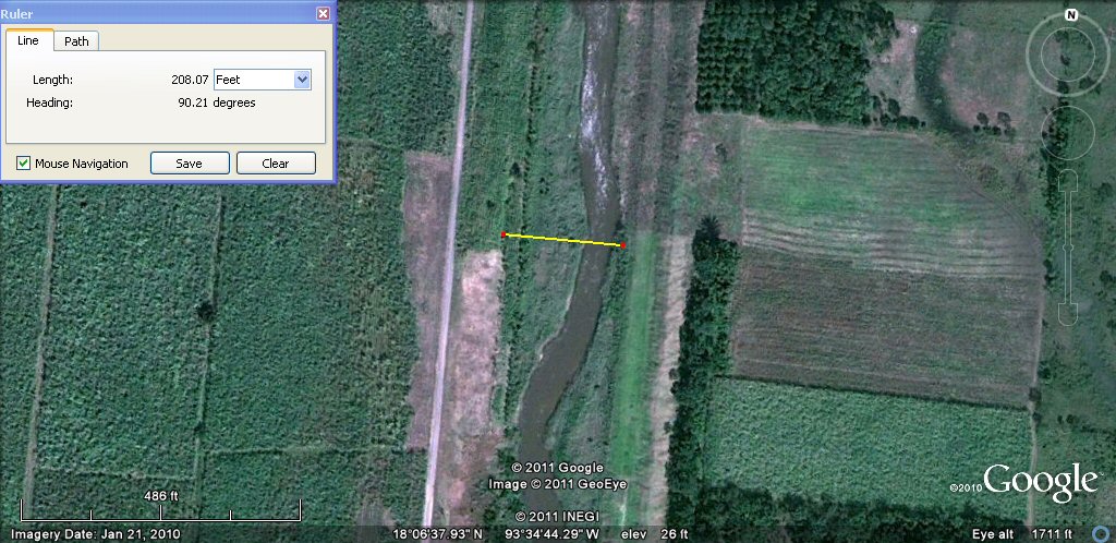
The above canal measures 208ft wide,
the same as two sections of similar canal near Oruro, Bolivia.
webatlantis@hotmail.com
