Above, left, artificial mound with canal, right, camellones (embankments)
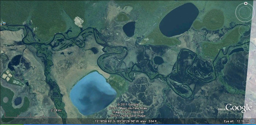
In the vast areas of the Beni and Moxos regions of Bolivia there exists evidence of a little known and long lost culture which lived on artificially constructed mounds on a large plain and who also constructed long straight canals and causeways as well as artificial lagoons of immense size. Natural lagoons formed by ox-bow lakes were also utilised and canals dug to give an access route from nearby rivers such as the rio Mamore with many smaller channels interconnecting different ox-bow lake systems. Similar works have been detected along the rivers Parana, Paraguay and Amazon.
Above, left, artificial mound with canal, right, camellones (embankments)
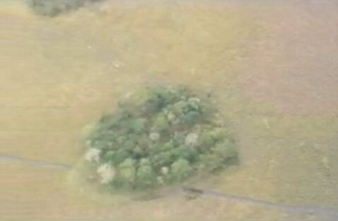
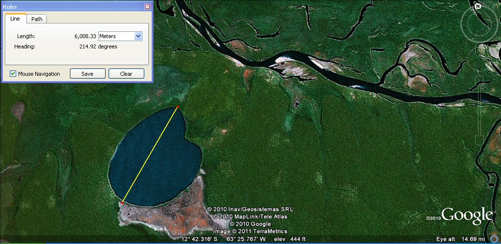
Typical circular artificial island in the Beni plain, 150 Sumerian cubits in diameter...
Typical of the camellones or artificial embankments in the Beni plain.
The area of the Beni and Moxos was studied and written about by Dr Clark Erickson who seems to have concentrated mostly on the mounds, causeways, straight canals and experimental reconstruction of camellones (also see article "Earthmovers of the Amazon by Charles C. Mann")

earthmovers of the Amazon by Charles C. Mann

pre-Columbian fish farming in Bolivia and Amazon by Clark Erickson PhD
The area also features in a recent documentary film by David Antelo as the Atlantis of the Antis Indians and "land of the Musus". The canals and earthworks in this region are not thought old enough to belong to Plato's Atlantis, that is, using the 9,000BC date Plato gave but Plato's date described a war which probably actually began in 1200BC. Plato's Atlantis describes a large level plain with a culture of people who built long straight canals and it is clear that his description is based upon a description of ancient South America. It is worthwhile to view the film "Atlantida de las Musus - Beni" which shows some of the many straight line canals and camellones (embankments) found in the region.

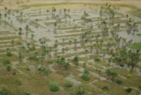
Above, in the wet season, vasts tracts of Amazonia and the Beni region of Bolivia
become submerged by floodwaters. The Beni plain as can be seen from the graphic
is not flooded as deeply as the Amazon, making it ideal for a hydraulic (water based) culture.
The large ponds may have retained floodwaters from the wet season or
may have been used for the capture or storage of fish stocks.
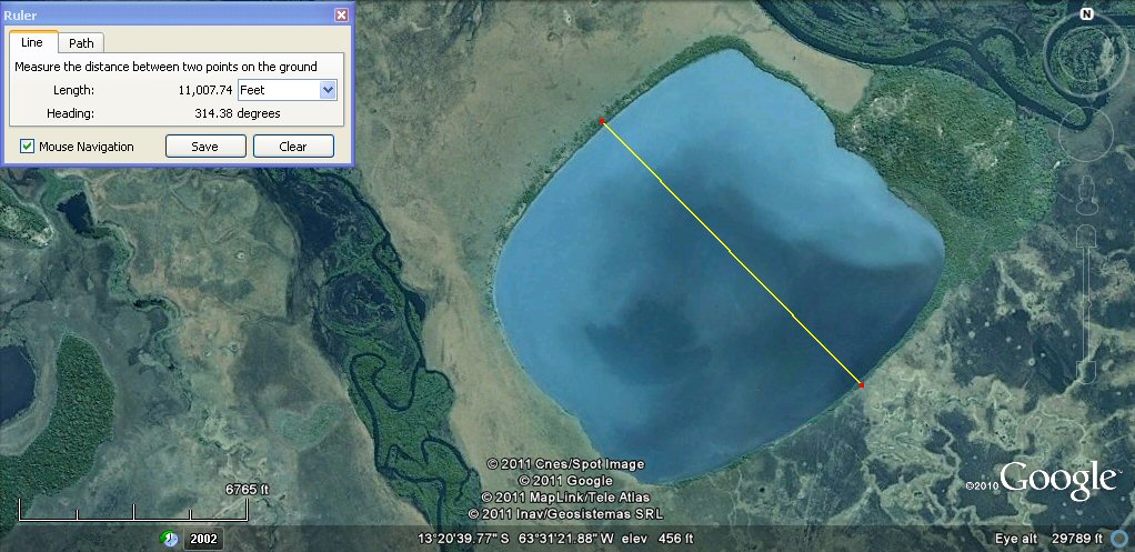
The artificial lagoons in the region have already been noted by people flying over by aeroplane, but what is completely staggering is the size and quantity of these artificial lagoons, the largest, an ovaloid shaped lagoon called "rogagua" measures about 13 miles or 21 kilometres in length by 5.6 miles (9 kilometres) wide.
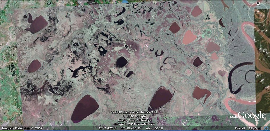
Above, artificial lagoons in the Moxos region of Bolivia
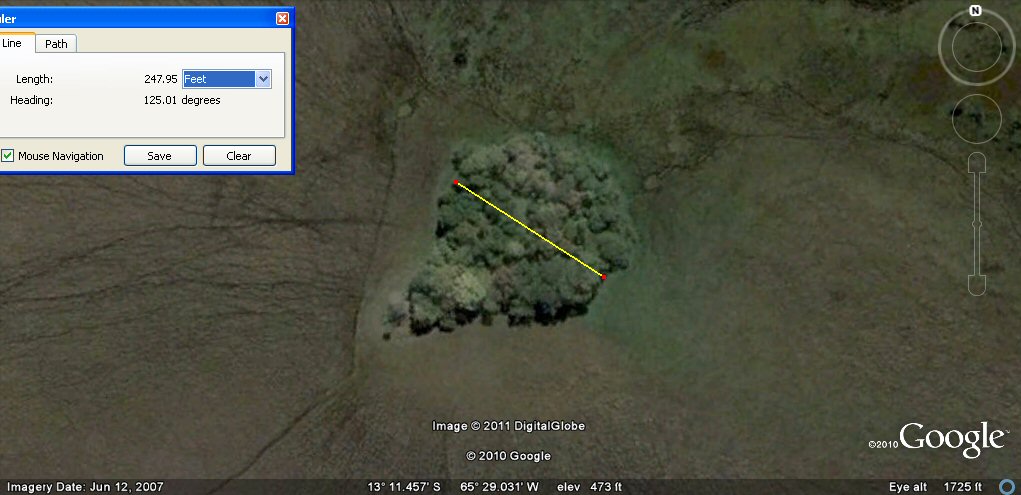
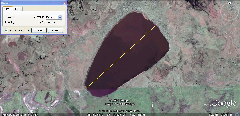
This page shows examples from Google earth of some of the large artificial lagoons, also raised artificial terraces called camellones, artificial islands and canals. Several of the lagoons have also been measured by Google earth and appear to show that instead of being haphazardly constructed in random dimensions, they were in fact planned and set out initially in Sumerian cubits and furlongs.
It is convenient to measure the lagoons in metres because 1 metre is virtually 2 x Sumerian cubits and
the ponds quite often come out in round numbers of metres such as 2,000 metres which would be about
4,000 Sumerian cubits of 19.8" or 10 furlongs of 660ft or 20 'stades' of 330ft etc.
Sometimes an odd number in metres turns out to be a round number in feet, for example 11,000 feet would be
10,000 Sumerian feet of 13.2" or 2000 Sumerian double yards of 100 shusi (66").
Assuming them to be ancient instead of modern since they are said to be pre-Columbian, finding them to be
constructed in Sumerian cubits and furlongs can only be considered as simply astonishing.
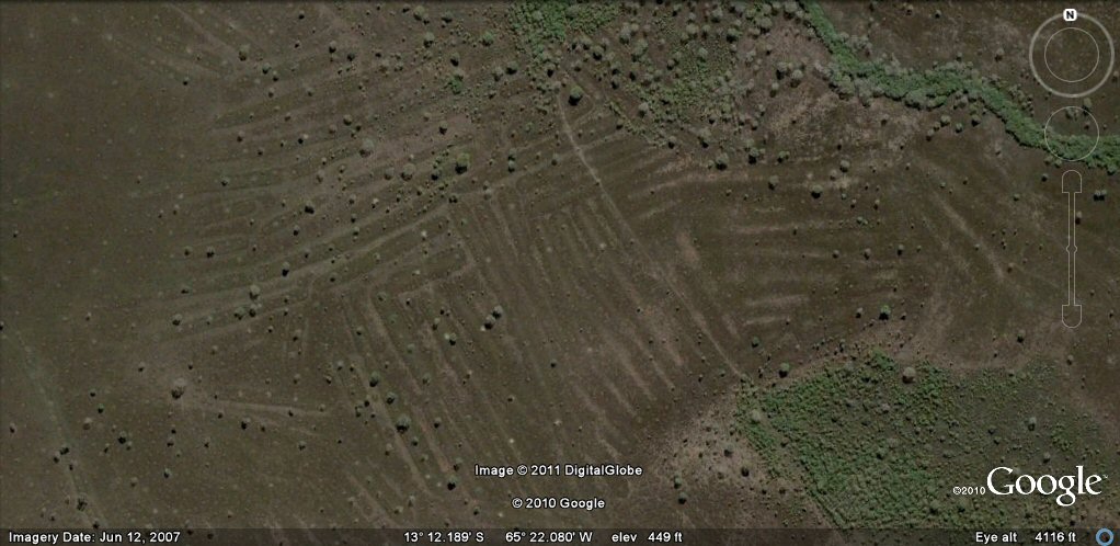
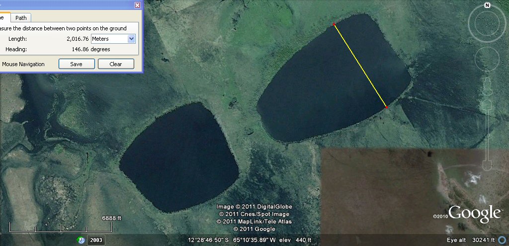
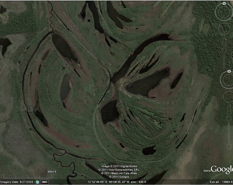
A small part of the area of artificial ponds in Beni region of Bolivia near the rio Mamore.
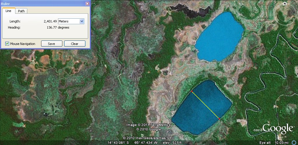
Pond 1. The lower two large ponds on previous photo are similar in size and layout. The left hand pond measures
approximately 4000 metres or 8000 Sumerian cubits which would be 20 furlongs.
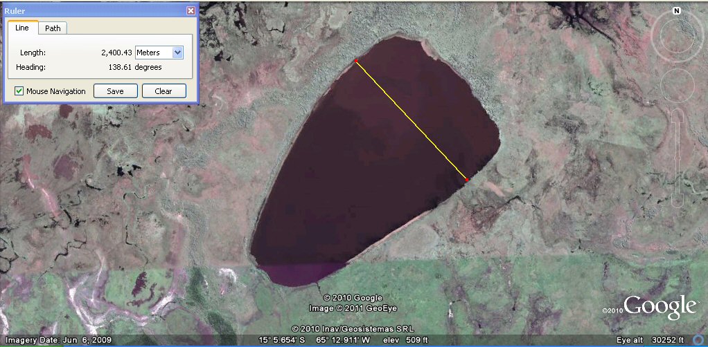
Pond 1. The left hand pond has a width of about 2400 metres which would be about 4800 cubits or
12 furlongs.
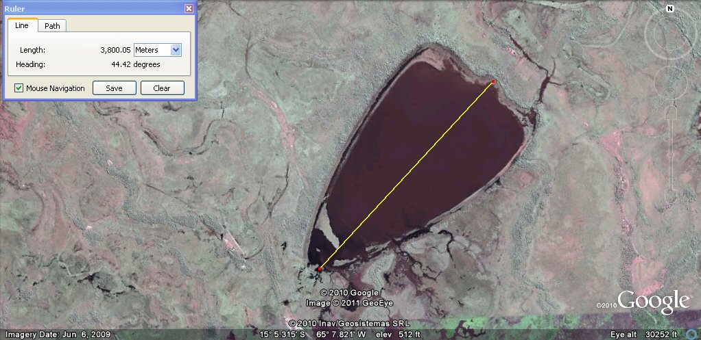
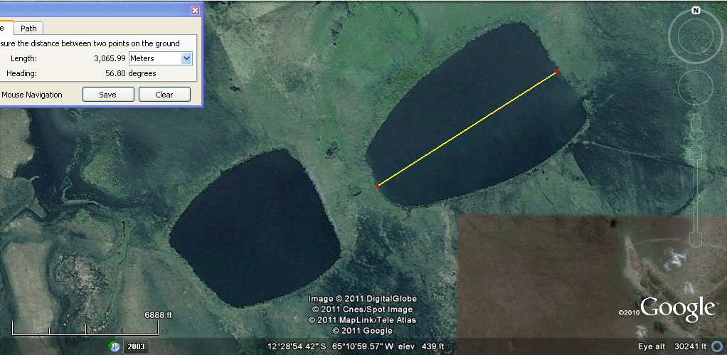
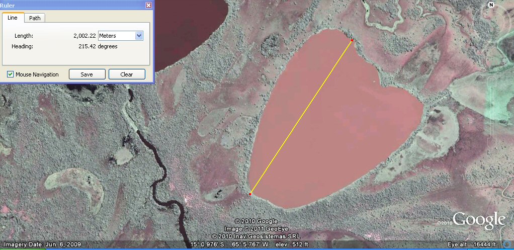
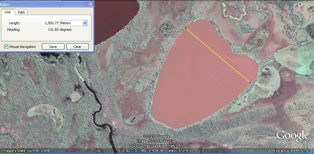
Pond 2. The right hand pond has a length of about 3800 metres or 19 furlongs and a beautiful sculptured shape..
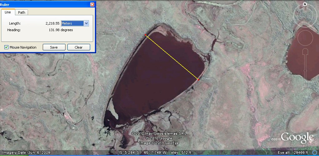
Pond 2. The right hand pond has a width of about 2200 metres or 4400 cubits which would be 11 furlongs..
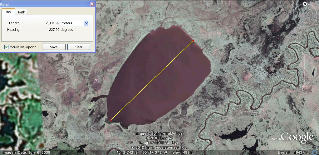
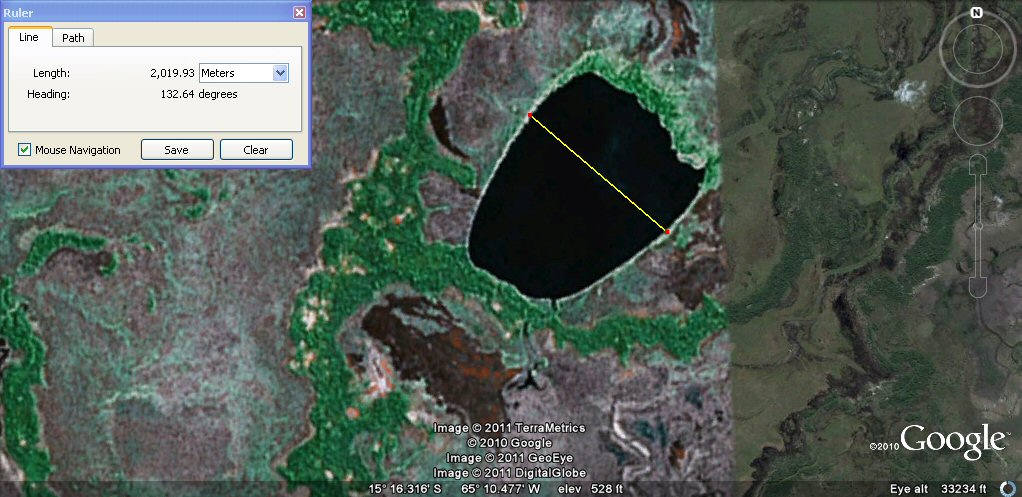
Pond 3. has a length of about 2000 metres or 4000 cubits which is 10 furlongs...
this pond by the rio Mamore has a width of about 2000 metres or 4000 cubits...
by 3000 metres or 6000 cubits.......
Pond 6. has a width of about 1676 metres or 1000 Sumerian double yards...

Pond 6. has a length of about 2400 metres or 4800 cubits which is 12 furlongs...
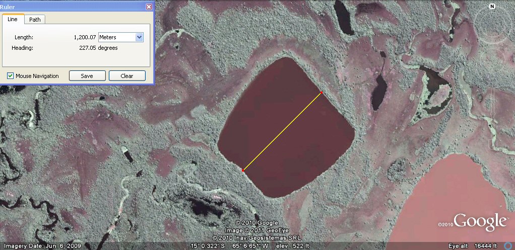
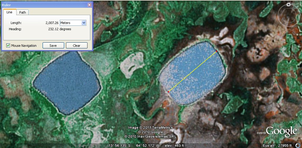
Pond 7. has a length of about 1200 metres or 2400 cubits which is 6 furlongs...
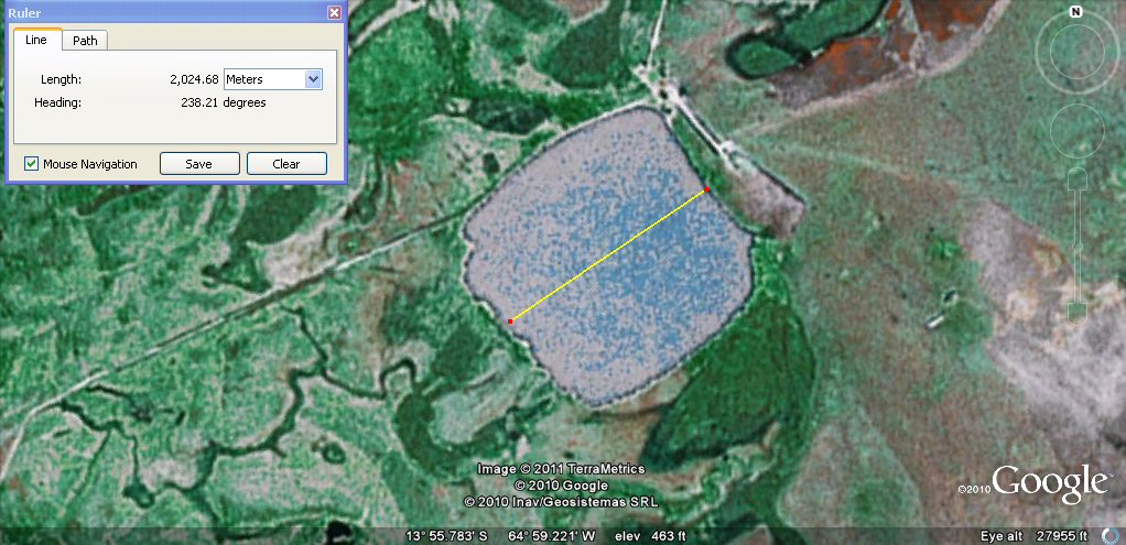
Pond 8. has a length of about 2000 metres or 4000 cubits which is 10 furlongs...
Pond 8. has a width of about 1500 metres or 3000 cubits which 900 Sumerian double yards...
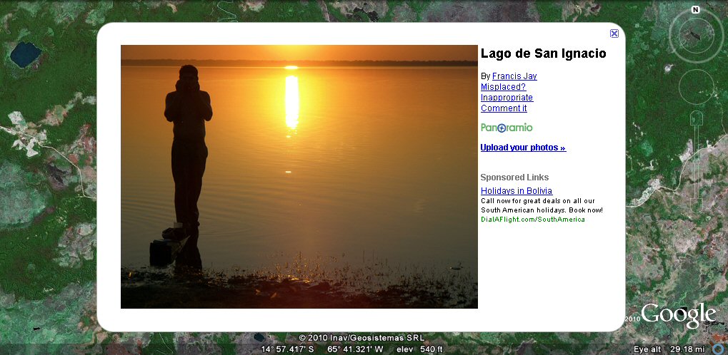
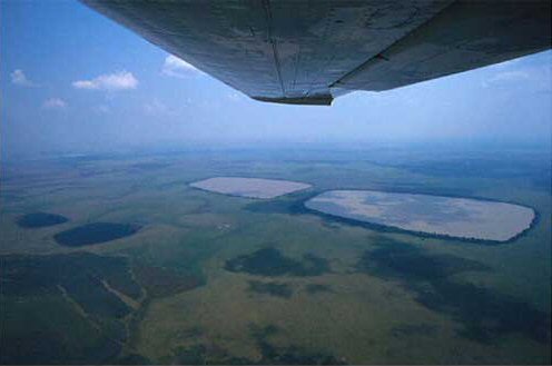
ground view of one of the artificial ponds or lagoons...
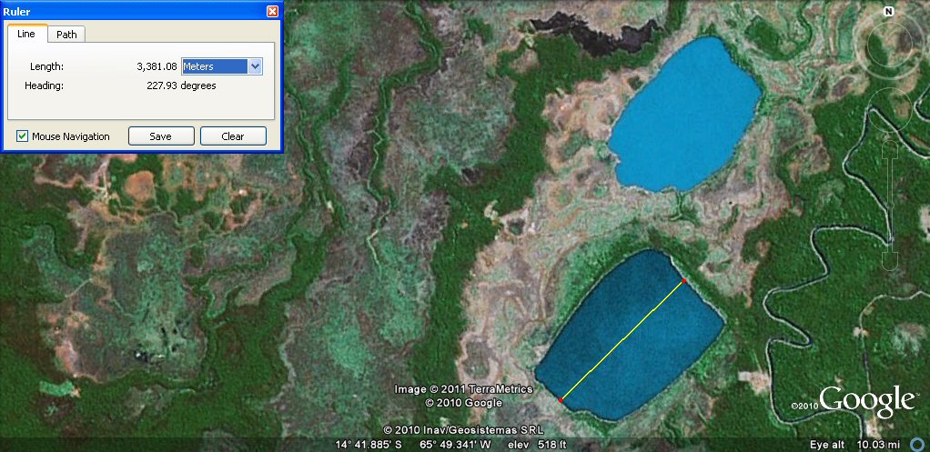
Pond 10. has a length of about 3381 metres or 2000 Sumerian double yards
Pond 10. has a width of about 2400 metres or 4800 cubits which 12 furlongs...
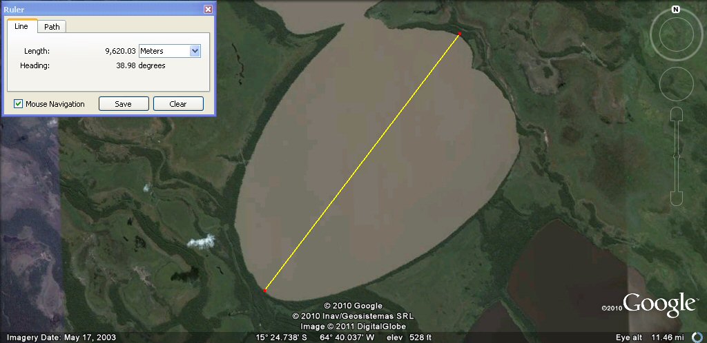
Pond 11. has a length of about 9620 metres or 48 furlongs ... that's 9.6 kilometres or 6 miles...

Pond 11. has a width of about 6688 metres or 4000 Sumerian double yards or 20,000 Sumerian feet....
Pond 12. has a width of about 4000 metres or 8000 Sumerian cubits or 20 furlongs ...
Pond 14. has a width of about 4000 metres or 8000 Sumerian cubits or 20 furlongs ...
Pond 15. has a width of about 2000 metres or 4000 Sumerian cubits or 10 furlongs ...
Pond 17. has a width of about 2000 metres or 4000 Sumerian cubits or 10 furlongs ...
Pond 18. has a width of about 2000 metres or 4000 Sumerian cubits or 10 furlongs ...
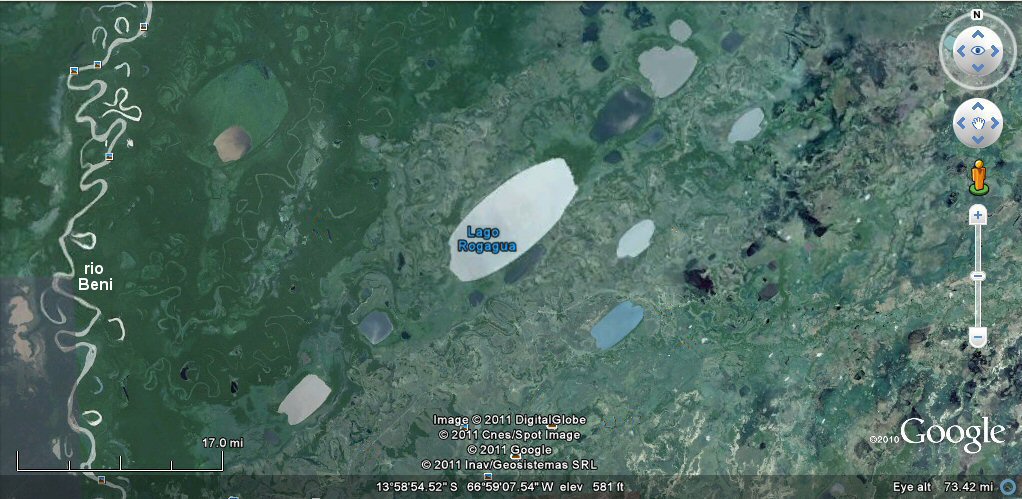
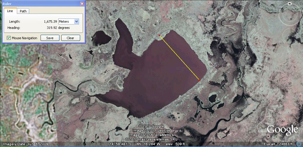
Lago Rogagua ponds and lagoons zone

Lago Rogagua measures about 13 miles (21km) in length at today's water level.
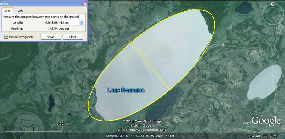
the sides of Lago Rogagua are perfectly ovaloid in shape and it meaures about 9,000 metres
or 180,000 cubits wide (5.6 miles).
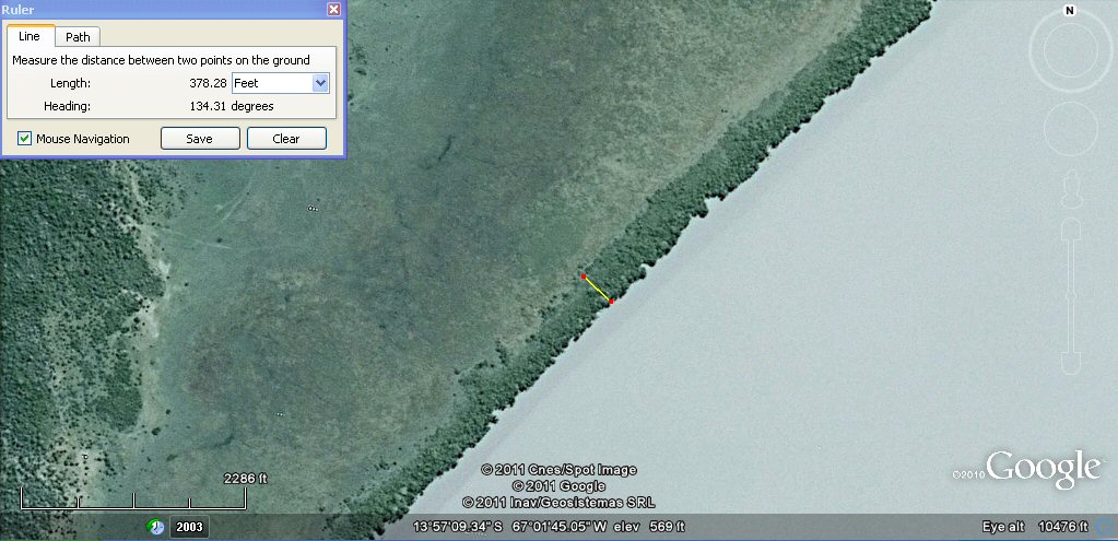
the lagoon may have been formed originally by the construction of a retaining wall about 378ft wide.

Another ovaloid shaped artificial lagoon, shown here the water surface measures about 6000 metres but
when full of water would be 4.5 miles or 36 furlongs long (just over 7km). It appears to have
been constructed by building an oval shaped retaining wall seen encircling the site..
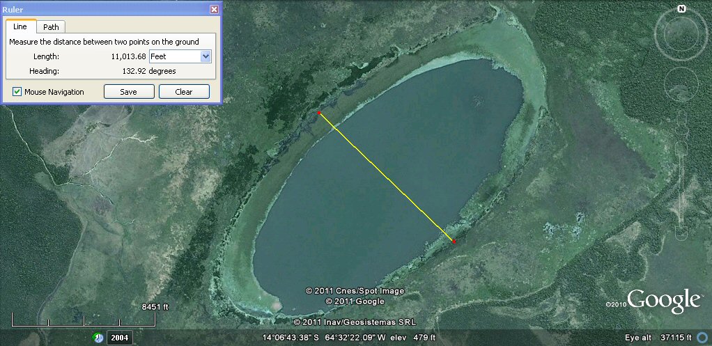
The width of the lagoon when full of water as measured to the edge of the retaining wall
would be about 11,000ft, which is
10,000 Sumerian feet or 2,000 Sumerian double yards.
the lagoon appears to have been built with a retaining wall over 300ft wide.
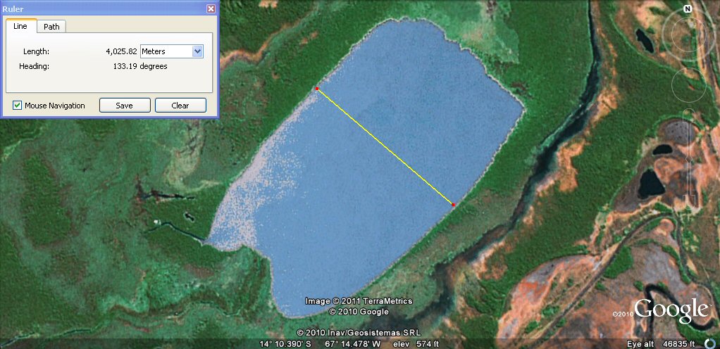
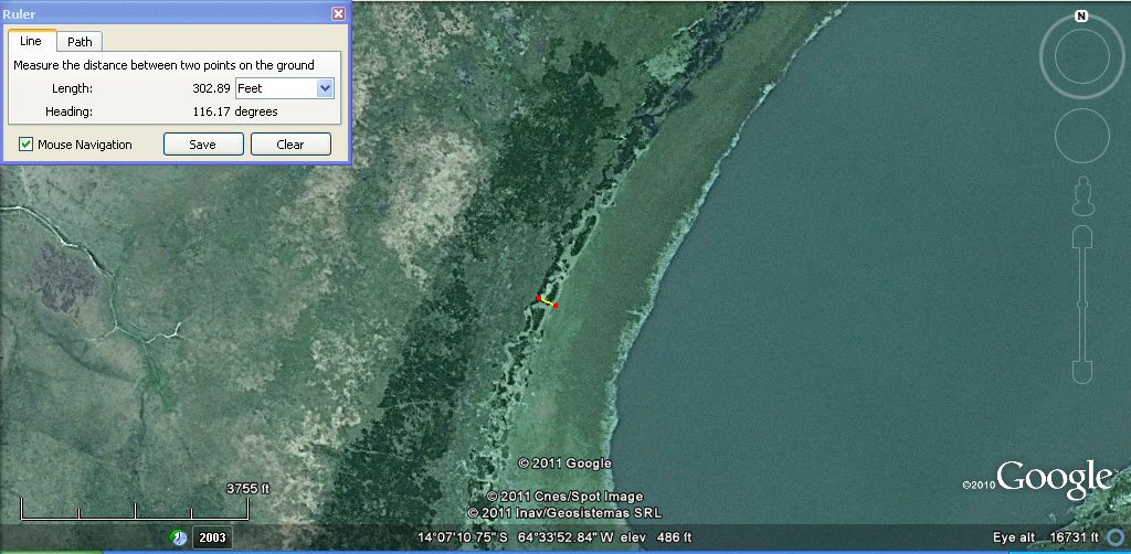
Artificial ponds alongside a river in the Baures region of the Beni plain.
This pond is about 11,000ft or 10,000 Sumerian feet or 2,000 Sumerian double yards wide.
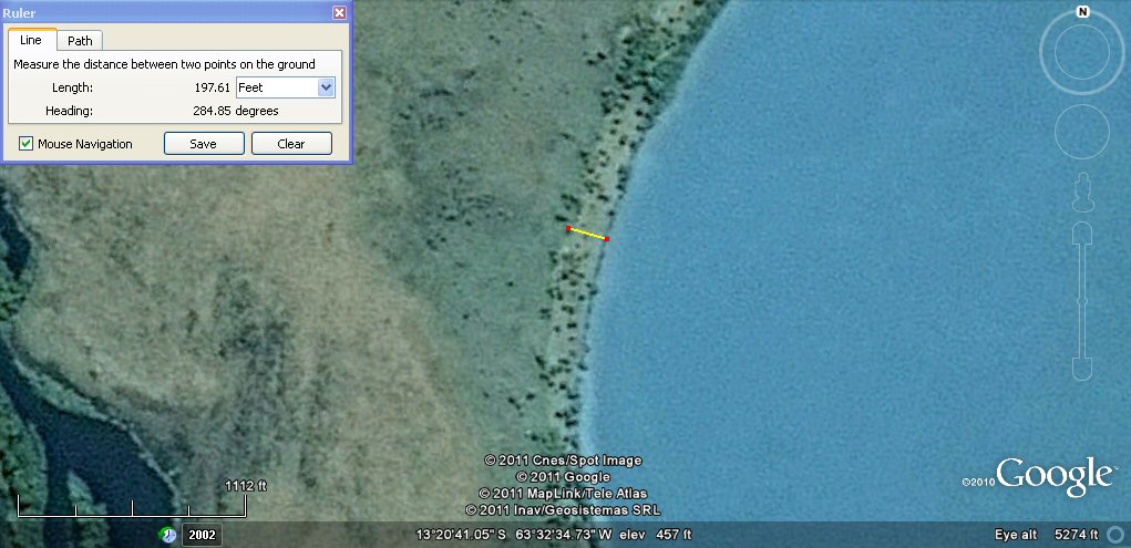
The retaining embankment appears to be about 198ft or 120 Sumerian cubits wide.
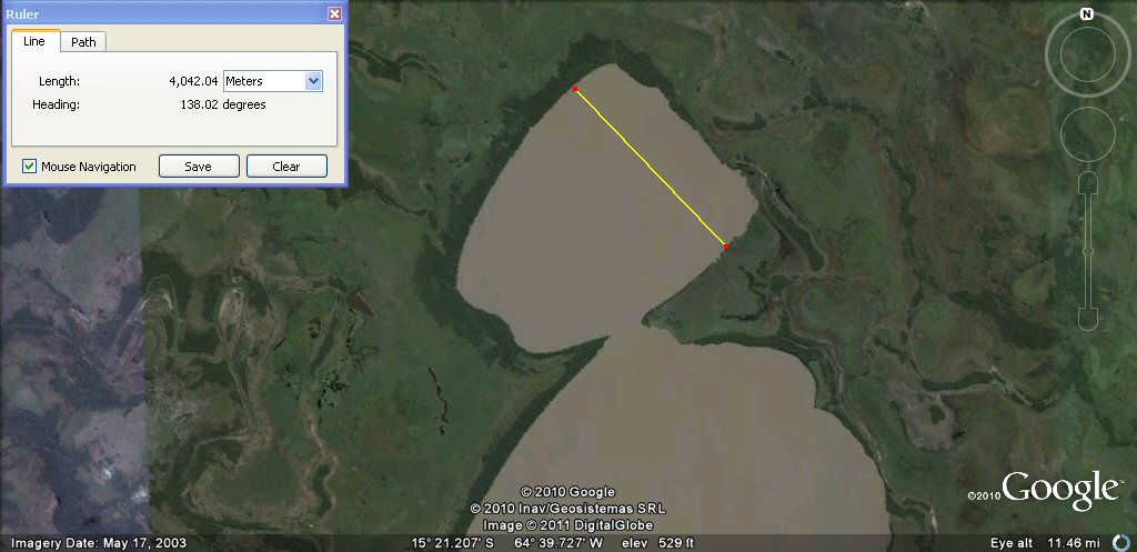
Oval pond reminescent of an artist's pallette... just over 2.5 miles or 4 kilometres
in length.
another artist's pallette shaped pond... 6000 metres or 12000 cubits
in length.
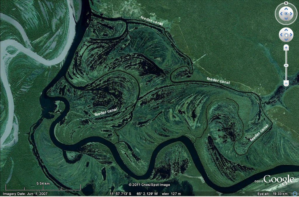
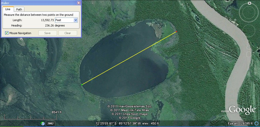
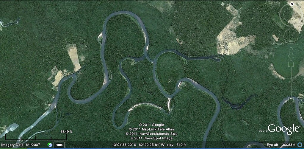
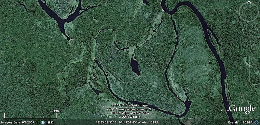
The junction of the river Guapore with the river Mamore shows great signs of former occupation in ancient times.
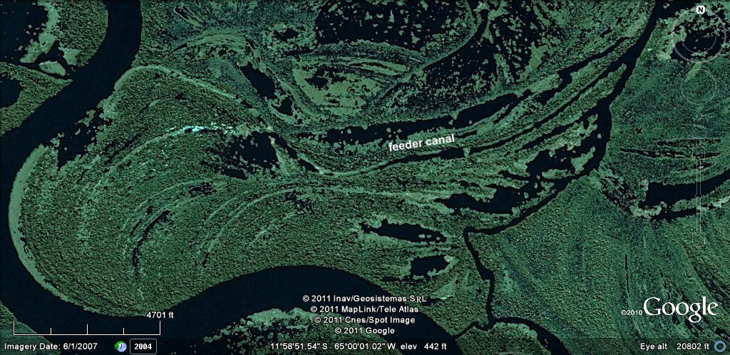
The natural curved lagoons created over millenia by the changing course of the river bends appear to be linked by a system of
feeder canals bringing fresh water and access from the main river. Similar developments have been seen on the rio Parana.
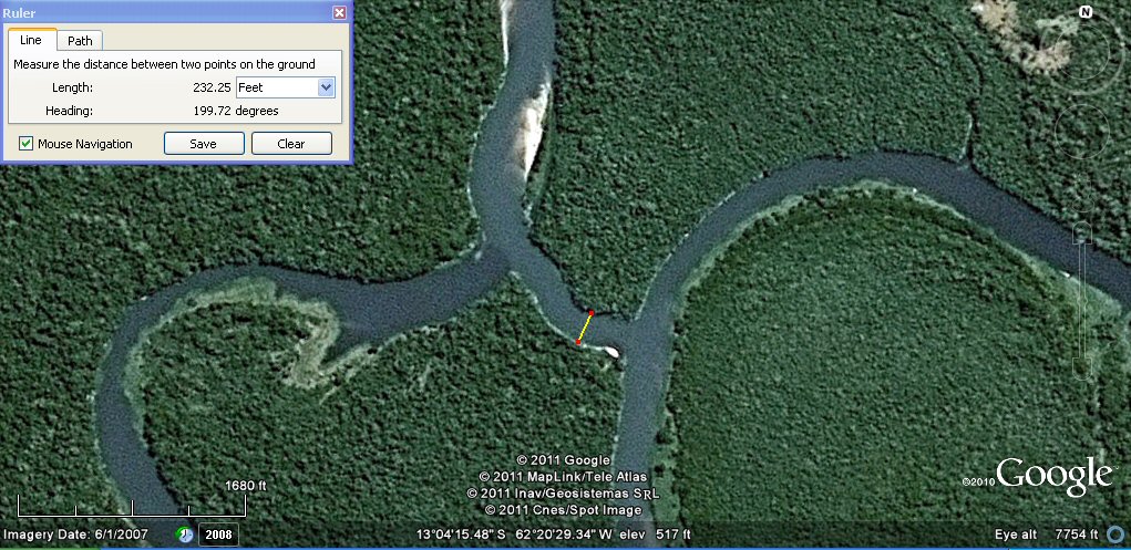
This section of feeder canal has been dug across from the main river to link to another canal....
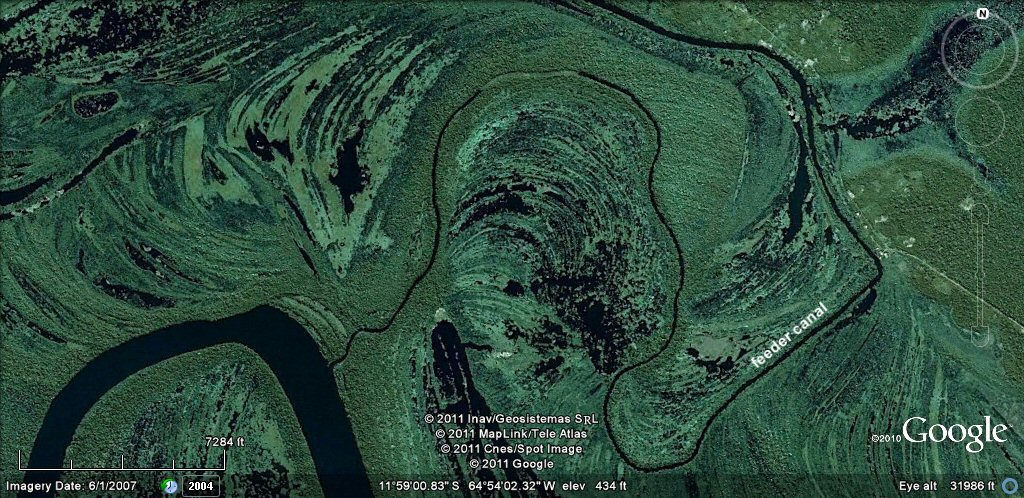
Part of the feeder canal which surrounds the whole complex.....
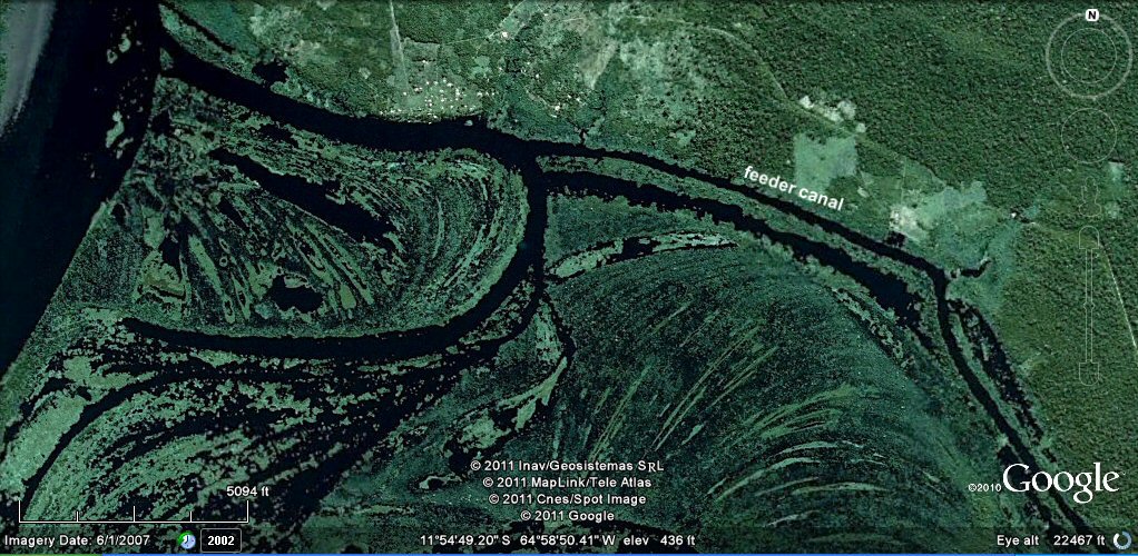
Water from the feeder canal joins the main river on the northern side of the complex.....
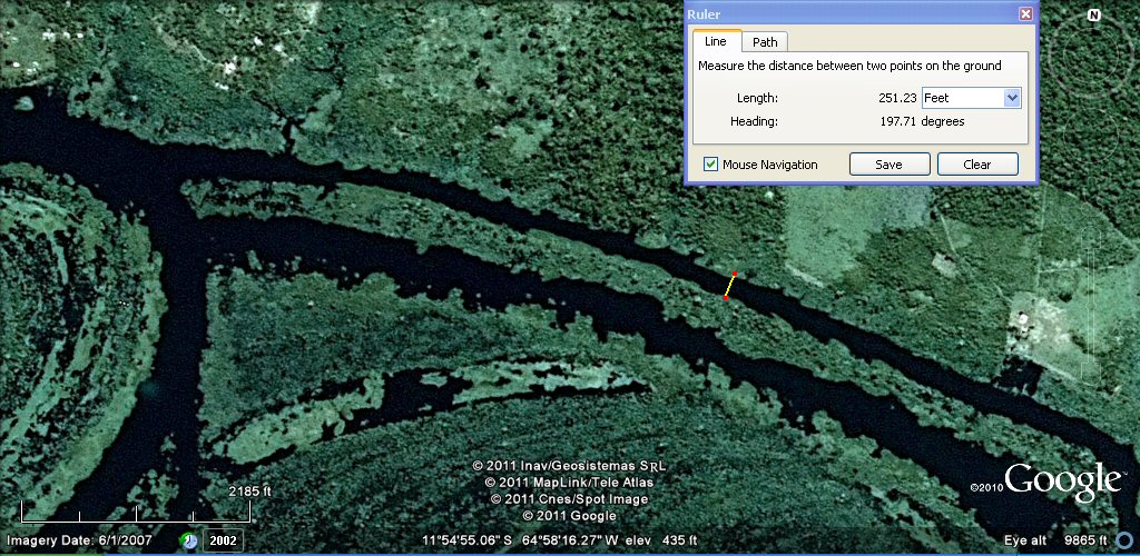
This section of feeder canal linking the various lakes measures 251ft....
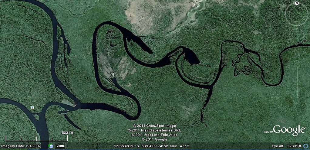
This oxbow lake shows a typical access canal cut through from the main river....
Another complex on the rio Mamore with feeder canals surrounding the site....
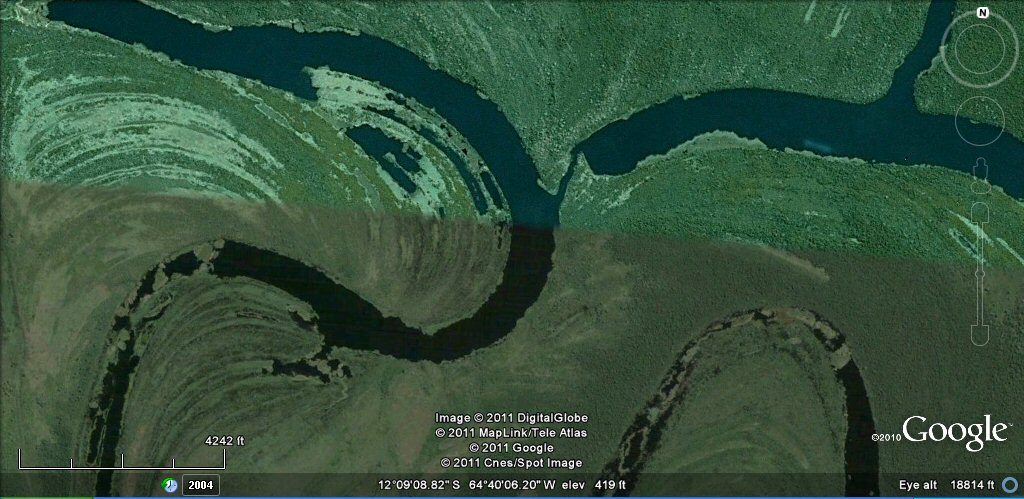
This complex of river bends on the rio Guapore looks to have been modified by the insertion of a linking canal....
Enlargement of linking channel seen above joining one part of the river to another.....
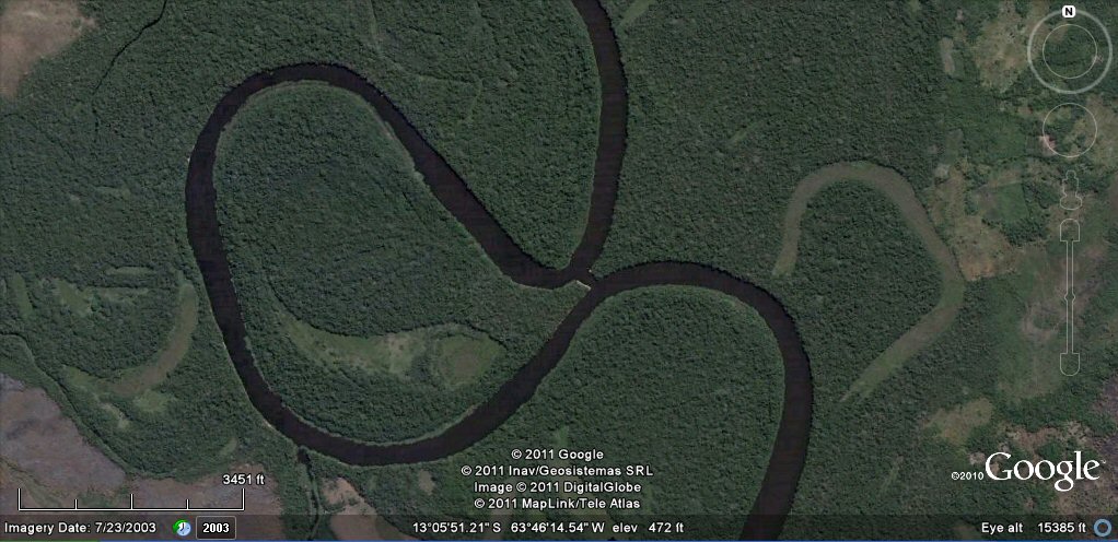
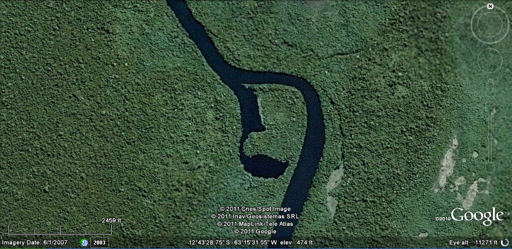
This river bend on the rio Baures looks to have been modified by the insertion of a linking canal....
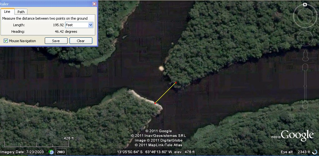
Enlargement shows the channel measures about 195ft at this point.....
another example of how a feeder canal has been dug around a site, rio Guapore area.
natural oxbow lakes have been linked together by artificial channels on this tributary of the rio Guapore.....
artificial ponds on a tributary of the rio Guapore.....
See also additional studies,
rio Paraguay levees canals
rio Parana canals, ponds and islands
rio Parana delta canals
Corrientes
rio Amazon to Manaus
rio Amazon west from Manaus
rio Orinocco to Amazon canal
canals on the Louisiana seaboard
Tabasco, Mexico canals gallery
flooding dates on the Altiplano
Atlantis stones gallery
atlantis canals on the Altiplano
canals gallery
Chipaya canals gallery
canals in Peru
Caral, Peru containment canal
Paria, Oruro containment canals
canal to sea (lago UruUru)
Pantanal
agricultural variations on the Altiplano
geoforms on the Altiplano
ringed hilltops
earthquakes
contour forms/irrigation Peru
contourforms/irigation Bolivia
Bombo earthquake route
Bombo route oblique views
Atlantis stade - Egyptian and Sumerian cubits
Tiwanaku cubits
Peru cubits and calendar
cubits between altiplano canals
Teotihuacan measuring unit
Teotihuacan citadel measuring units
Chichen Itza and El Castillo measuring units
Monte Alban, measuring units
the Tiwanaku soli-lunar calendar
the Muisca calendar
Lost Calendar of the Andes
Decoding the quipu mathematics
J.M. Allen, January 2011, updated 30 June 2011
webatlantis@hotmail.com