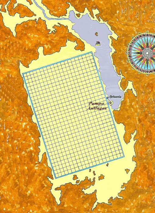
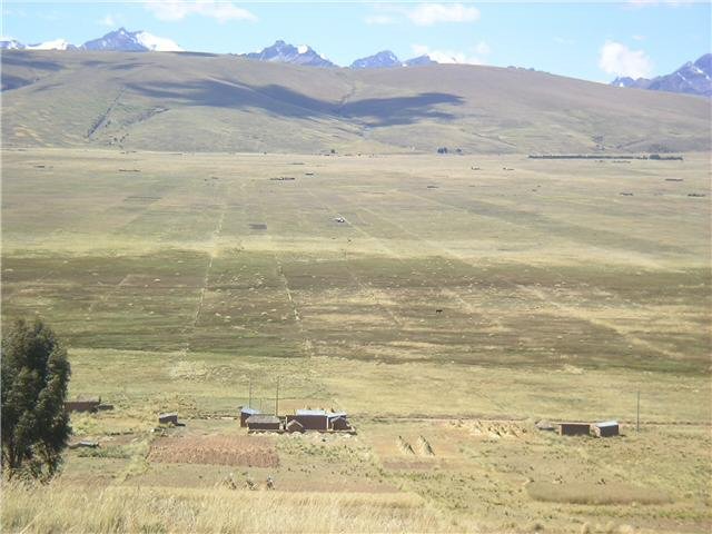
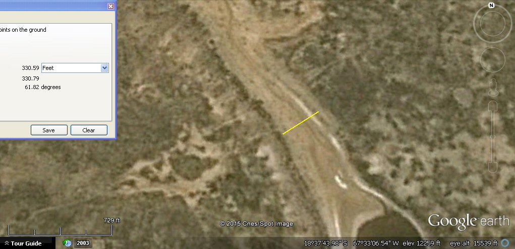
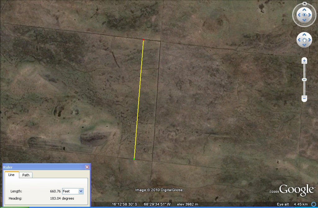
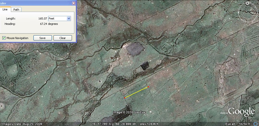
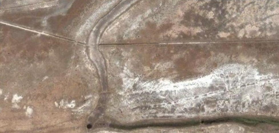
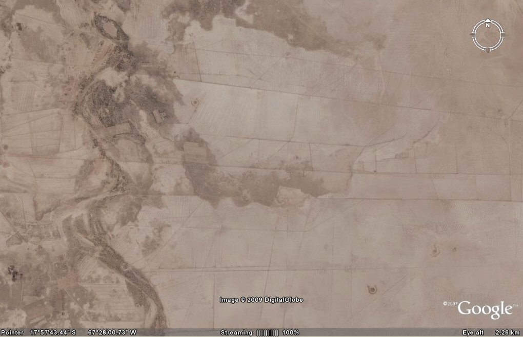
These square plots surrounded by water channels on the Bolivian Altiplano north west
of La Paz are are 330 feet or 200 Sumerian cubits per side, suggesting the unit used to measure the rectangular
Altiplano
was a "double stade" of 200 cubits, whereas the "stade" used to describe the circular ringed city of Atlantis,
by measurement of the site at Pampa Aullagas seems to have been a stade of 100 cubits.
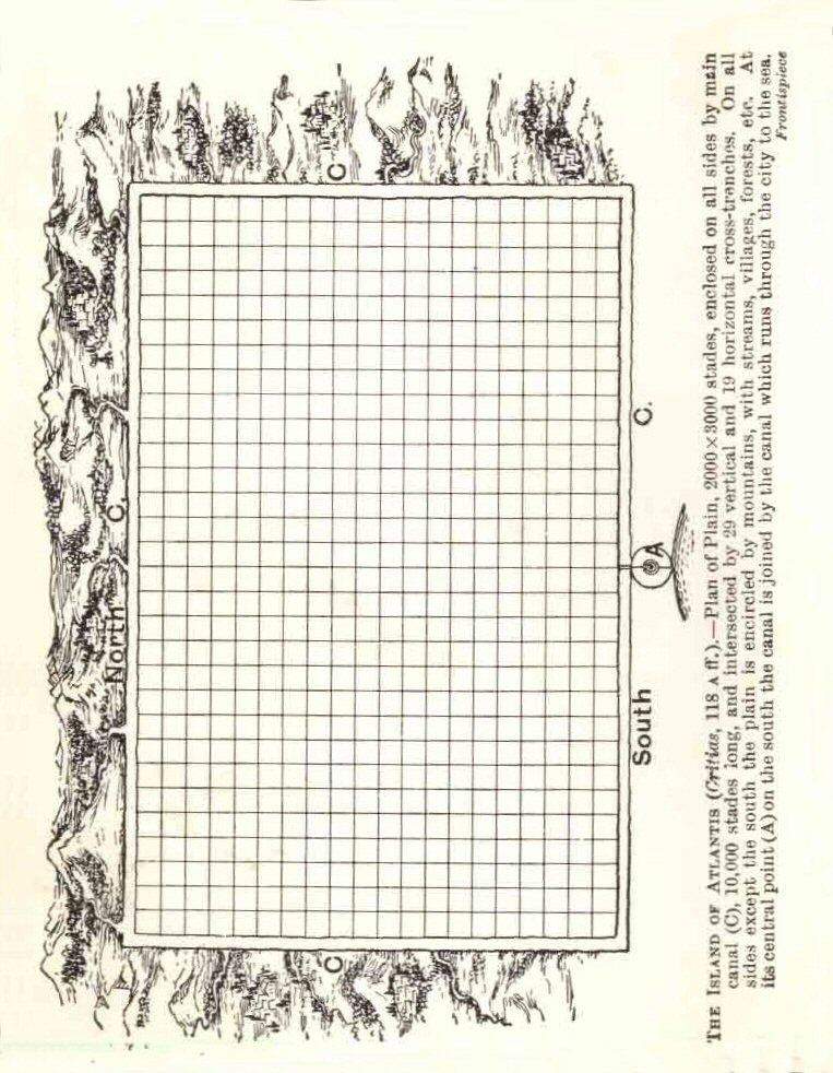
The Atlantean stade of 100 cubits of 19.8" (165 feet) was also divided into 96 "Egyptian" cubits of 20.625", making it extremely useful for land measurement.
The plain was reported to be divided into allotments of 10 x 10 stades with the main canals
at 100 stade intervals so there would be 100 plots of 330ft x 330ft per 100 stade square, and each
could therefore be divided into 4 blocks of the smaller 165ft x 165ft stades (100 x 100 cubits),
making 20 x 20 sub-holdings of land per allotment.
CLICK for Atlantis Stade page
Atlantis Canals Evidence
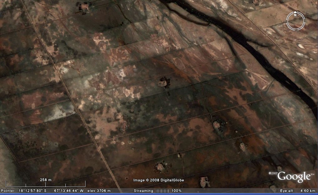
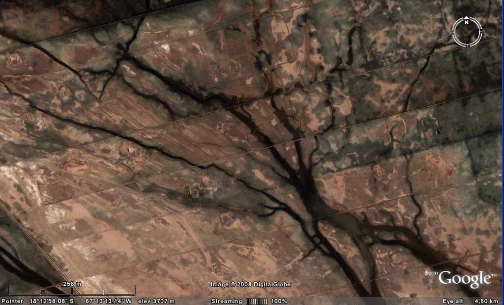
Looking for evidence of a canals system on the Altiplano has been a key
feature in the search for evidence. The presence of canals was denied for a long time by the "experts"
such as Simon Lamb of Oxford University, according to geologist Simon Lamb, there are no canals on the Altiplano. Well, at least
that's the impression this
review of his book "Devil in the Mountain" tells us.
"Simon Lamb, a geologist
at Oxford University, got a call one day from a television producer about pictures of Atlantis. The lost
civilization could be found on 12,000-foot high plains nestled in the Andes Mountains. An Atlantis expert
(whatever that is) had shown the producer satellite photographs of the plains, pointing out canals running
in parallel straight lines for miles. What more proof could one ask for? The producer called Lamb, an expert
on the Andes, for confirmation.
Lamb pulled out his own satellite photographs, found the canals, and laughed. He told the producer that canals
had formed naturally, without any help from Atlanteans. Hundreds of millions of years ago, before the Andes
existed, rocks had slowly piled up in layers. Later the rocks were heaved onto their side and raised up thousands
of feet, whereupon rain began to flow down their exposed flanks. The water gnawed away at the weakest layers,
creating a series of straight-edged channels. As he spoke, Lamb could sense hostility on the other end of the line.
The producer didn't want to hear about strata and erosion. ''Well, that's your explanation, anyway,'' he huffed,
and went off to make his documentary without Lamb's help. ''Atlantis in the Andes'' later appeared on the
Learning Channel.
On the other hand, if you want an unbiased opinion you could log into Google Earth and
see the canals for yourself or check out the ground shots below...

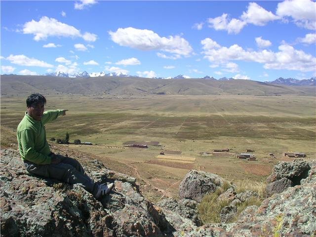
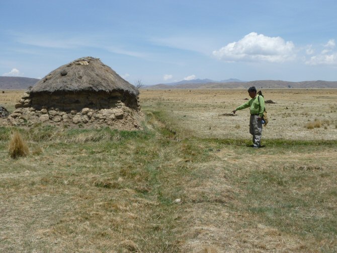
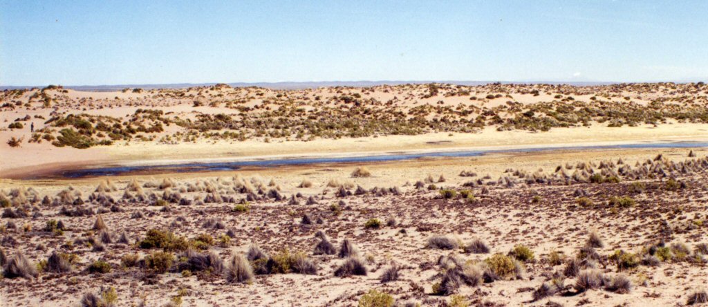
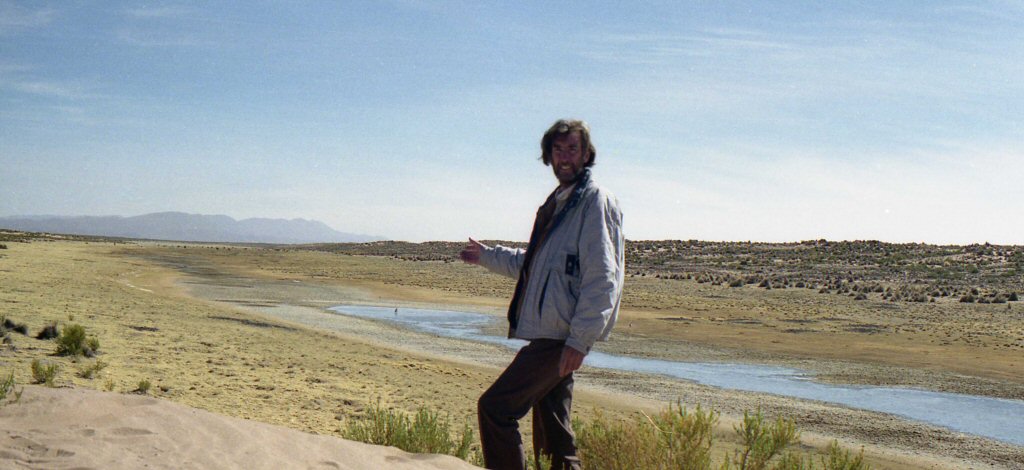
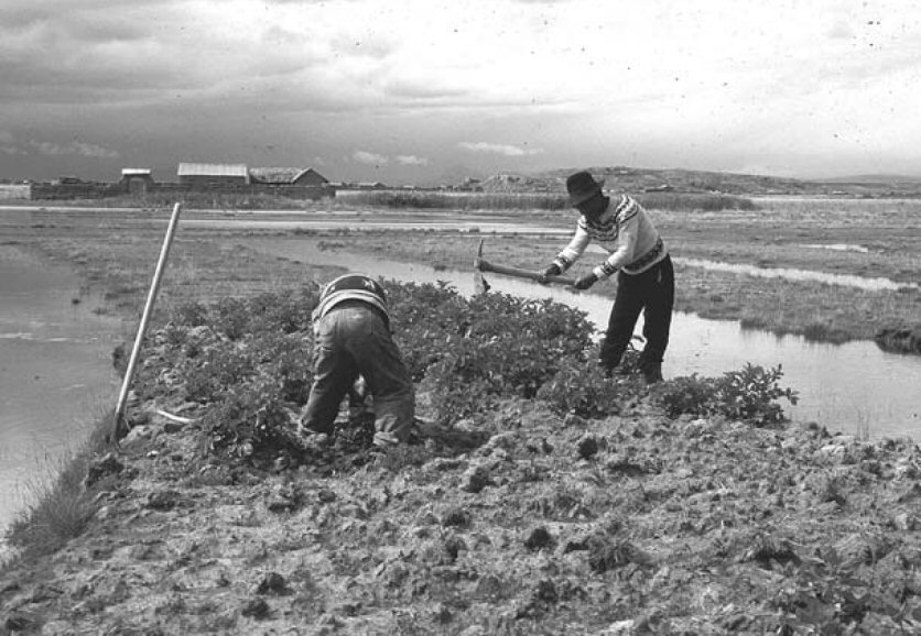
Porfirio Limachi, Aymara boatbuilder, takes a day off to point out remains of old canals on the Altiplano.
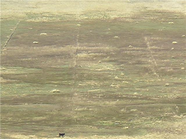
The smallest subdivision of one stade square is divided by smaller channels.
Ground view of the above channels which divide the zone into square plots,
some are still maintained for use today (above) whilst others are abandoned.
Porfirio Limachi points out overgrown channels at this intersection.
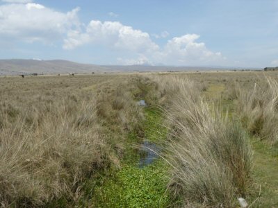
Other channels are wider such as the overgrown example (left) and the redug example (right).
Others such as near Chipaya on the level plain are still wider.
Plato: "Canals were dug in straight lines across the plain."
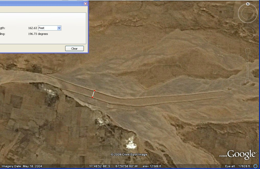
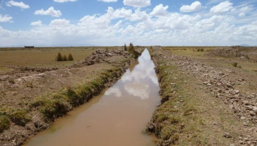
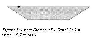
This section of old canal nearly 165ft wide brings waters down from the mountains...
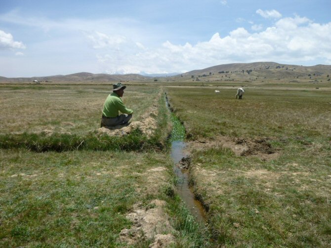
Canals are certainly a feature of the area which still suffers today from alternating drought and flooding.
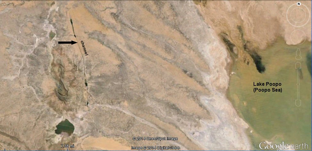
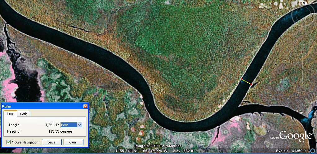
The image below shows remains of another section of giant canal 200ft wide just north of Oruro.
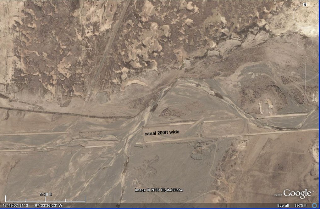
above, the satellite measures another section of canal near Oruro as 200 feet (60 metres)wide.
see Paria, Oruro canals page

The satellite technology measures this canal section 200ft wide.
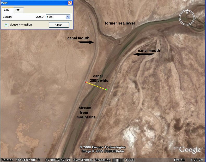
The satellite technology measures another canal 200ft wide,
discharging into the sea, lago UruUru (Lake Poopo). Although not as old as Plato's date,
this more recent canal shows how what Plato described is typical of the region.
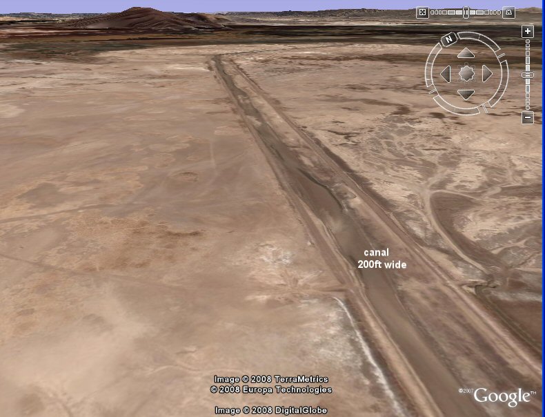
above, oblique view of section of unexplained canal 200ft wide near Oruro, Bolivia.
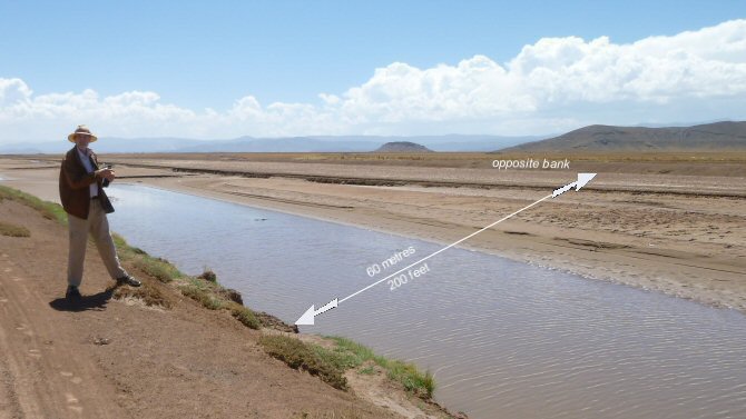
Ground view of the above canal section containing waters of the rio Desaguadero. Seen here half full, this 200ft wide channel stretches from the nearside embankment to where it is marked "opposite bank".
The purpose of this particular canal is also to prevent the adjacent fields from being flooded in the wet season.
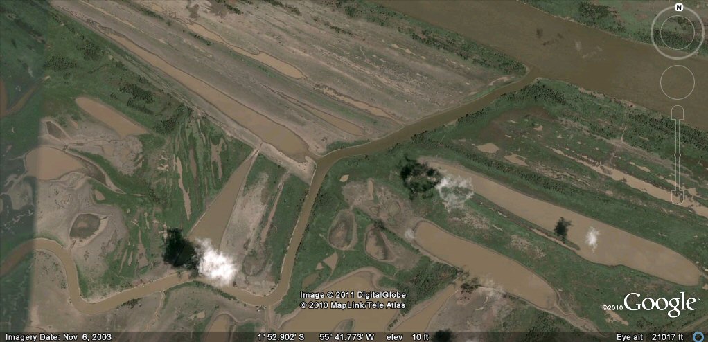
Satellite images showed a very large channel similar to the giant canal
which Plato described just to the west of Lake Poopo and when this was
visited on site,
it still had water in the base due to the fact that the channel was
supplied by water from wells drawing water from underground sources.
Satellite image showing the wide channel west of Lake Poopo.
The channel joins together natural underground springs or wells found on the Altiplano.
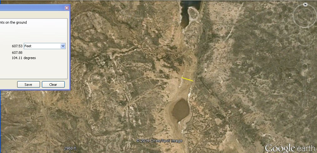
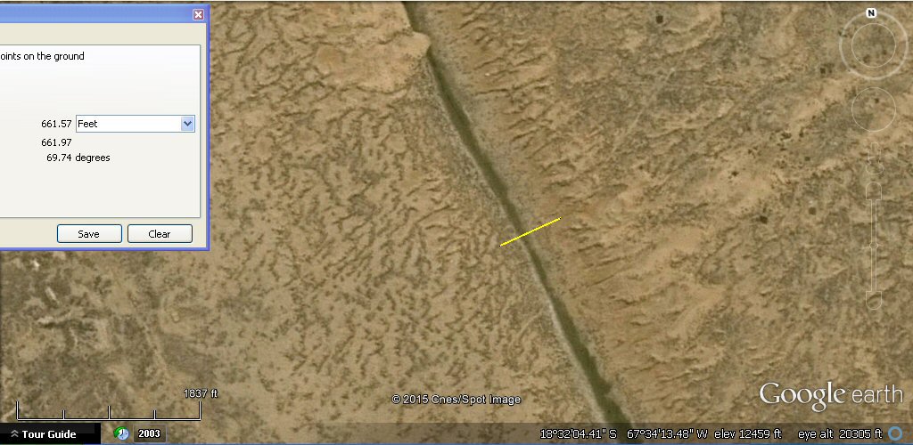
Although this section measures
607 feet wide, one Greek Stade, it was never constructed in Greek stades, edges are difficult
to determine exactly on the satellite images
and some sections appear to be 330 feet (200 cubits) wide whilst other parts are wider and closer to 660 feet (400 cubits).
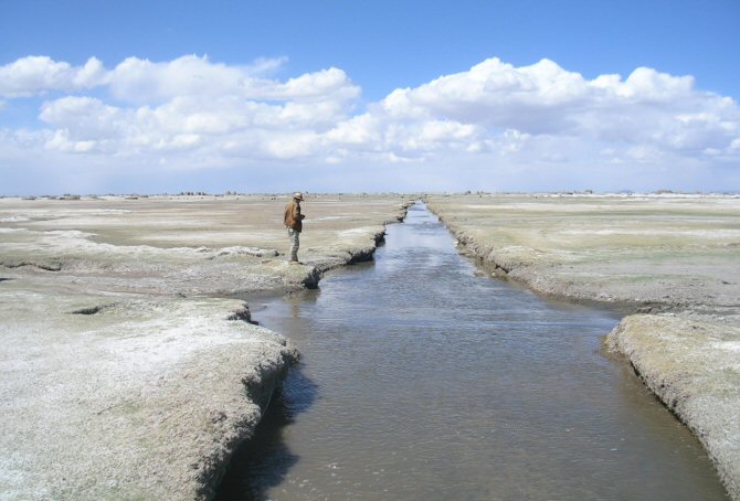
Looking into a section of giant channel about 330ft to 660ft wide
similar to the channel which Plato said ran right around the plain. An idea of the scale can be given if you look for the figure of the jeep driver standing at the left of the photo.
Its route is sustained by underground
springs and has a ribbon of water even in the height of the dry season. The construction of the canal was very similar to that described in a paper on Atlantis by Ulf Richter.
The cross section of the canal is very similar to that proposed by Ulf Richter
in a paper presented to the Atlantis Conferences
except that additionally, the soil removed is used to build up embankments on either side.
Ground view showing the flat base and sloping sides of the wide channel,
although sometimes dismissed as a fault line, the local geologist who mapped the area stated
it was a canal and not a fault line.
This section of channel at the northern end is 660 feet wide, 400 cubits or one furlong.

This section of channel at the northern end is 660 feet wide, 400 cubits or one furlong.

Water in this section of channel at the northern end measures 660 feet wide, 400 cubits or one furlong.

This section measures 330 feet wide, consistent with the stade of 200 cubits used to measure the Plain.
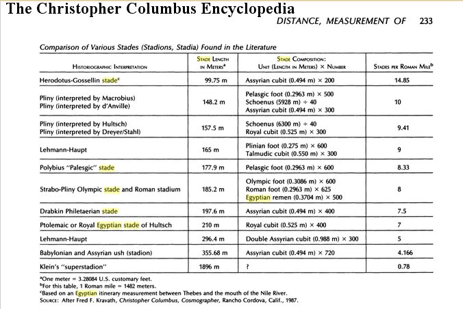
A stades chart from "The Christopher Columbus Encyclopedia" shows an Assyrian stade of 200 cubits, so not
unreasonable that the Atlantis stade used to measure the Plain should also be 200 cubits.
This this section of channel measures 330 feet wide, consistent with the stade of 200 cubits used to measure the Plain.

The water in this section measures 330 feet wide, consistent with the stade of 200 cubits used to measure the Plain.
Plato: "It seems incredible that the canal should be so large as the account states, but we must report
what we heard..."
Plato mentioned that in Atlantis they cropped the land twice a year and some people think that because today
the Altiplano climate is often described as harsh and soils as poor, that it was always like that. Apart from the effects
of climate change, the destruction of the original agicultural systems was mainly due to the efforts of the Spanish
conquistadors who removed people from the land and sent them down the mines in their quest for gold and silver. The original
agricultural systems
became abandoned and forgotten about, but Google Earth shows that vast areas of the
Altiplano were at one time originally cultivated using a variety of agricultural systems perfectly adapted
to the terrain.
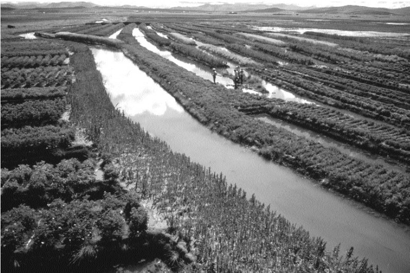
Suka kollus or raised fields on the Altiplano
When the abandoned system of agricultural called "suka kollus" or "camellones" was revived as
a scientific experiment, it was found that these heaped up beds surrounded by water channels increased the local
temperatures
and prevented the crops from dying off due to frosts, yields were greatly increased including two crops a year due to the nutrients heaped
onto the land platforms from the water channels. The raised platforms also helped prevent the crops from being
carried away in the flood seasons, both on the Altiplano and the Beni regions.
"Potato yields on experimental raised fields ranged from 5 to 20 MT/ha;
traditional agriculture on the slopes yields 2–5 MT/ha (Erickson 1996; Kolata et al.
1996). Based on potato production between 1981 and 1986, I calculate a carrying
capacity of 37.5 persons/ha of raised field cultivation platform or 2.25 million inhabitants
for the entire raised field system." reproduced from "THE LAKE TITICACA BASIN -
A Precolumbian Built Landscape", by Clark L. Erickson
Restored raised field production was therefore up to four times more productive than
traditional methods used on the Altiplano today.
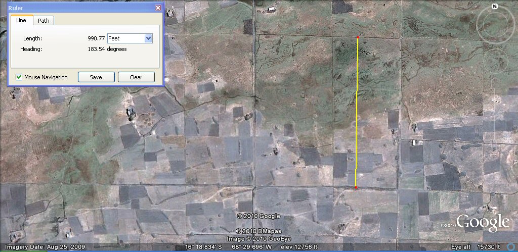
Above, these chequerboard plots of about 330ft (100 metres) are in the region north of Penas.

Above, this zone, north-west of La Paz has many straight canals where the terrain is more suitable.
Above, the two horizontal parallel canals are 1 x furlong or 660 feet or about 200 metres apart
and they form plots of 200 x 250 metres
or 400 x 500 Sumerian cubits. Dating is important to establish which unit of measurement was originally used, see below.
Above, in this zone, an underlaying system of canals forms a chequerboard pattern with squares of
600 Sumerian cubits or
300 metres.

Above, these underlaying canals form blocks of 600 Sumerian cubits or 300 metres. It can be seen on this photo where older canals have been redug in modern times.
The metre was adopted by the French academy of Sciences
for universal use in 1793, so if these canals are more recent than 1793, or are modern, they could have been
set out in metres, however if they are pre-Columbian then they are probably set out in "Sumerian" cubits of 19.8" whilst if they date from after
the time of the Spanish Conquest they could still be in "Sumerian" units such as cubits and furlongs since these were also brought over by
the Spanish as the old Spanish vara was in fact the "Sumerian" yard of 33.0". Each block is 600 Sumerian cubits or 360 Sumerian yards square.
Above, the underlaying canals form blocks of 600 Sumerian cubits or 300 metres.
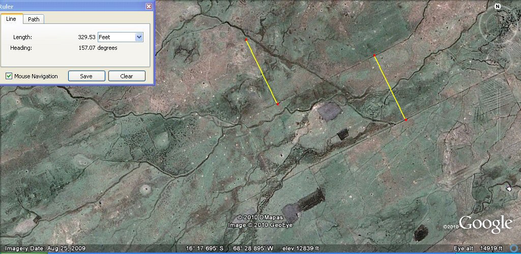
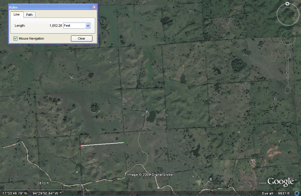
Above, these channels are about 330 feet (half furlong or 200 Sumerian cubits) or 100 metres
apart as measured by the yellow lines.
Above, in the same area, these sub-channels are about 165 feet (100 Sumerian cubits) or 50 metres
apart as measured by the yellow line. If these canals are pre-Columbian then they show the use of "Sumerian"
measurement units in the Americas.
Click here for Atlantis stade and more on the cubits etc
If they are of more
recent times, then they did not last long and in any event show how easily the canals wash away
and disappear over time....
Recent
high resolution satellite imagery shows the area just south of Oruro to
be completely covered in a system of parallel canals similar to Plato's
description.

high resolution satellite image showing canals crossing the
plain in parallel lines, CLICK for more canals photos
Enlargement. The parallel canals are approximately 550 to
600ft (167metres to 183metres) apart with intermediate canals 275 to 327ft (84
to 100 metres) apart.
enlargement
Another system of wandering channels like canalised rivers
crosses the straight canals and appears to link up a system of wells fed
originally from the underground water table.

The canals are supplied by a system of wells connected by
feeder canals, the wells are probably more recent attempts to obtain water from underground sources due to the drying up of the climate.

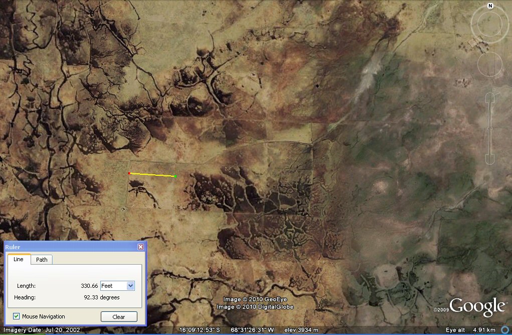
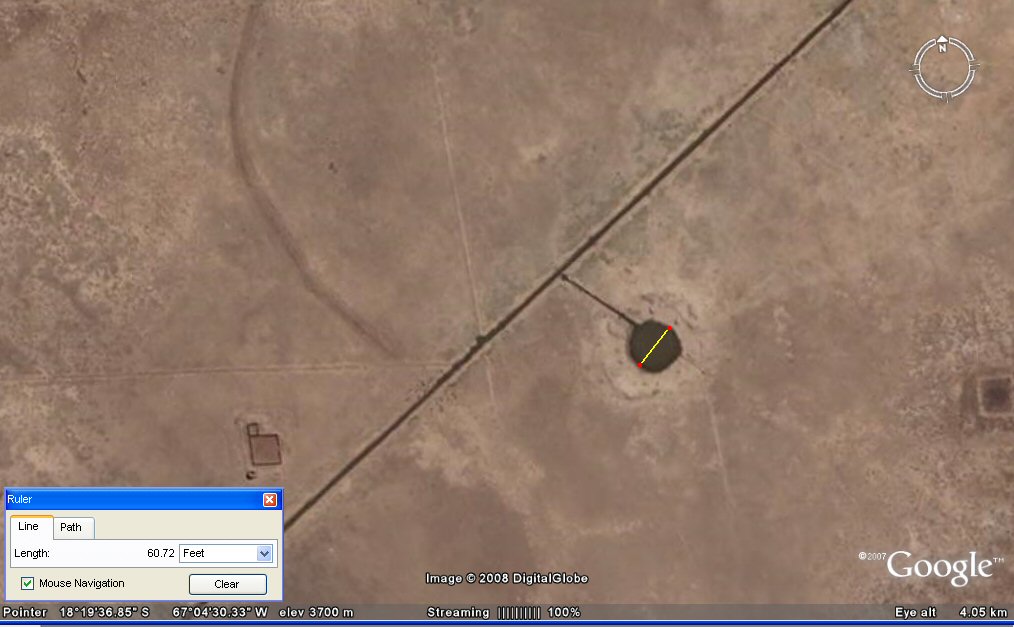
Detail of well supplying canal system. The well has an outer diameter of 200ft and the water level appears
to be too low for the system to function today.

Section of canalised river with wells feeding straight canals.
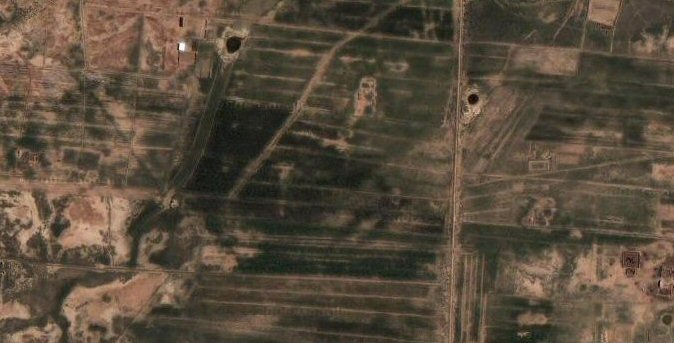
Some of the canals are still in use today but the vast majority appear to be abandoned and the cultivations fallen into disuse.
Recently, attempts have been made to expand the cultivation of quinoa in the region.
canal fed by well, internal diameter 60ft

the canal disappears under rio Desaguadero.

straight canals continue under the rio Desaguadero.
Irrigation canals with feeder channel and well.
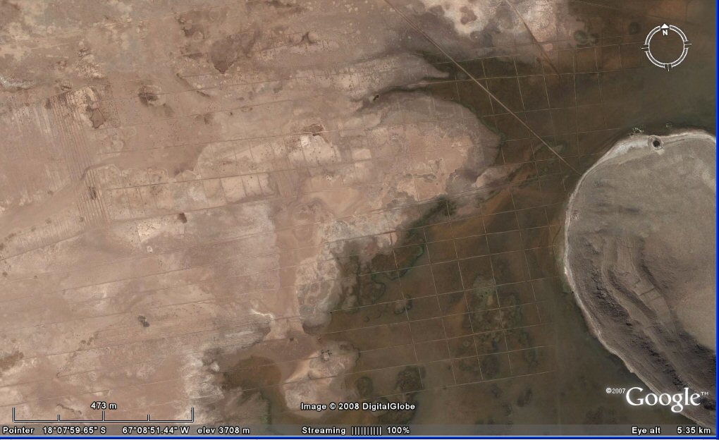
canals extending into present-day lake UruUru, the irregular pattern suggests these are probably more
modern creations than the ancient canals which were more perfectly regular.
canals beneath present day salt desert.
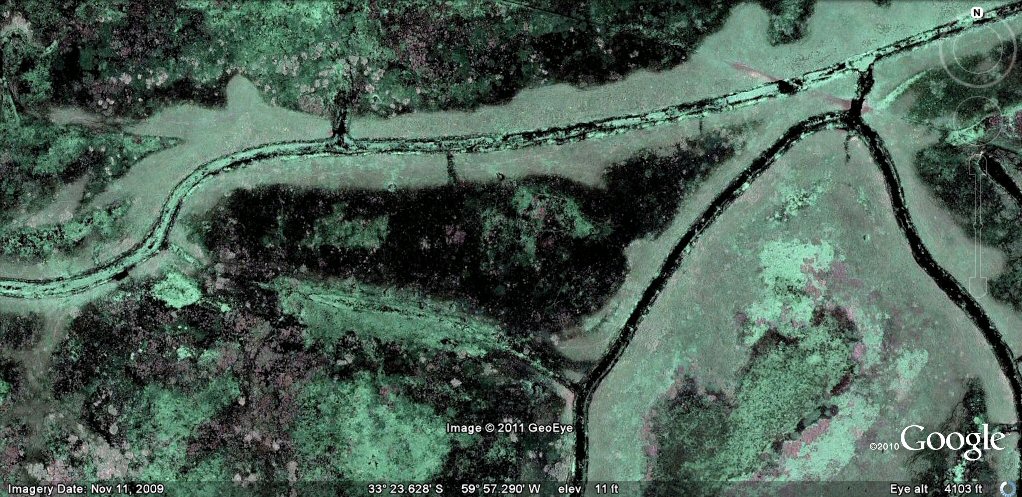
Evidence of ancient canals, artificial harbours and artificial islands exists throughout South America.
ancient canals in the rio Parana
see canals Parana rio page
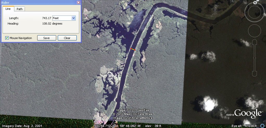
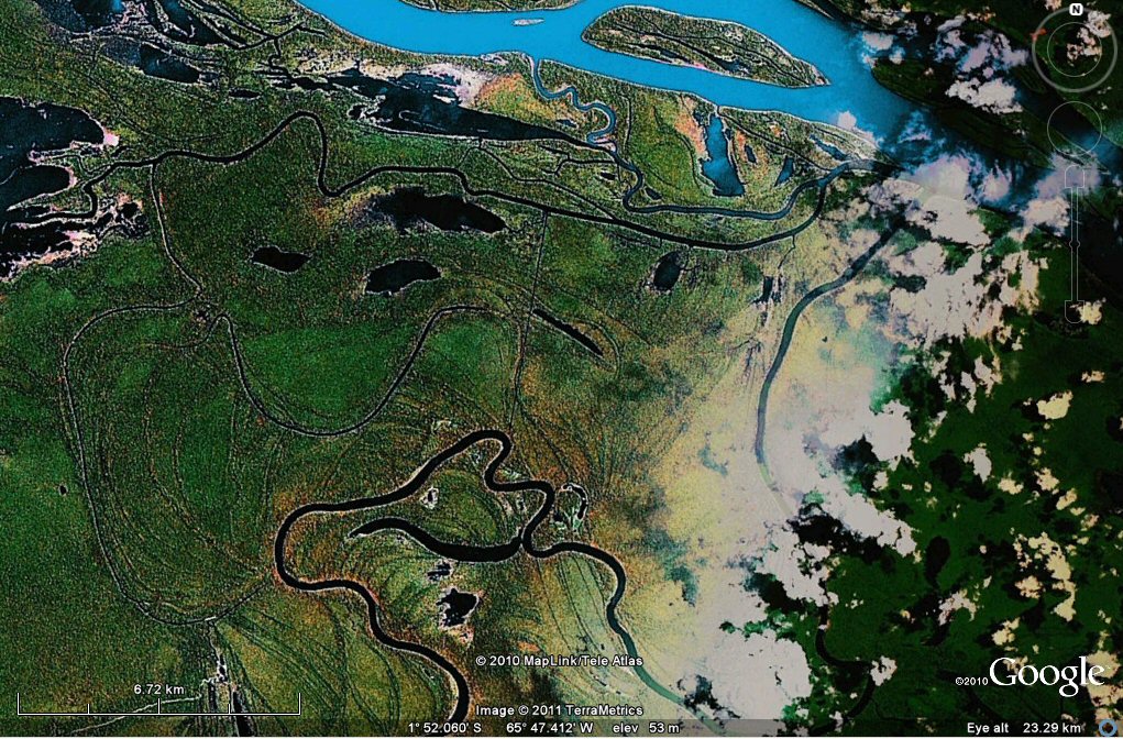
Above, example of man-made canal in Amazonia, there are many examples linking rivers and tributaries
and giving access to oxbow lakes and ponds.
see canals Amazon rio page
The upper entrance to the interlink (Auati Paraná)
joining a tributary to the Amazon showing signs of canalisation.
see canals Amazon rio west page
Above, this section of ancient engineered canal joins the river
Orinocco to the river Amazon
see canal Orinocco to Amazon page
Close-up study of areas of the Amazon suggests a great number of natural ponds have
been adapted for use as artificial ponds
and served by a network of access canals
click for rio Amazon page
Selection of related studies,
See also
dating of canals in northern Peru 4,684BC
dating and location of canals in northern Peru Wikipedia
"The new find suggests that agricultural settlements may have appeared in South America at about the same time they did in the Middle East.
Dillehay notes that the earliest evidence of irrigation canals in Sumeria is between 7,000 and 8,000 years old."
National Geographic quote... Researchers found three canals that date to at least 5,400 years ago buried by sediment layering. A fourth possible canal was also found, which special radiocarbon dating techniques revealed to be 6,700 years old.
"Some colleagues in the Andes surmise early canal irrigation based on the presence of crops at 9,000 to 10,000 years ago," said Tom D. Dillehay, an anthropologist at Vanderbilt University in Nashville, Tennessee, who lead the study.
canals in Peru
rio Parana canals, ponds and islands
rio Paraguay levees canals
rio Parana delta canals
Corrientes
rio Amazon to Manaus
rio Amazon west from Manaus
rio Orinocco to Amazon canal
flooding dates on the Altiplano
atlantis canals on the Altiplano
canals gallery
Chipaya canals gallery
Caral, Peru containment canal
Tabasco, Mexico canals gallery
canals Louisiana
Paria, Oruro containment canals
canal to sea (lago UruUru)
Pantanal
Beni, Moxos gallery