Since relatively little archaeology has been done in Bolivia and probably mostly at known and accessible sites, it might be worthwhile in future for archaeologists/geologists to visit some of these earthquake-destroyed sites to try and determine the dates of their destruction, including the ringed hilltops (link at bottom of page).
Locations are plotted on map at foot of page.
The Atlantis site at Pampa Aullagas.
See also additional studies,
atlantis canals on the Altiplano
canals gallery
Chipaya canals gallery
canals in Peru
Caral, Peru containment canal
Atlantis stade - Egyptian and Sumerian cubits
Tiwanaku cubits
Peru cubits and calendar
Above, This ringed hill on the Peruvian side of the Altiplano appears to show
the remains of concentric irrigation channels but similar sites usually have walled terraces/pathways.
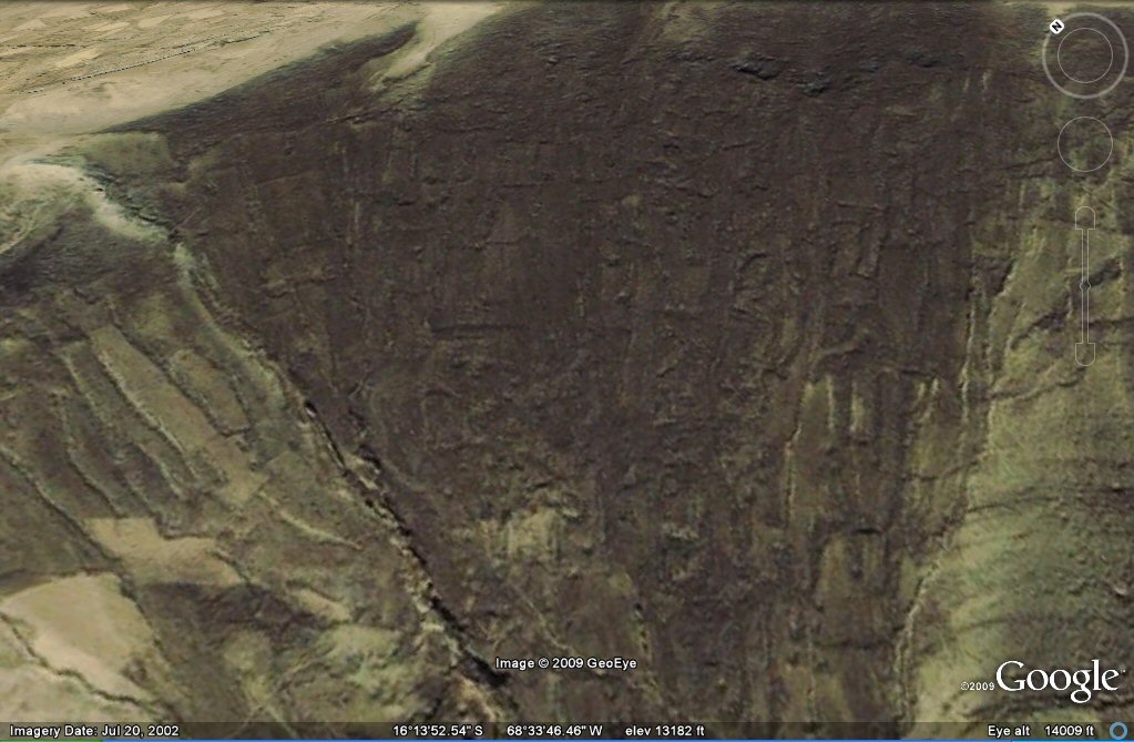
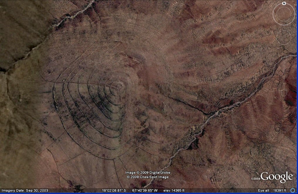
Above, No. 130 This ringed hill shows total destruction on the eastern side where earthquakes have turned the terrain onto its side..
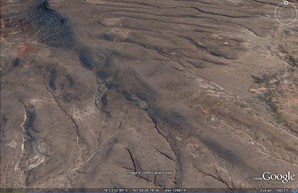
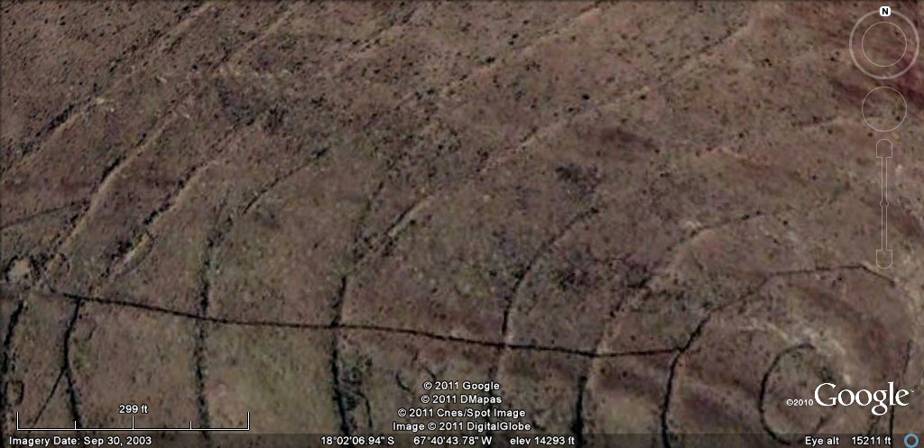
Above, 102 This ringed hill shows considerable destruction by earthquakes.
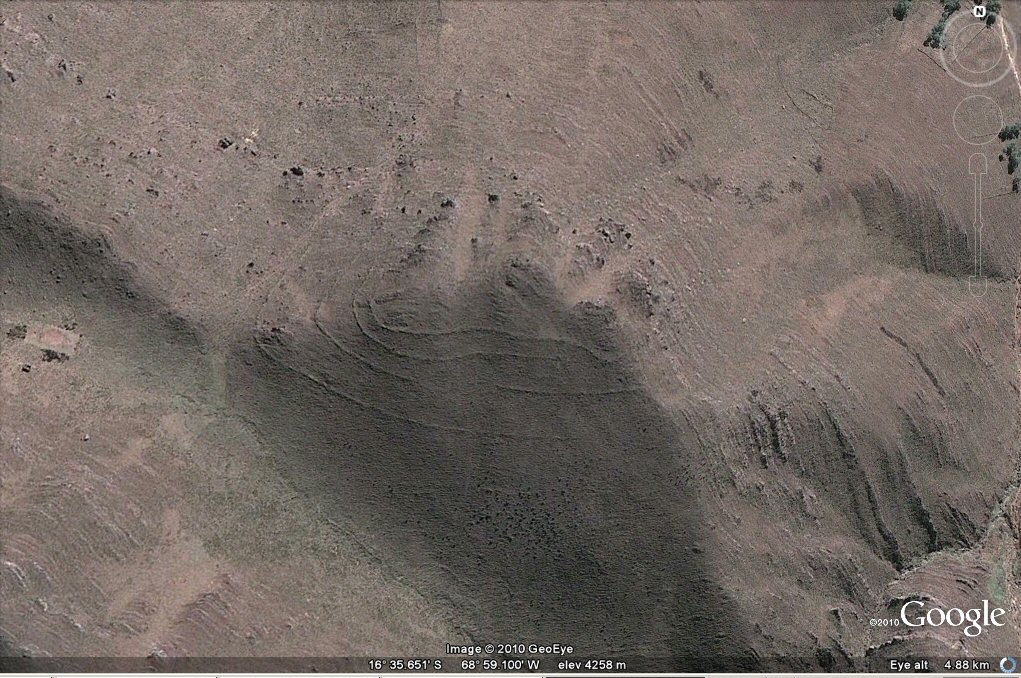
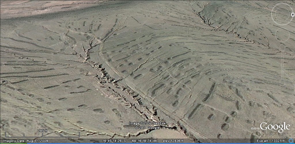
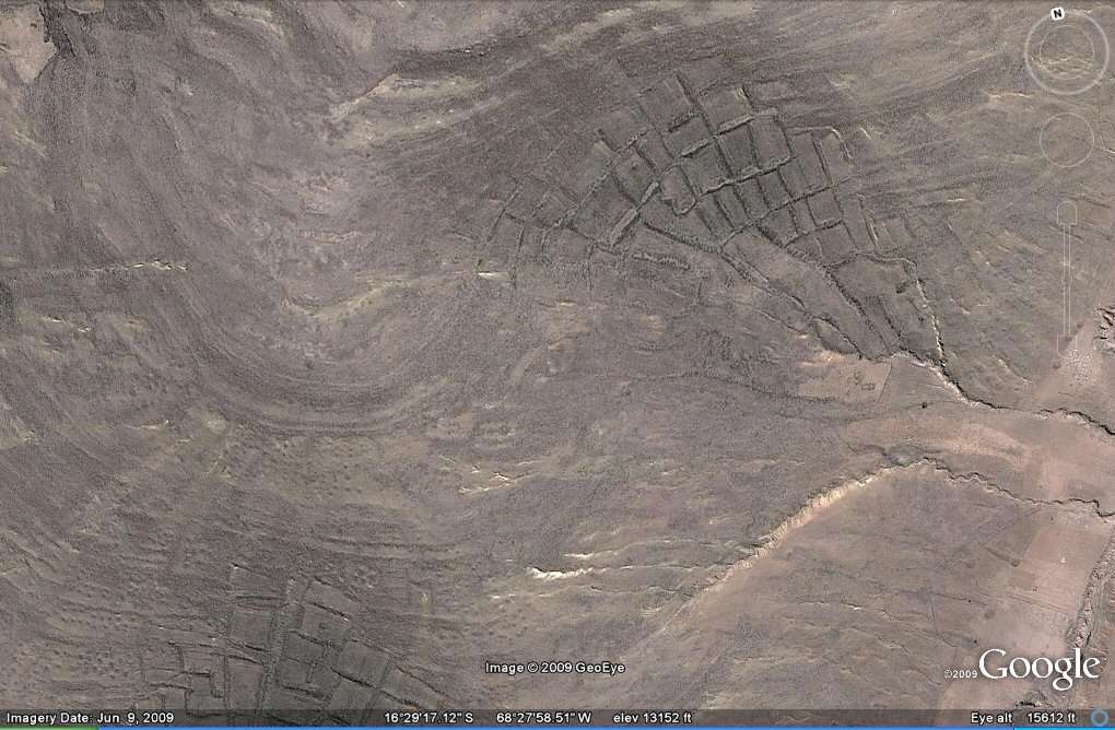
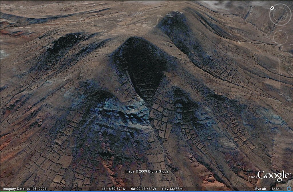
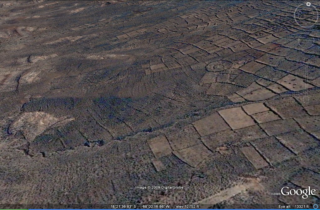
138 Above, earthquake activity often appears to show as "smoothed" grey areas such as
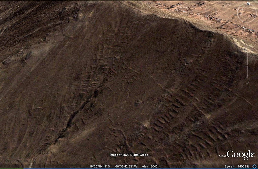
in this zone south of La Paz with "geoglyph" agriculture.
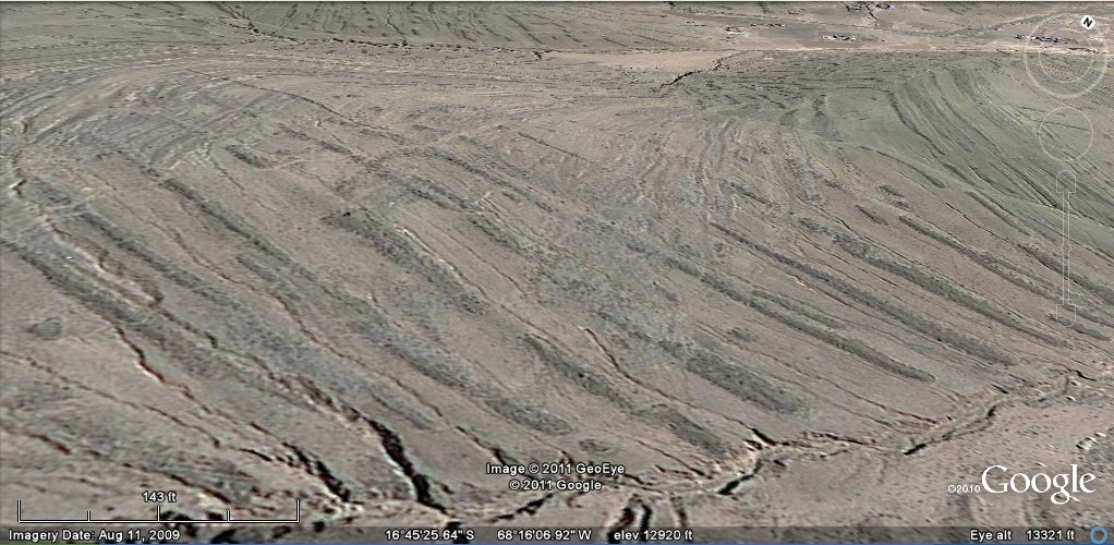
Above, in this close-up view the "geoglyph" agriculture system is supplied with water by horizontal irrigation channels intersected by natural streams.

Above, in this close-up view the "geoglyph" agriculture system is supplied with water by horizontal irrigation channels intersected by natural streams.
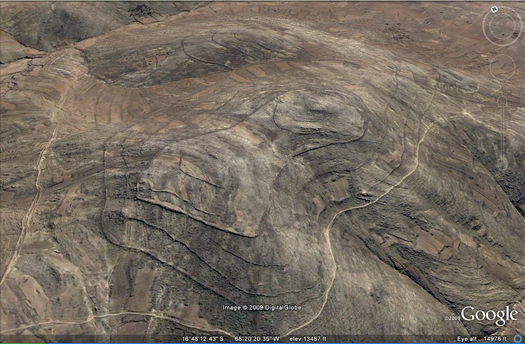
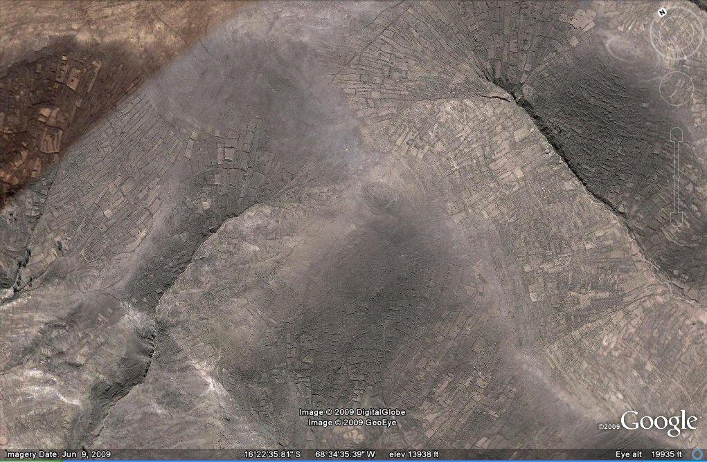
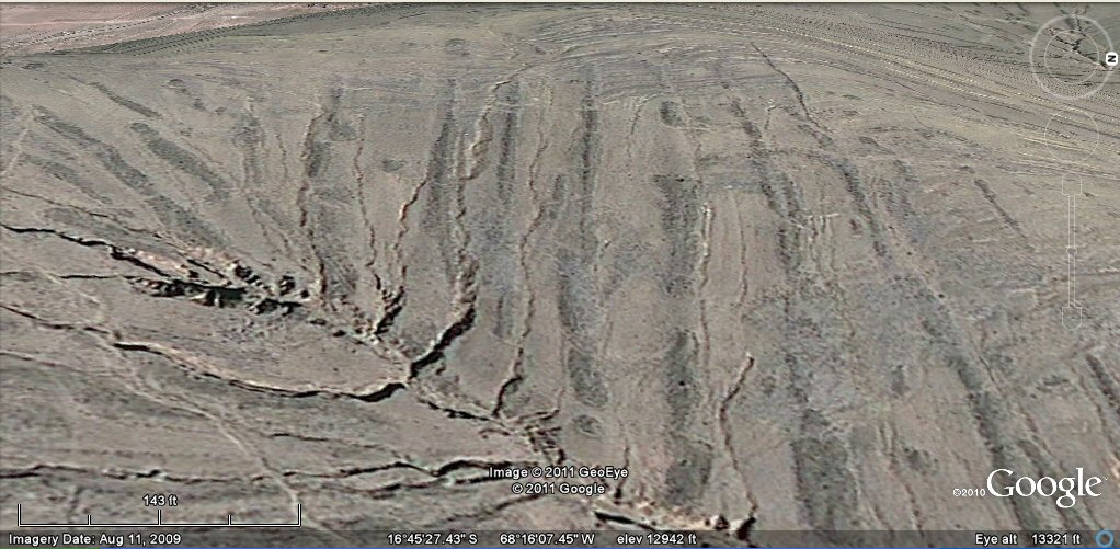
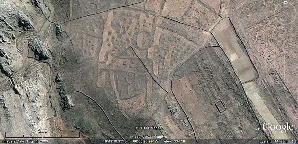
101 d, Above, This hilltop, as a general example, is surrounded by the remains of
concentric teraces
and remains of the "geoglyph" agriculture system.
101 d, Above, this close-up appears to show remains of the concentric channels
which supplied the agriculture with water, but only terraces were found on site.
101 d (north side), Above, in this oblique view the "geoglyph" agriculture system can be seen extending
over the sides of the valleys
with parallel embankments and small rounded mounds.
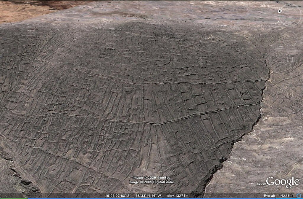
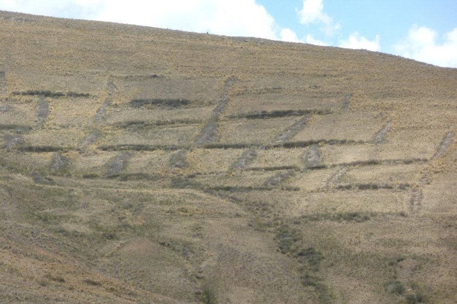
101 d (north side), Above, in this close-up view the "geoglyph" agriculture system appears as parallel
embankments.
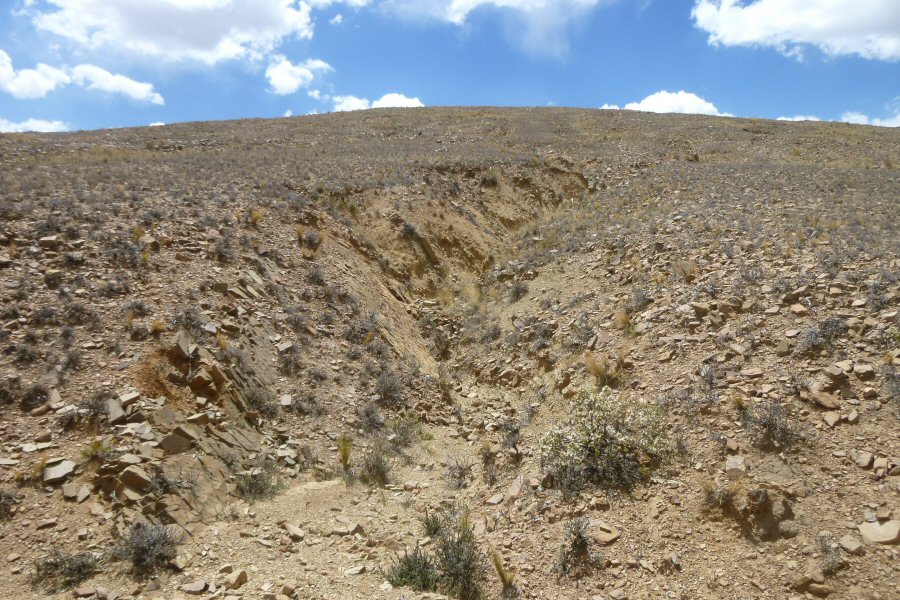
101 d (north side), Above, close-up of "geoglyph" agriculture system struck by earthquakes
with fissures opening in the land afterwards.
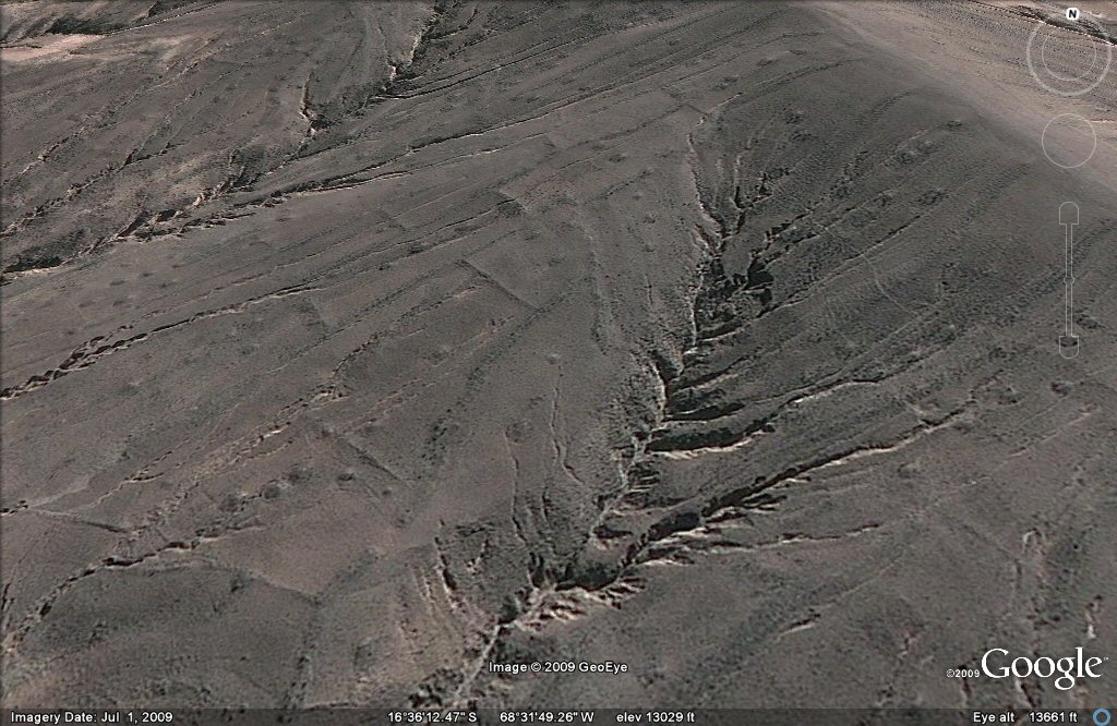
Above, 132 Close-up of fissure amongst the original "geoglyph" agriculture system.
Above, 132 Close-up of fissures amongst the original "geoglyph" agriculture system.
Above, 132 close-up of fissures amongst the original "geoglyph" agriculture system.
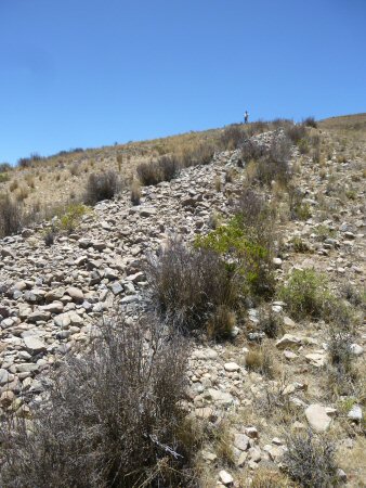
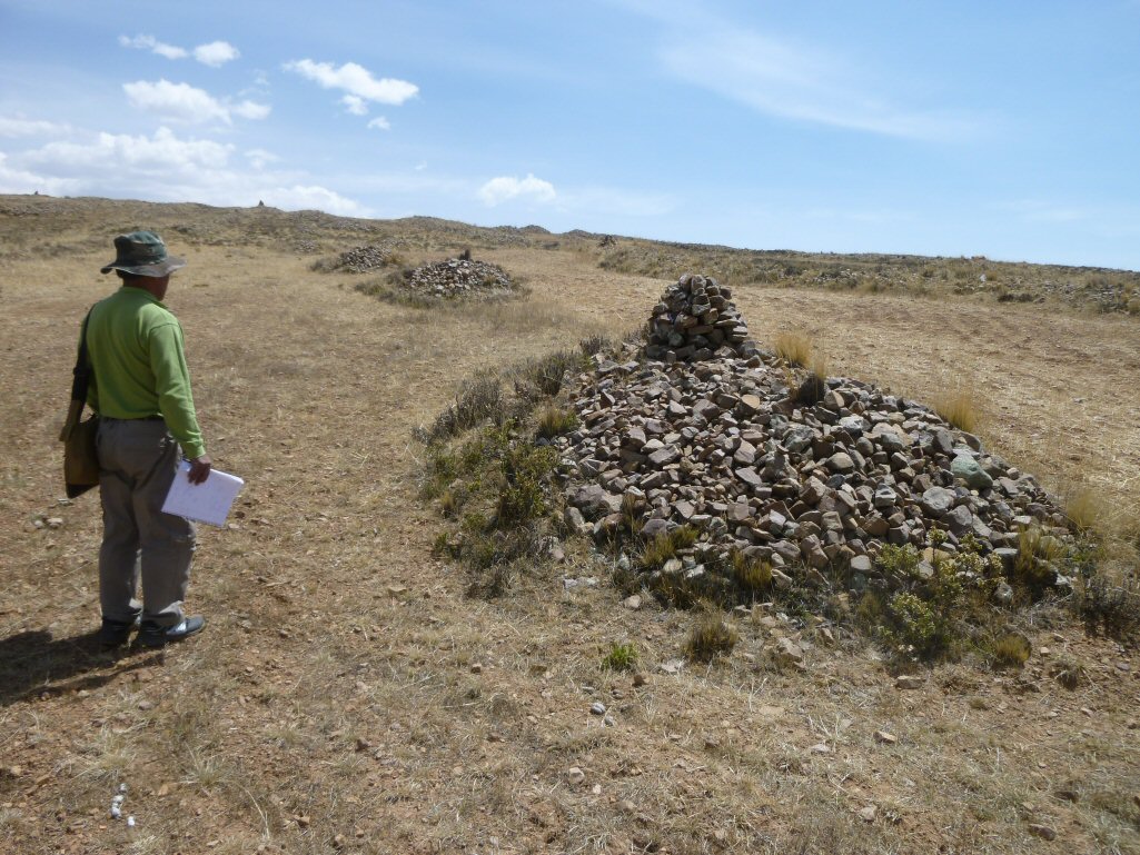
Above, 132 ground view of the colummns and mounds of stones cleared from the original sites.
Above, 132 Close-up of fissures amongst the original "geoglyph" agriculture system.
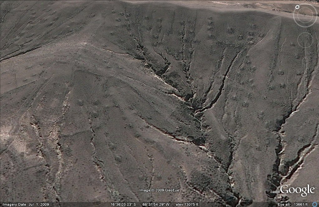
Above, 132 Fissures as a result of earthquakes amongst the original "geoglyph" agriculture system in ridge of mountains near Tiwanaku.
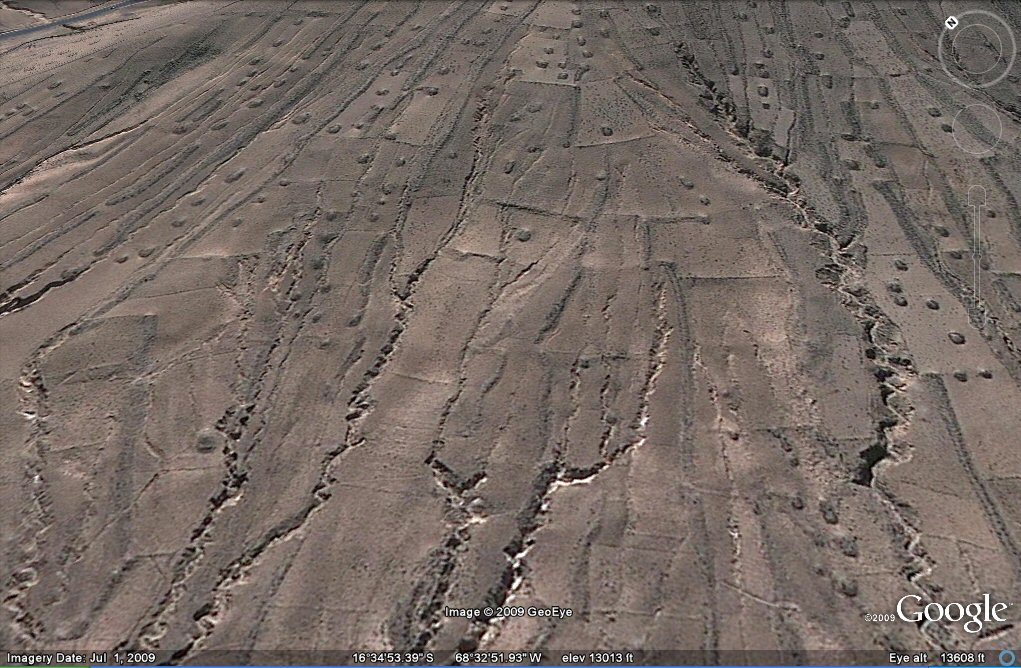
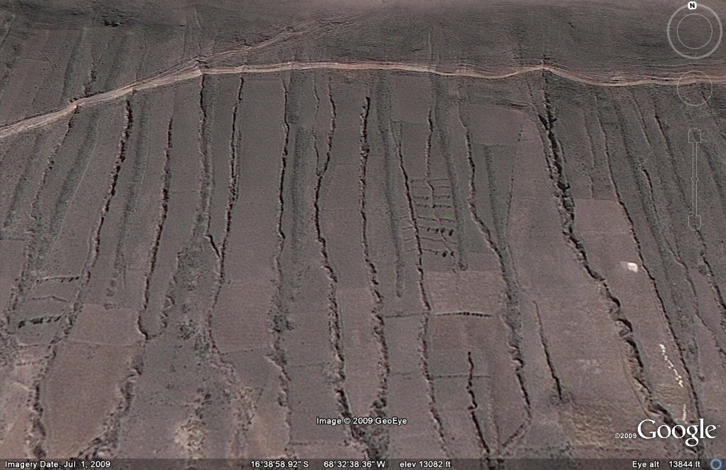
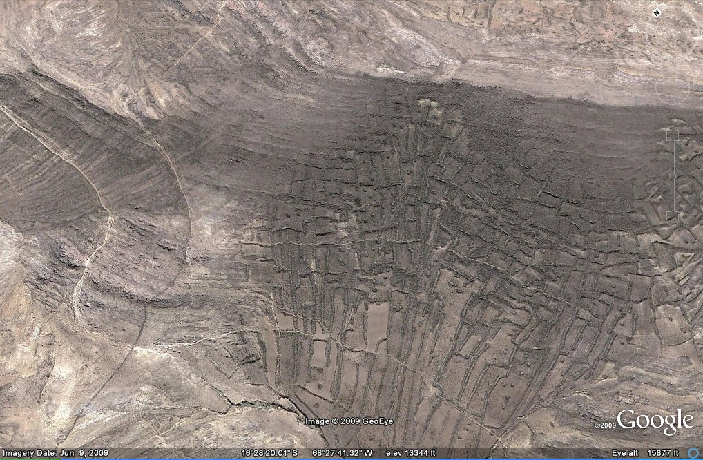
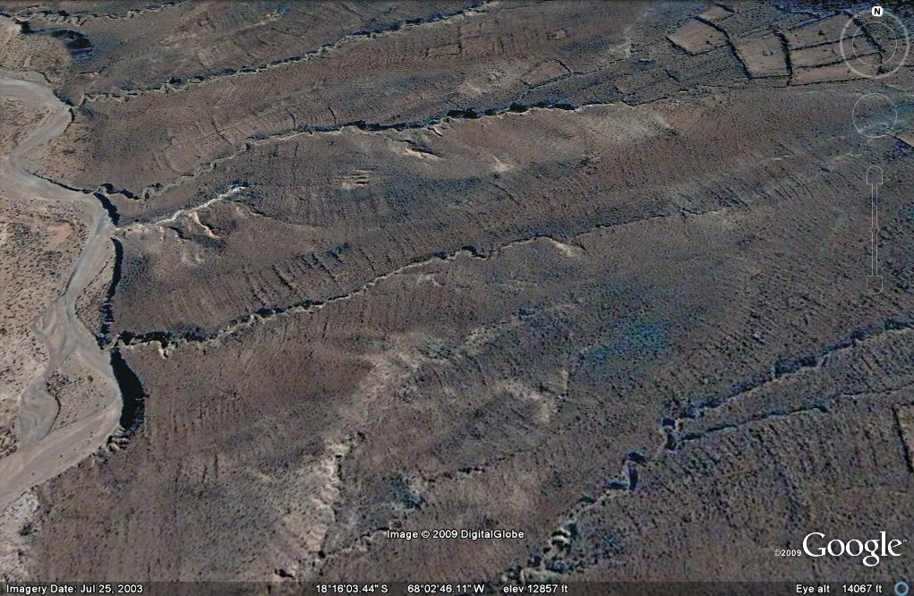
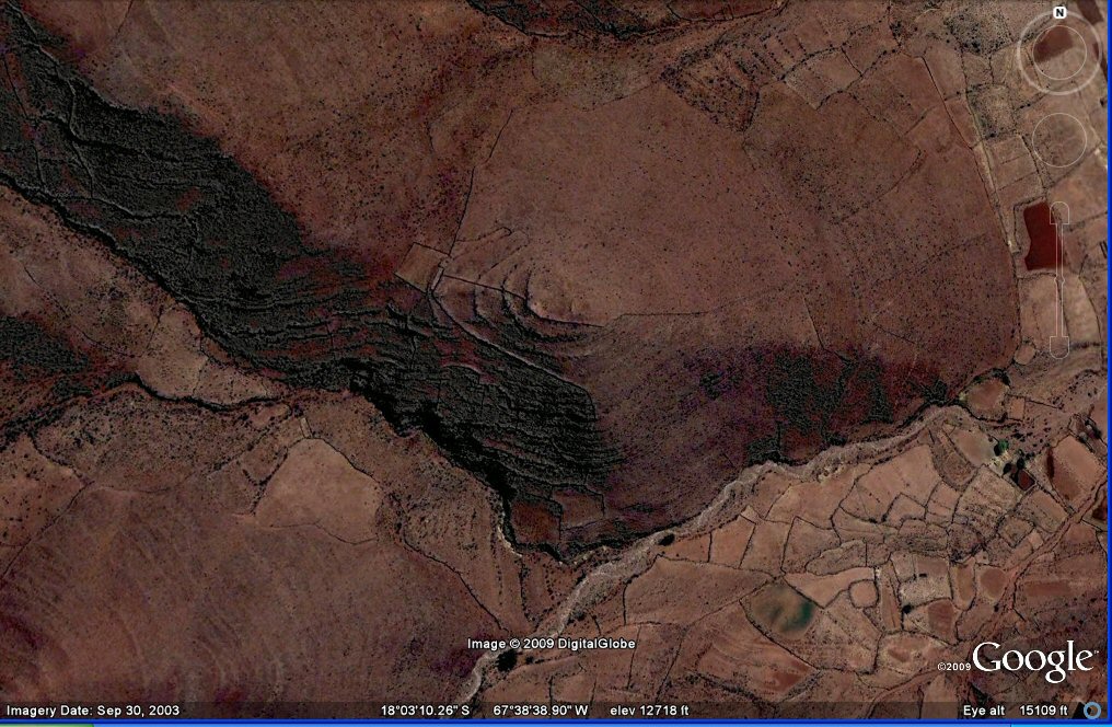
138 Above, earthquake activity appears in this zone of terraces in the Tiwanaku region.
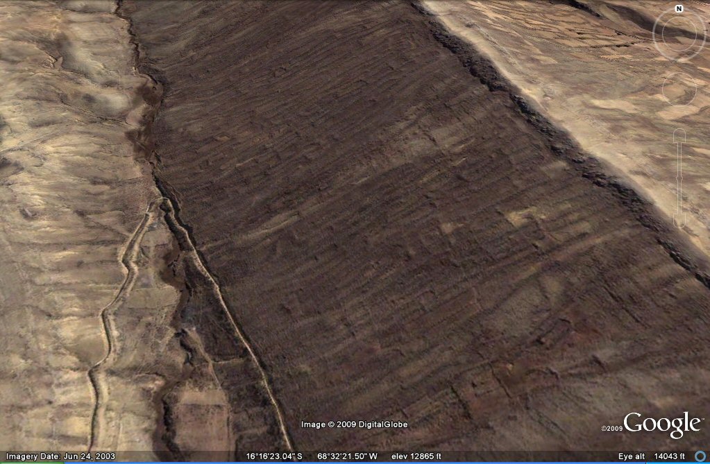
140 Above, earthquake activity appears in this zone of "geoglyph" agriculture Tiwanaku area. The remains are so old that they appear "fossilised".
140 Above, earthquake activity appears in this zone of "geoglyph" agriculture,
now apparantly hanging down a cliff face, Tiwanaku area.
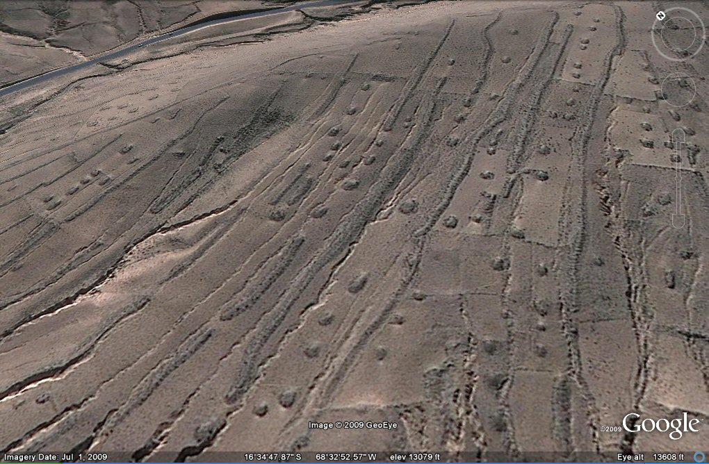
134 Above, earthquake activity appears in this zone south of La Paz with "geoglyph" agriculture.
Small pockets of the original agricultural system remain in this area which has been largely obliterated and overturned by earthquakes.
134 Above, ground view of remains of "geoglyph" vertical teracing system and (right) nearby zones destroyed by earthquakes.
134 Above, earthquake activity appears in this zone south of La Paz with "geoglyph" agriculture.
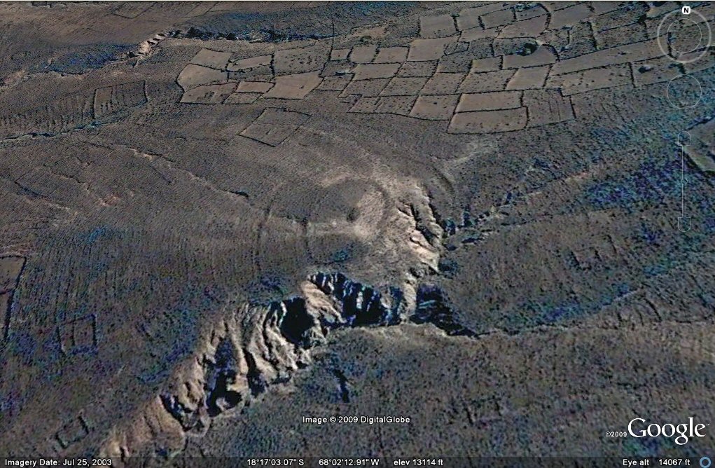
104 c, Above, this photo clearly shows how the ancient, disused system of agriculture
has been abandoned and built over by later peoples who constructed walled enclosures (the thin, sharp lines).
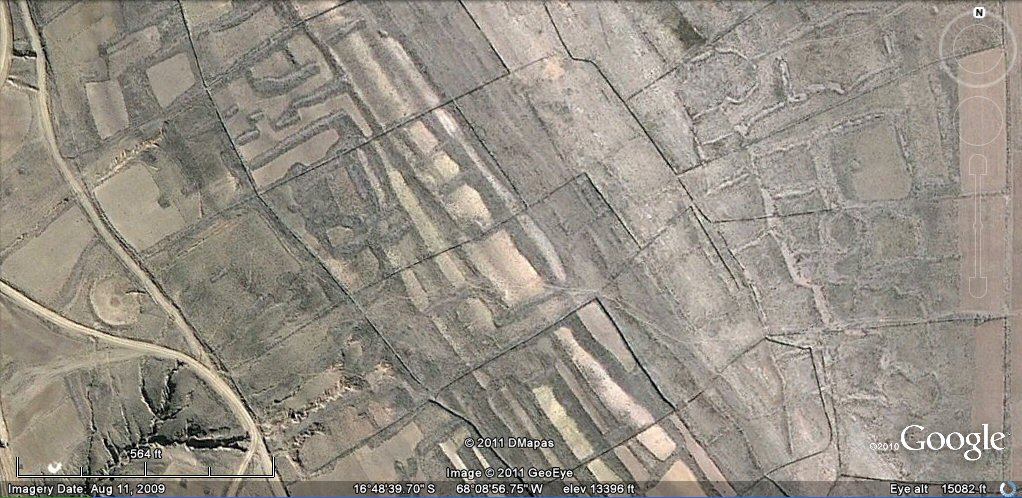
104 b, Above, another example of how the ancient, disused system of agriculture
has been abandoned and built over by later peoples who constructed walled enclosures (the thin, sharp lines).
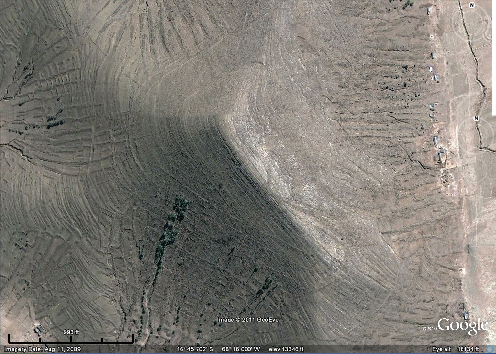
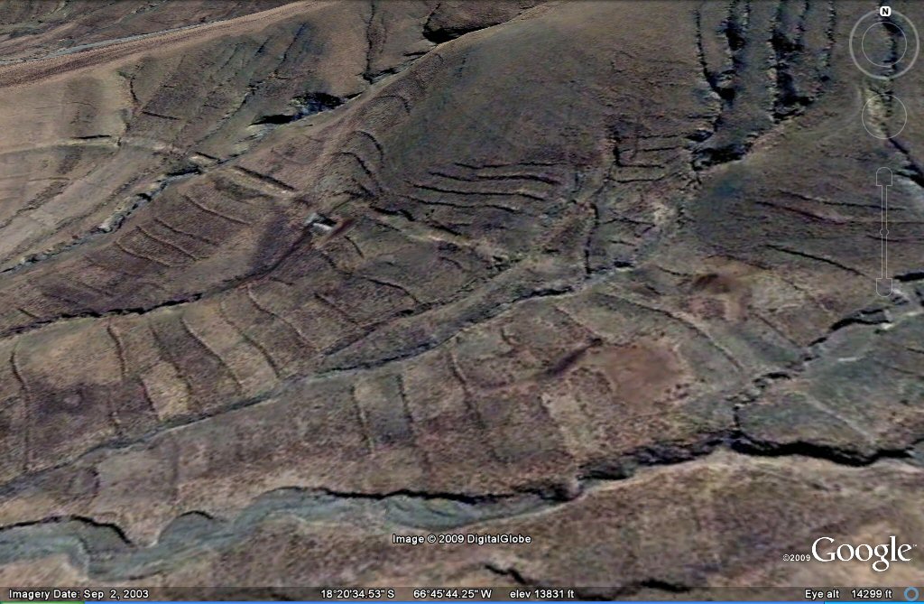
No. 17 Above, fields now on mountain sides suggest earthquake uplifiting in this area
south of Turco, in the Oruro region.
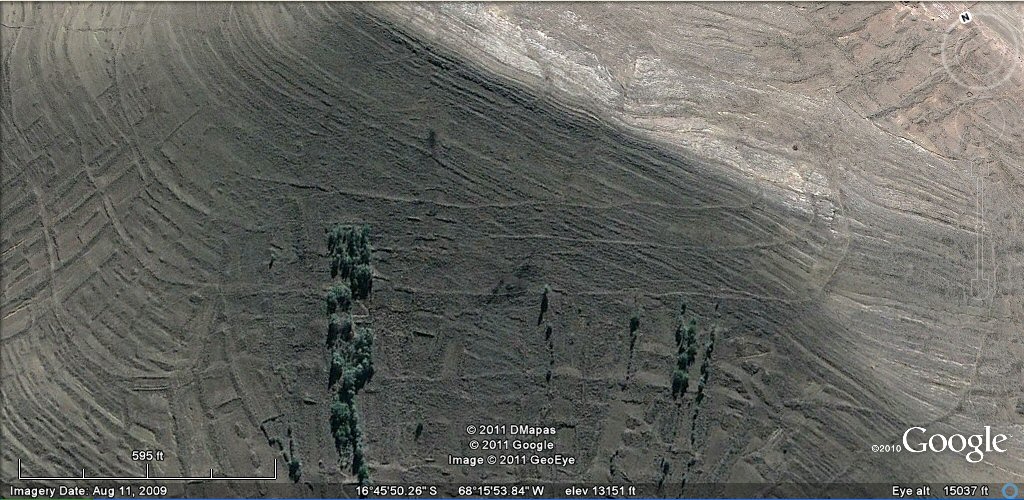
No. 17. Above, earthquake activity appears along this ridge with circular
feature in this zone south of Turco.
No. 17. Above, close-up view shows these circles to be the remains of concentric ancient
irrigation channels but ground visit showed only walled pathways on this ridge south of Turco
No. 17 area, Above, earthquake activity appears in this zone south of Turco.
No. 17 area, Above, earthquake activity appears in this zone south of Turco. The squarish plots are probably from a later date.
No. 17 area, Above, earthquake activity appears in this zone south of Turco. The squarish plots are probably from a later date.
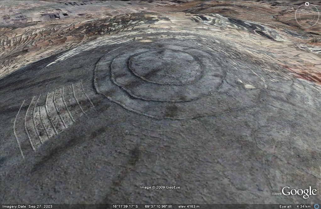
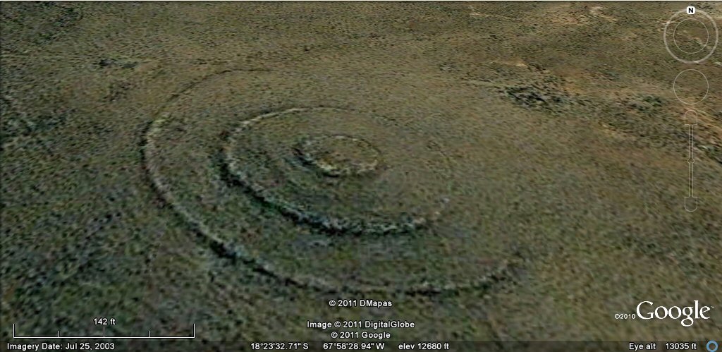
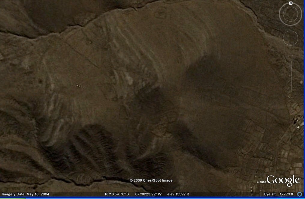
Above, No. 46a This ringed hilltop south west of Oruro has been devastated by earthquakes.
Above, No. 46a Close-up view shows the rings to have originally been concentric
irrigation channels although walled pathways/terraces are more usual. The site has been destroyed by earthquakes then at a later period people
have returned and built walls (shown as very thin black lines) as animal enclosures (corrales) alongside the original features.
Above, No. 46b This ringed hilltop south west of Oruro has been devastated by earthquakes.
Above, No. 46c This ringed hilltop south west of Oruro has been devastated by earthquakes.
Above, region near Bombo, east of Lake Poopo. The diagonal line is the remains of either railway
or possible irrigation canal running for a distance of about 8 miles and whose route has been completely destroyed by earthquakes.
See also for additional views of this area click here
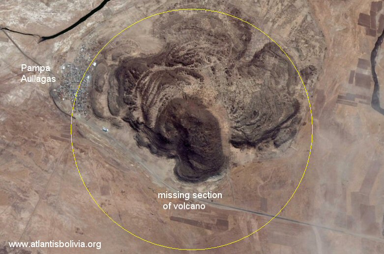
Above, the Atlantis site at Pampa aullagas has been considerably altered due to earthquake activity.
In this photo you can see how the southern section of the volcano is entirely missing. The outer western section has sunk in elevation
whilst the inner western section has risen in elevation. The north-eastern section looks like it has been pushed there from the southeast.
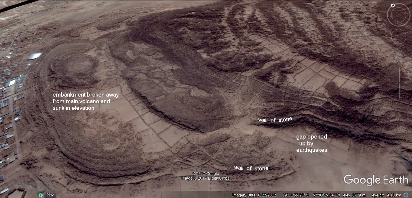
Above, the Atlantis site at Pampa aullagas has been considerably altered due to earthquake activity.
In this photo you can see how the western embankment has been detached and pushed outwards from the original volcano.
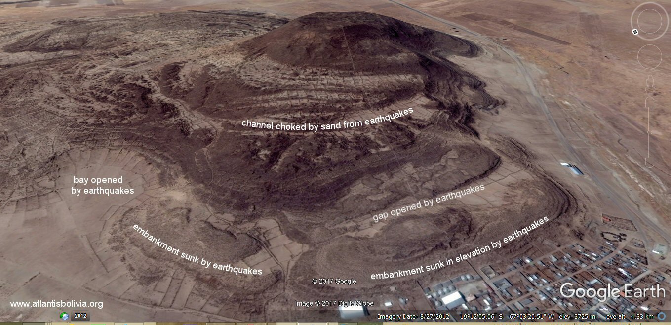
The two western embankments have been sunk in elevation due to earthquakes, the central channel is full of sand thrown up by earthquakes.
(view from the west)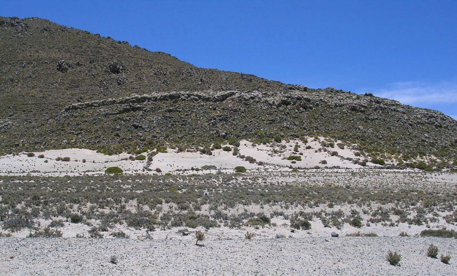
In this photo you can see how the entire face has fallen away from the volcano and disappeared, except for the ribbon of white stones
covered in "katawi", deposits from the time when the volcano was under the waters of the nearby lake.
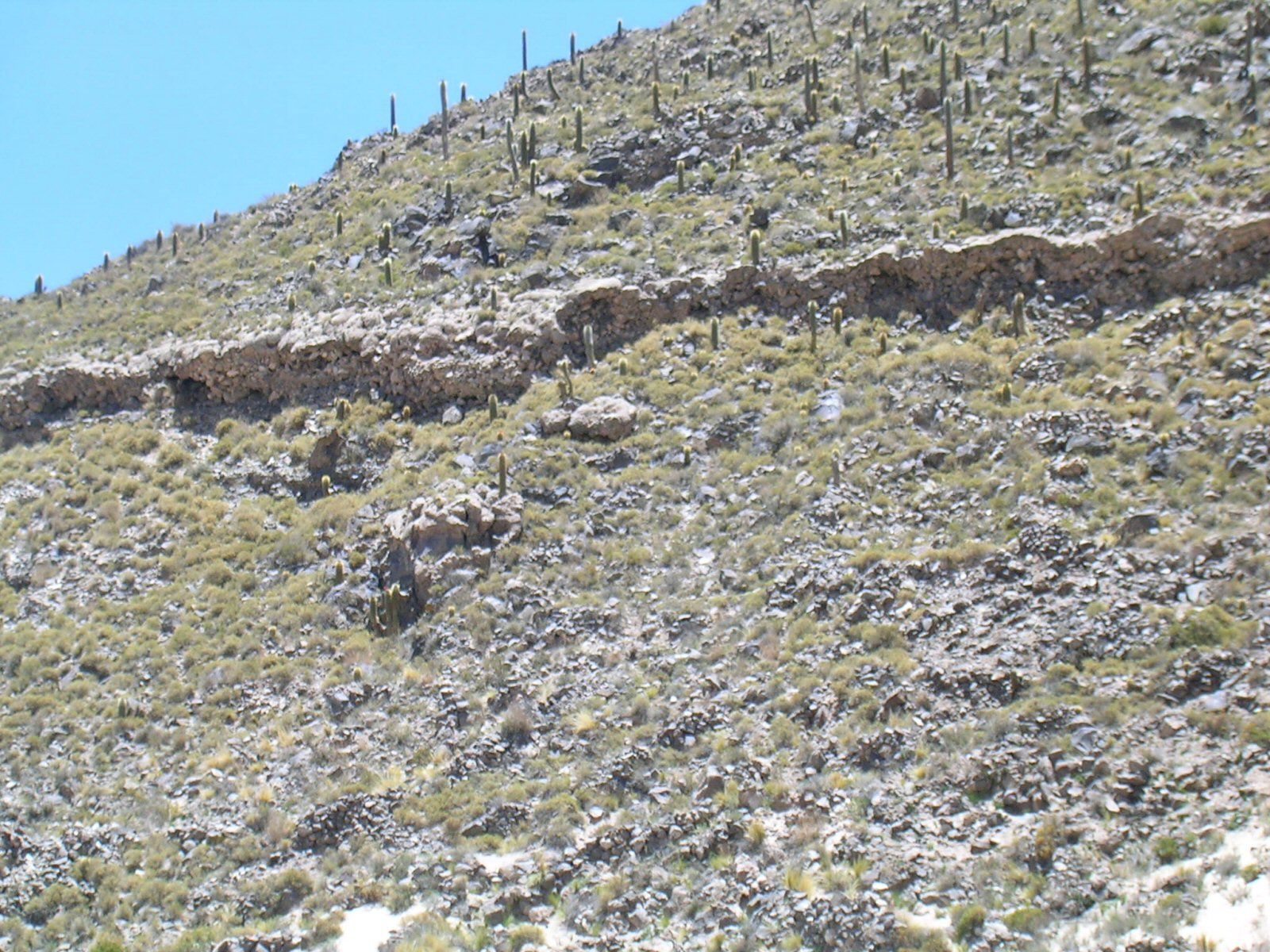
Above, more evidence of destruction by earthquakes leaving only small portions of the original outer stones.

The white stone on the right is covered in "katawi", deposits from the time when the lower parts of the volcano were under the waters of the nearby lake.
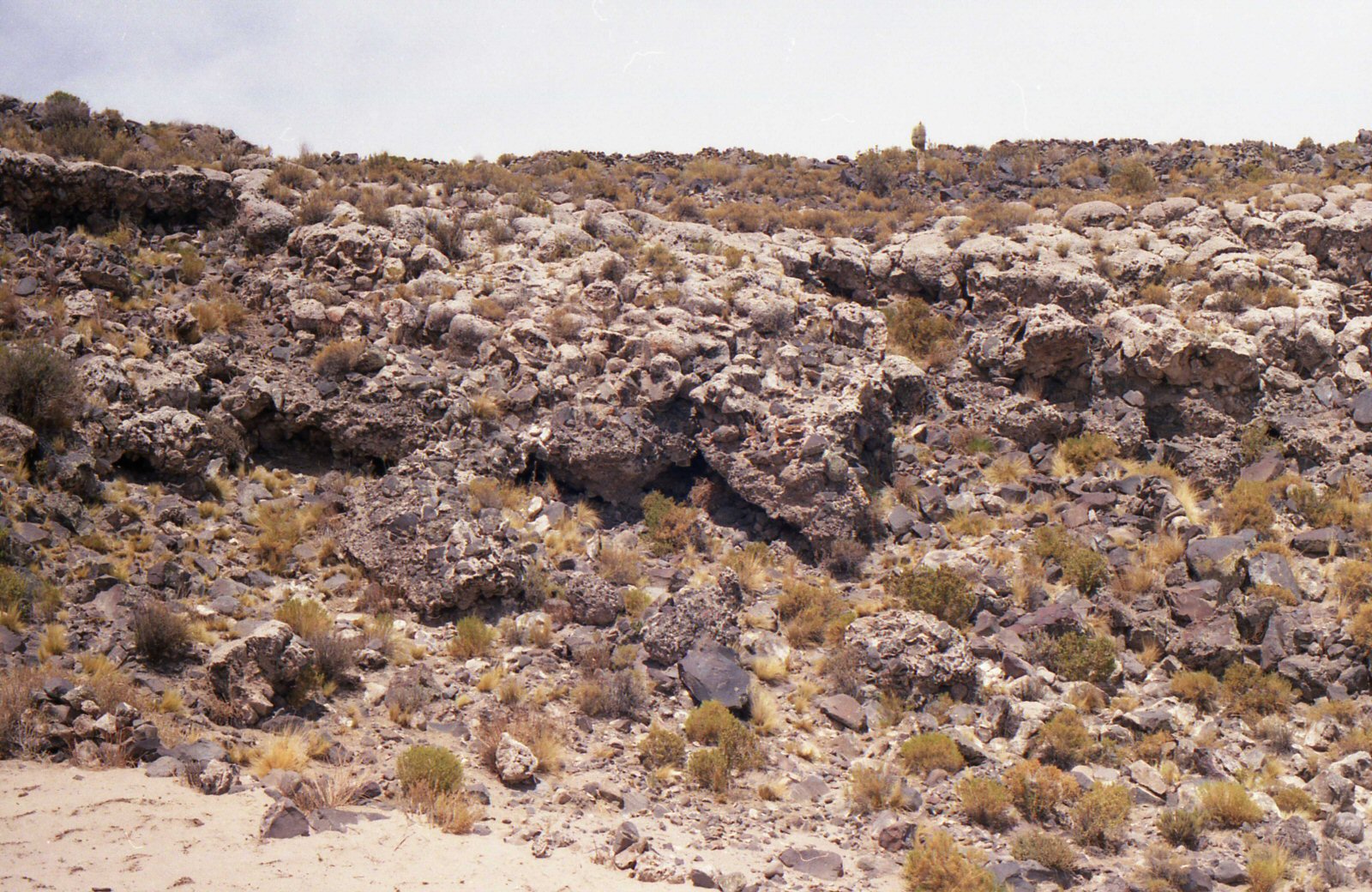
Earthquakes or explosion has embedded the katawi stone into the other stone, or vice versa.
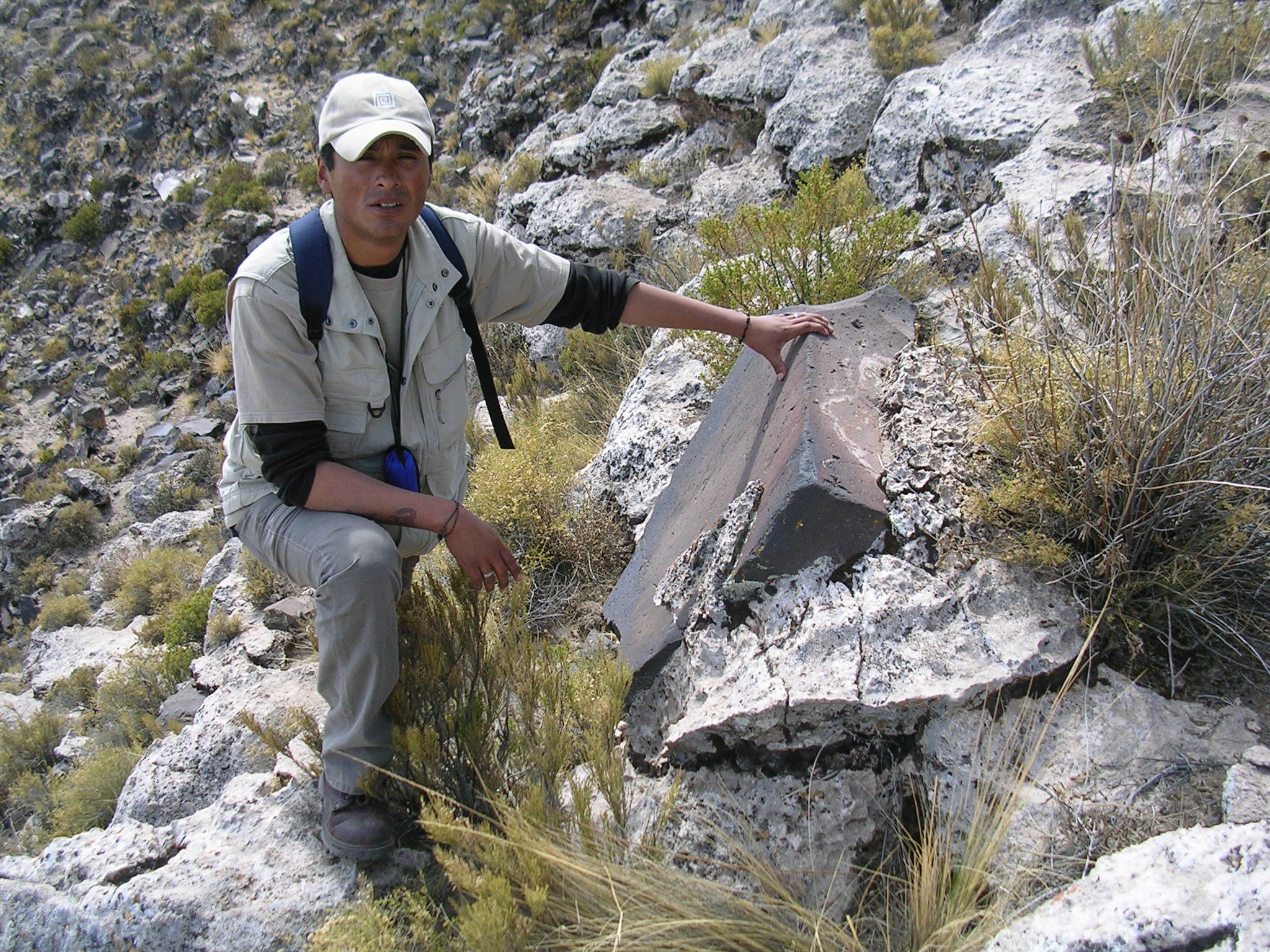
This large black stone, which looks cut and also burned on one corner by intense heat has only a light covering of the white material,
suggesting it has been displaced from somewhere else on the volcano higher up.
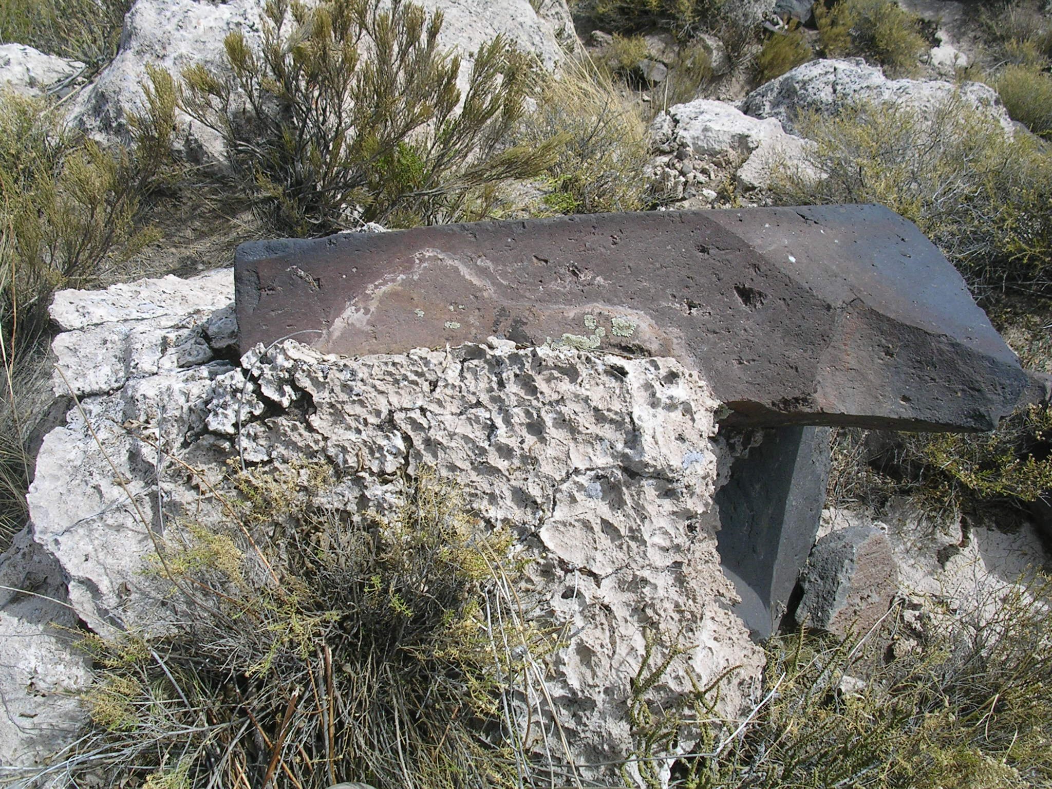
Another view of the same stone, perfectly cut at one end and shattered by earthquakes at the other end.
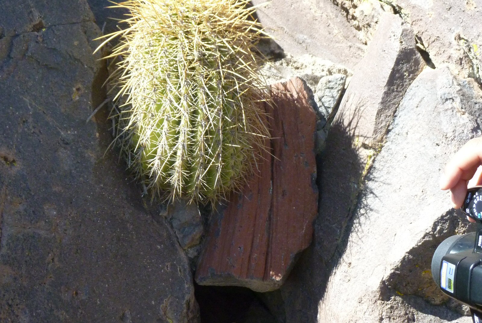
This stone appears to have been painted red, yet it is found driven by earthquakes or explosion into another pile of shattered stones.
The concentric ringed battlement walls of the Persian cities of Ecbatana and Susa were similarly painted in distinctive colours including crimson.
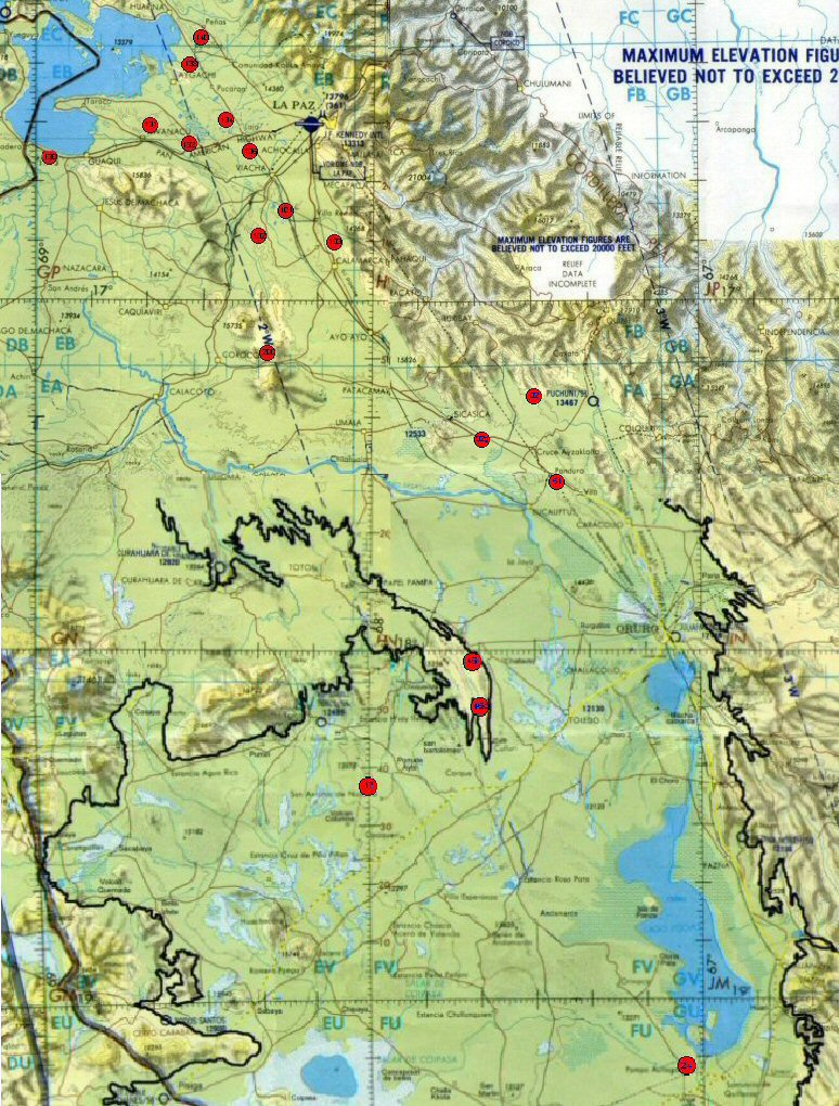
Above, map showing earthquaked sites seen on Google Earth (marked with red circles)
which seem to follow a fault line extending from the north of Tiwanaku right down to Pampa Aullagas.
Could this have been the "cataclysm" Plato described?
agricultural variations on the Altiplano
ringed hilltops
geoforms - geoglyphs and other agricultural landforms
contour forms/irrigation Peru
contourforms/irigation Bolivia
Bombo earthquake route
Bombo route oblique views
Paria, Oruro containment canals
canal to sea (lago UruUru)
Tabasco, Mexico canals gallery
Pantanal
Beni, Moxos gallery
rio Paraguay levees canals
rio Parana canals, ponds and islands
rio Parana delta canals
Corrientes
rio Amazon to Manaus
rio Amazon west from Manaus
rio Orinocco to Amazon canal
flooding dates on the Altiplano
Atlantis stones gallery
Teotihuacan measuring unit
Teotihuacan citadel measuring units
Chichen Itza and El Castillo measuring units
Monte Alban, measuring units
the Tiwanaku soli-lunar calendar
the Muisca calendar
Decoding the quipu mathematics
J.M.Allen 15th Nov 2009, updated Apr 2011 and July 2019
webatlantis@hotmail.com