Canals Gallery
A selection of satellite images, some of them of almost art-like quality, which show the extent of canalisation and abandoned cultivations on the Bolivian Altiplano around ORURO.
Cultivations have recently started in the area again with quinoa being a popular crop, small areas of new canals can be clearly seen, usually in irregular patches, while other more ancient canals are sometimes reused and maintained however an enormous number of old canals appear to have been abandoned and disused for a considerable time, probably since the time of the Conquest when agriculture was abandoned and the people set to work in the mines.
One of the key factors of Atlantis as described by Plato was a level plain
which was criss-crossed by a system of irrigation and drainage canals. These satellite
images show that alternate flooding and drought along with
irrigation for cultivation has always been a key feature of the Altiplano near Oruro.
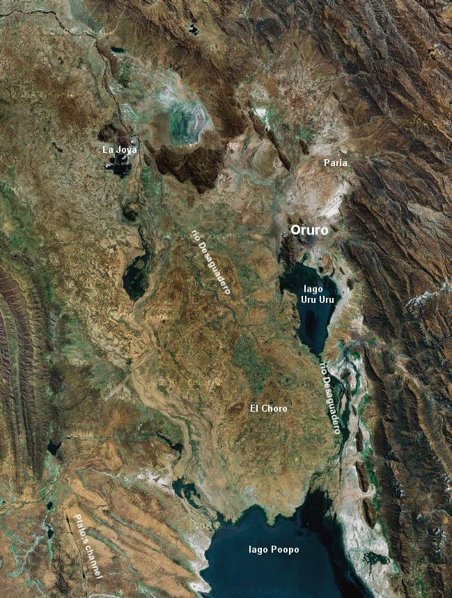
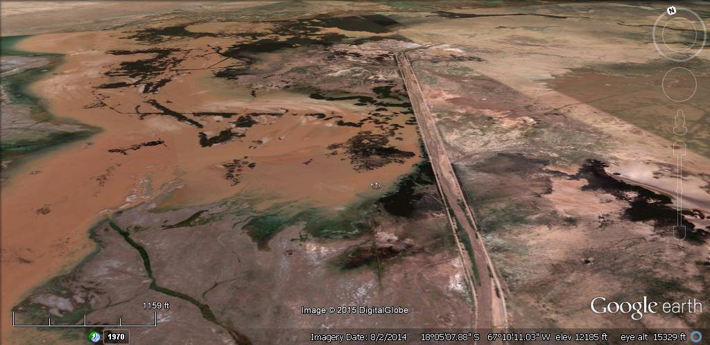
The region between Oruro and the northern edge of lake Poopo known as "El Choro"
shows an enormous concentration of parallel straight canals


Above, old canals disappearing beneath the sands.

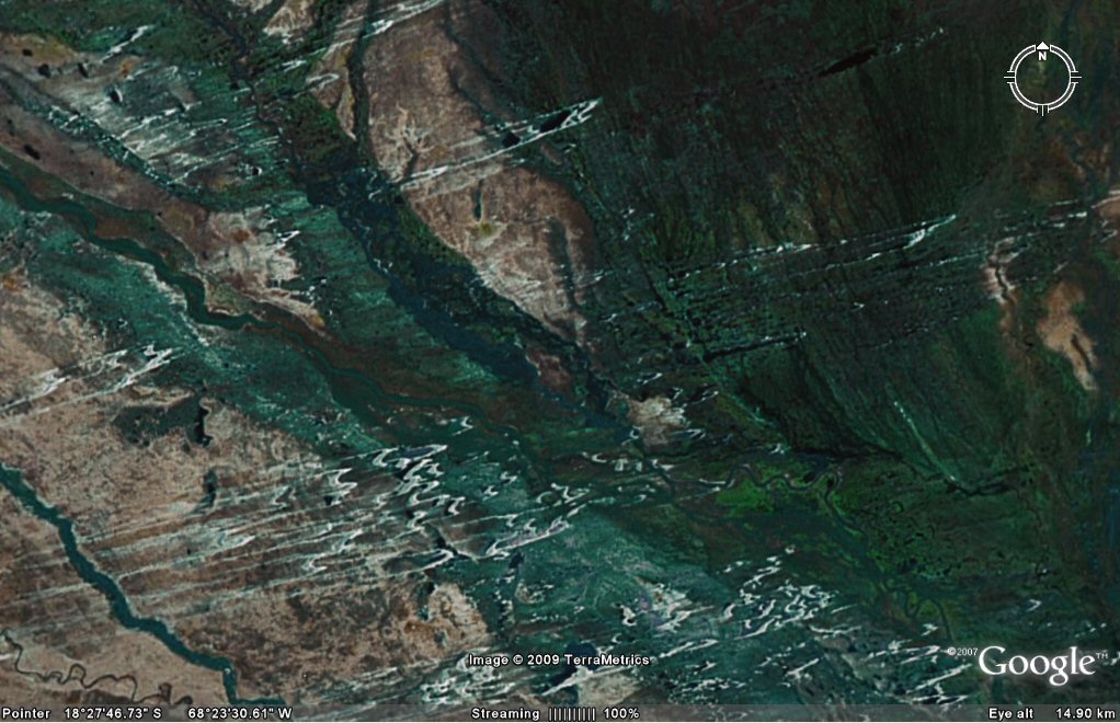
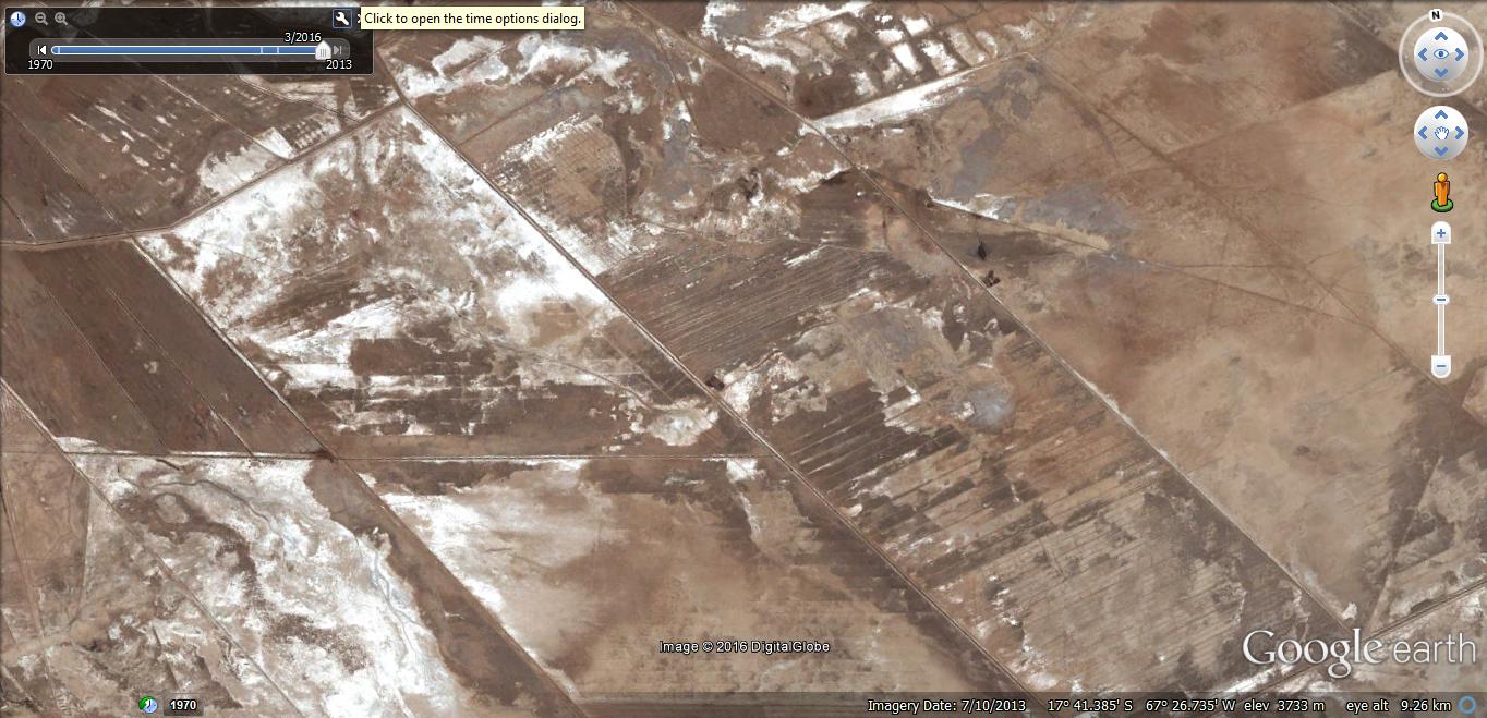
the canals show up better in the wet season..

the canals show up better in the wet season..

the canals show up better in the wet season, east of Belen, El Choro region...
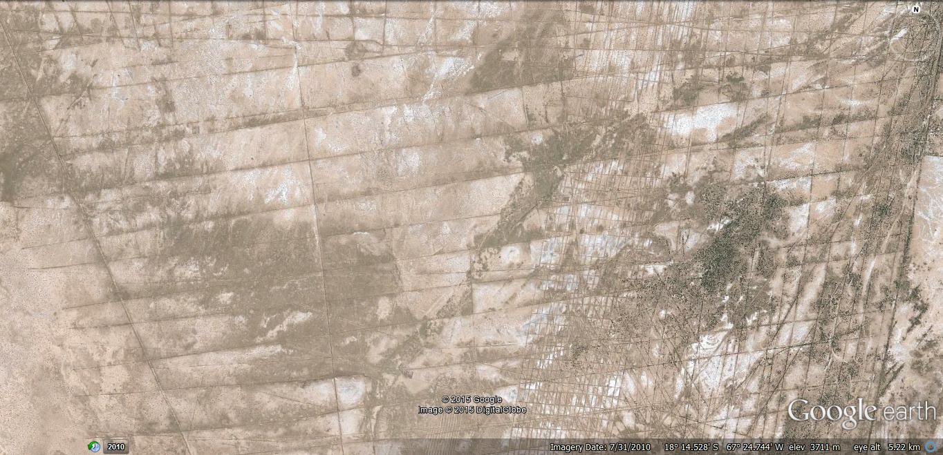
These look like salt trails indicating remains of
parallel canals in the desert Altiplano north east of Volcan Quemado,
on the "level rectangular plain". Note the orientation is the same as the canals in the El Choro region just south of Oruro.

the canals show up better in the wet season.. El Choro region.

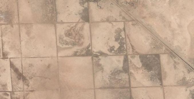
Some of the canals are more modern, such as the one crossing diagonally from the left, cut for relief drainage purposes.


Above, wells and canals beneath lago UruUru (lake Poopo).
into lago UruUru

between Oruro and lago Poopo


on the edge of and into lake Poopo/ Uru Uru

canals are re-dug over more ancient canals. Note the well on the right supplying water from an underground water table.
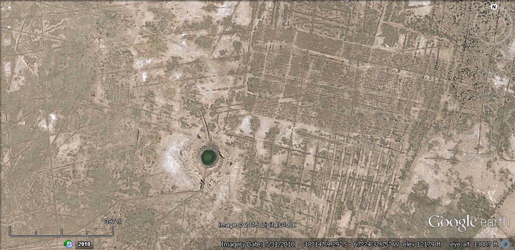
canals are re-dug over more ancient canals. Note the well on the left supplying water from an underground water table.

parallel canals disappearing beneath the sands of the desert.

In this region there is also an immense number of ancient walled plots, particularly to the north-west of Lake Poopo.
 dry canals zone, link to satellite, pan and zoom

Above, a system of parallel canals extended beneath what is now the edge of the rio Desaguadero.

Above, beneath the diagonal canal there is an even older system of parallel canals.

Above, the close-up shows more clearly an older system of parallel canals benath the diagonal canal.
through and under the rio Desaguadero


the parallel canals passing through the edge of the rio
Desaguadero show this part has sunk and the river expanded since the canals were first made.

Above, this canal runs beneath the edge of the rio Desaguadero to the old course of the river.

Above, this canal reaches to what would have been the original
course of the rio Desaguadero on the right hand side of the frame.


Above, ancient canals running through the rio Desaguadero near lake Poopo.

Above, ancient canals on the northern shore of Lake Poopo.

Above, ancient canals bordering the rio Desaguadero near lake Poopo.
Lago Uru Uru west (below)

above, remains of a section of canal 200 feet (60 metres) wide draining into lago Uru Uru, part of Lake Poopo south of Oruro, .
see Paria, Oruro canals page
The canal shows up parcularly well in the wet season when the surrounding fields have become flooded.
above, Oblique view of remains of a section of canal 200 feet (60 metres) wide draining into lago Uru Uru,
part of Lake Poopo south of Oruro, .
see Paria, Oruro canals page
Pariawest (below)

above, remains of a section of canal north of Oruro near Paria 200 feet (60 metres) wide.
see Paria, Oruro canals page
Oruro north towards Paria


La Joya north

Old abandoned canals just north of La Joya
Old abandoned canals nort west of Oruro

close up of old abandoned canals just north of La Joya

close up of old abandoned irrigation canals and plots just north of La Joya
Canals and irrigation are a feature of the area, many appear to be very ancient whilst others appear more recent but what is astonishing is the amount of
former agriculture and irrigation in what today appears to be largely salt desert.


These appear to be more recent and current irrigation channels, cultivation of quinoa has been re-introduced in the area.
La Joya south west

SW of La Joya, evidence of old canals crossing the salt flats.


Oruro west lake


Machacamarca north

Poopo village area

Pazna village area

Ponds north-west of Pampa Aullagas


These appear to be small artificial ponds dug in rows.

Above, the ponds are connected by small channels.

Similar artificial ponds also exist south-west of Pampa Aullagas.
Cultivations around the borders of Salar de Uyuni
south west of volcan Tunupa


east of Salar de Uyuni


south of Salar de Uyuni


Selection of related studies,
See also
dating of canals in northern Peru 4,684BC
dating and location of canals in northern Peru Wikipedia
"The new find suggests that agricultural settlements may have appeared in South America at about the same time they did in the Middle East.
Dillehay notes that the earliest evidence of irrigation canals in Sumeria is between 7,000 and 8,000 years old."
National Geographic quote... Researchers found three canals that date to at least 5,400 years ago buried by sediment layering. A fourth possible canal was also found, which special radiocarbon dating techniques revealed to be 6,700 years old.
"Some colleagues in the Andes surmise early canal irrigation based on the presence of crops at 9,000 to 10,000 years ago," said Tom D. Dillehay, an anthropologist at Vanderbilt University in Nashville, Tennessee, who lead the study.
atlantis canals on the Altiplano
flooding dates on the Altiplano
Chipaya canals gallery
rio Parana canals, ponds and islands
rio Paraguay levees canals
rio Parana delta canals
Corrientes
rio Amazon to Manaus
rio Amazon west from Manaus
rio Orinocco to Amazon canal
canals in Peru
Caral, Peru containment canal
Tabasco, Mexico canals gallery
canals Louisiana
Paria, Oruro containment canals
canal to sea (lago UruUru)
Pantanal
Beni, Moxos gallery
geoforms - Bolivian altiplano
agricultural variations on the Altiplano
ringed hilltops
earthquakes
contour forms/irrigation Peru
contourforms/irigation Bolivia
Bombo earthquake route
Bombo route oblique views
Atlantis stade - Egyptian and Sumerian cubits
Tiwanaku cubits
Peru cubits and calendar
cubits between altiplano canals
Teotihuacan measuring unit
Teotihuacan citadel measuring units
Chichen Itza and El Castillo measuring units
Monte Alban, measuring units
Atlantis stones gallery
the Tiwanaku soli-lunar calendar
the Muisca calendar
Lost Calendar of the Andes
Decoding the quipu mathematics
webatlantis@hotmail.com