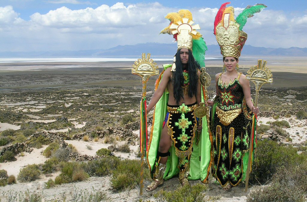
"Welcome to Atlantis!"
Pampa Aullagas
Legend of Atlantis
"Welcome to Atlantis!"

as featured in the documentary by Discovery Channel
"Atlantis in the Andes"

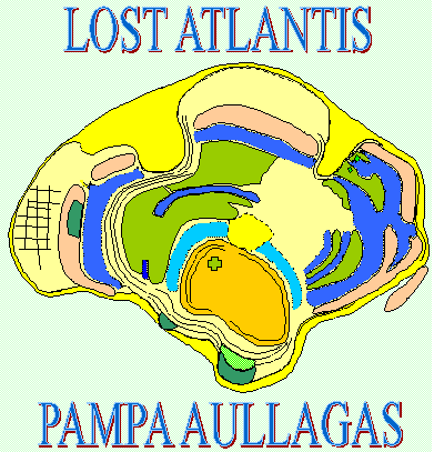
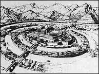
plan of Atlantis according to Plato.
Plan that is, of Atlantis before it was sunk by earthquakes.
Plato: "there occurred portentous earthquakes and floods,"
"the island of Atlantis in like manner was swallowed up by the sea and vanished; wherefore also the ocean (sea) at that spot
has now become impassable and unsearchable, being blocked up by the shoal mud which the island created as it settled down."
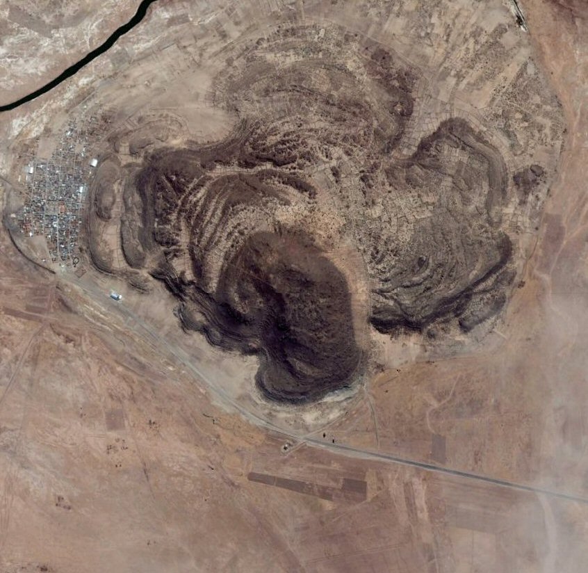
Note that the whole volcano at Pampa Aullagas, in addition to being destroyed by earthquakes is covered in sand, the "shoal mud"
which the "island threw up". It is usual in earthquakes, where there is an underlying water table, for the solid ground to jurn to a jelly-like substance due to a process called "liquefaction"
where heavy objects such as stones disappear beneath the ground, and mud or sand is ejected into the air, later covering everything in a layer of mud or sand.
So what would Atlantis look like after being sunk by earthquakes, and what is the force of an earthquake?
energy release power of earthquakes
A magnitude 5.0 earthquake is about 200 tons of TNT, magnitude 6.0 is 6,270 tons, 7.0 is 199,000 tons, 8.0 is 6,270,000 tons,
and 9.0 is 99,000,000 tons of TNT. As you can imagine, 99 million tons of TNT is enough to destroy just about anything, and
is the equivalent of about 25,000 nuclear bombs. (This is according to the Center for Earthquake Research and Information
and the U.S. Geological Survey.)
Someone making a comment on a Youtube film of Pampa Aullagas shot by Brien Foerester made a comment that ...
"wow, that site looks like it has been nuked".
Correct, most volcanoes occur on fault lines and are likely to be the epicentre of any earthquakes in the area. A volcano hit by an earthquakes is quite likely to look afterwards "as if it had been nuked". What it would not look like is a fully intact Greek-style city from the time of Plato, sitting calmly on the bottom of the Ocean floor as shown in so many comtemporary illustrations.

According to Atlantipaedia, all that exists at Pampa Aullagas volcano is "a pile of builder's rubble."
In that respect he is right - that is what it is meant to look like after being sunk by earthquakes....
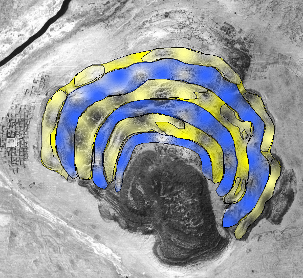
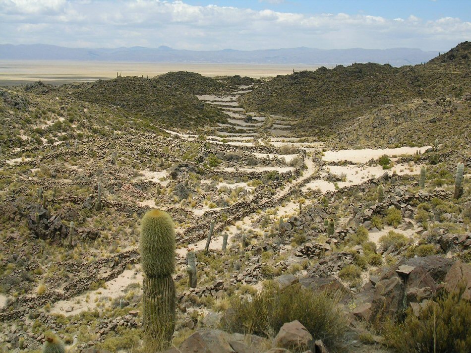
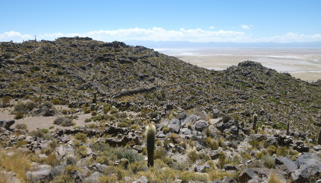
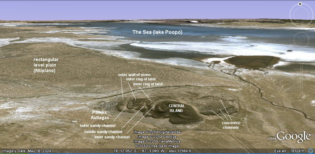
At Pampa Aullagas about 65% of the volcano is missing. Most of the southern side. The eastern side looks like it was pushed up there from the south-east quarter. The west side has broken away and moved outwards from the main volcano. The middle and inner rings on the west side look like they have risen in elevation. And most of the outer face of the volcano has broken away, fallen off the edge of the volcano and disappeared beneath the ground. How do we kow that? Because on the south eastern side there is a thin line of original stone clinging to the face of the volcano, and this stone is covered in fossiled coral from the time when this part of the volcano was submerged by the great paleolithic lakes which once covered the region.
Under those circumstances, is it possible to make any sense of what remains on site to relate to Plato's story?
A continent the size of Libya and Asia combined... yes
A smooth, level rectangular plain in the centre of the continent ... yes
A volcano low on all side in the centre of the plain and 50 stades from the sea ... yes
Concentric rings carved by nature (i.e. the god Poseidon) out of the centre of the mountain "low on all sides" ... yes
Pampa Aullagas still has the remains of concentric rings of land and
depressions which
would have held water when the nearby lake or inland sea had a
higher level.
Poseidon.... "
to make the hill whereon she (Cleito) dwelt impregnable he broke it off all round about; and he made circular
belts of sea and land enclosing one another alternately, some greater, some smaller, two being of land and three of sea,
which he carved as it were out of the midst of the island; and these belts were at even distances on all sides, so as to be impassable for man;"
Plato: "The greatest of the circles into which a boring was made for the sea was three stades in breadth,
and the circle of land next to it was of equal breadth; and of the second pair of circles that of water was
two stades in breadth and that of dry land equal again to the preceding one of water; and the circle which ran round
the central island itself was of a stade's breadth."
Plato: "beginning at the sea, they bored a channel right through to the outermost circle, which was three plethra in breadth,
one hundred feet in depth, and fifty stades in length; and thus they made the entrance to it from the sea like that to a harbor
by opening out a mouth large enough for the greatest ships to sail through". (Bury)
The Bolivian legend of a missing city sunk by earthquakes and floods is
called
The Legend of the Desaguadero.
The locals report that part of the original site
was destroyed in "el gran diluvio" -
the Great Flood. The lake was
also formerly called Lake Aullagas.
Pampa Aullagas is also said to be home of the water god Tunapa - the
equivalent of the Greek god Poseidon and according to Bolivian legend Tunapa
married a local girl and subsequently created the ringed formation at Pampa
Aullagas - surely the origins of Plato's Atlantis story of Poseidon marrying
Cleito and "breaking the hill off all round about......"
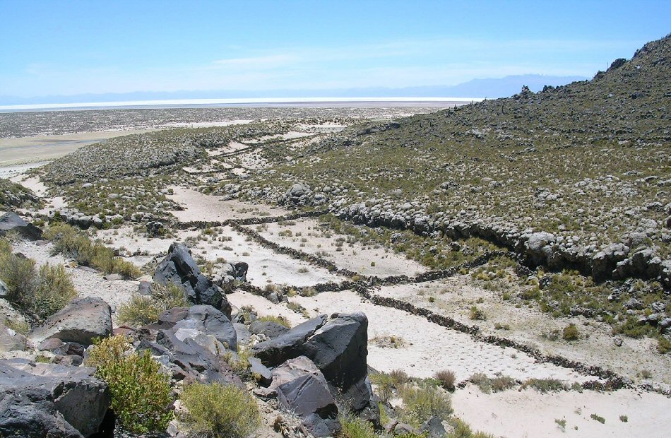
reconstruction of land and water circles at Pampa Aullagas.
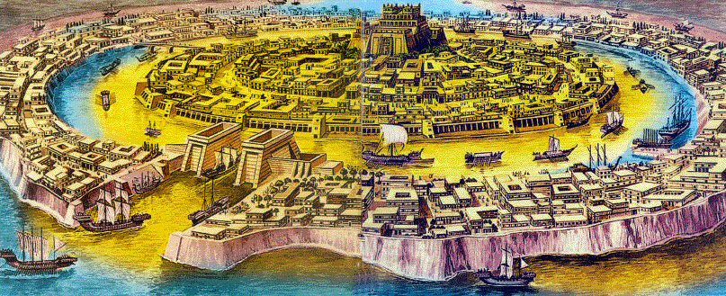
contemporary illustration of Atlantis

contemporary illustration of Atlantis
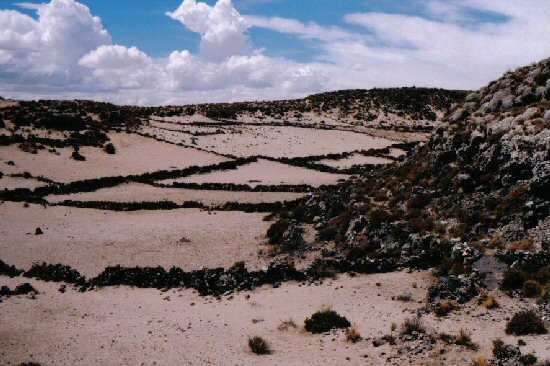
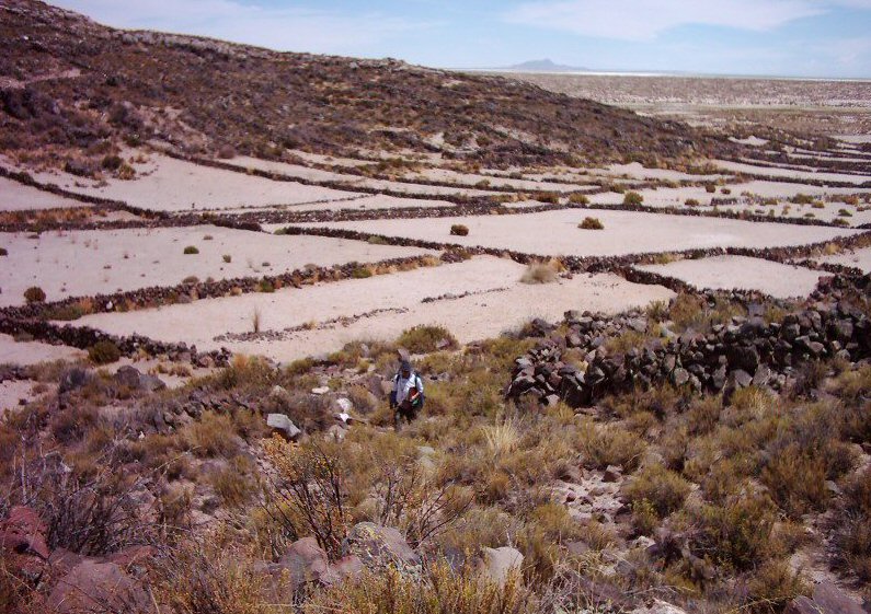
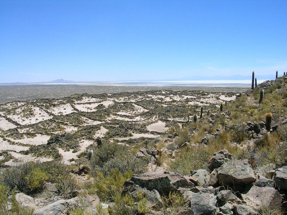
one of the circular channels
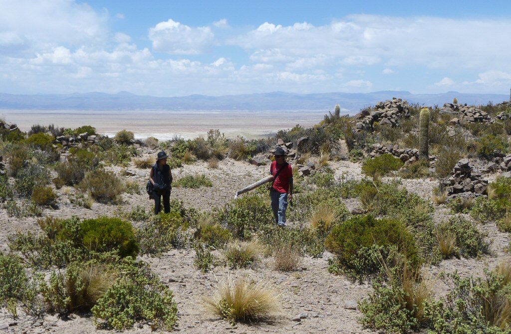
tourists visit one of the circular channels

satellite image of outer channel on south-east side.

close-up satellite image of outer channel on south-east side.
view of one of the circular channels at Pampa
Aullagas

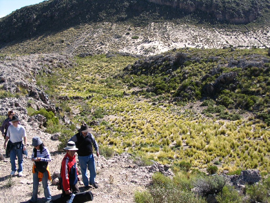
climbing into the circular channels, south side.
middle channel south east side.
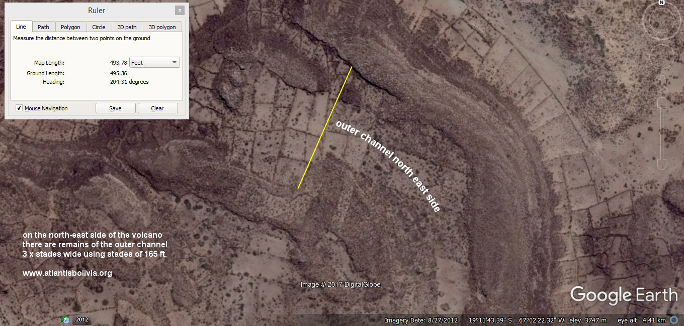
satellite image showing remains of outer channel on the north-east side.
"They began by digging a canal three hundred feet wide, a hundred feet deep and fifty stades long from the sea to the outermost ring," - Sir Desmond Lee.

Satellite image showing remains of the canal to the sea, 3 x "plethra" wide i.e. "they bored a channel right through the outermost circle".
Ground view showing remains of opening "dug through the outermost circle" into the volcanic rings, 3 x "plethra" wide.
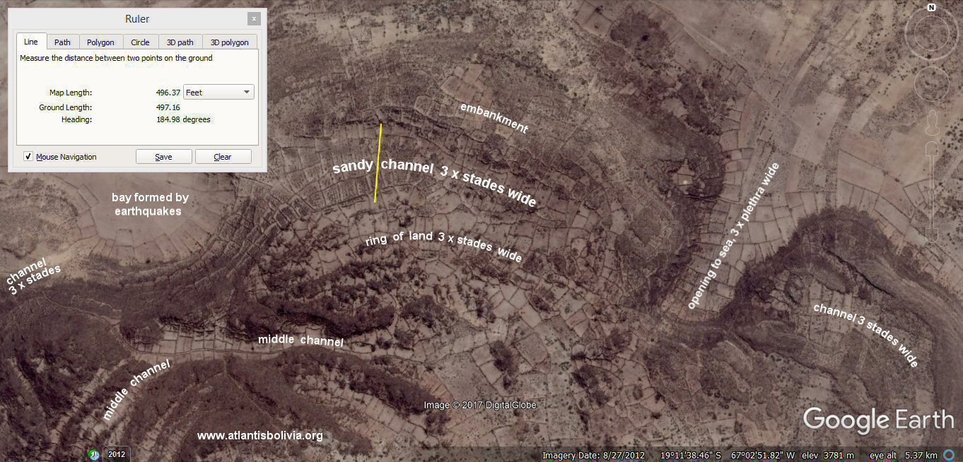
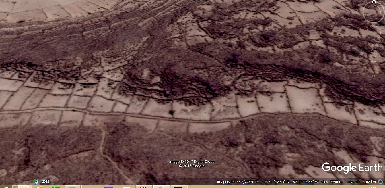
satellite image showing remains of the outer channel on north side, choked up with sand.
oblique satellite image showing the middle circular channel on the north-western side
view of the middle circular channel on the north-western side
view of the outer channel on west side.

the channel continues to the right then disappears into thin air...
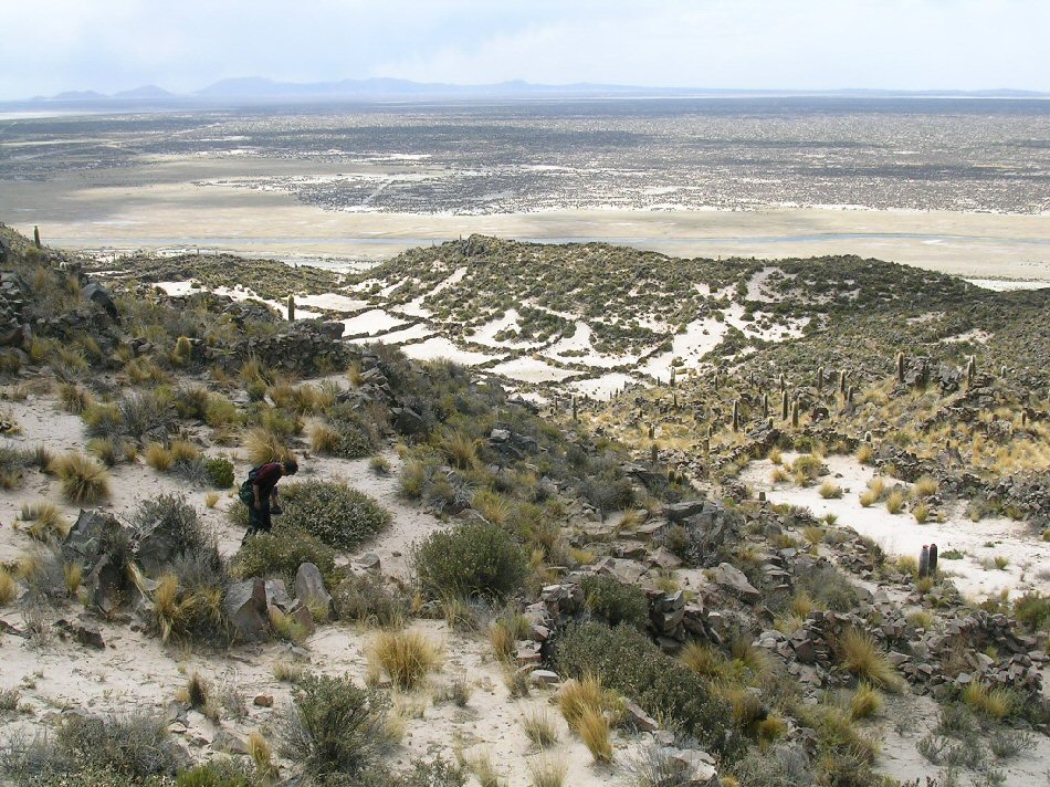
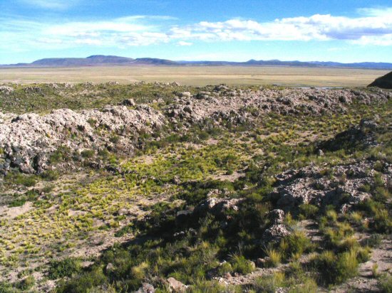
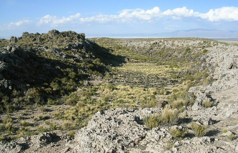
general view.
general view of inner ring looking towards the lake.

general view of inner ring looking towards Quillacas.
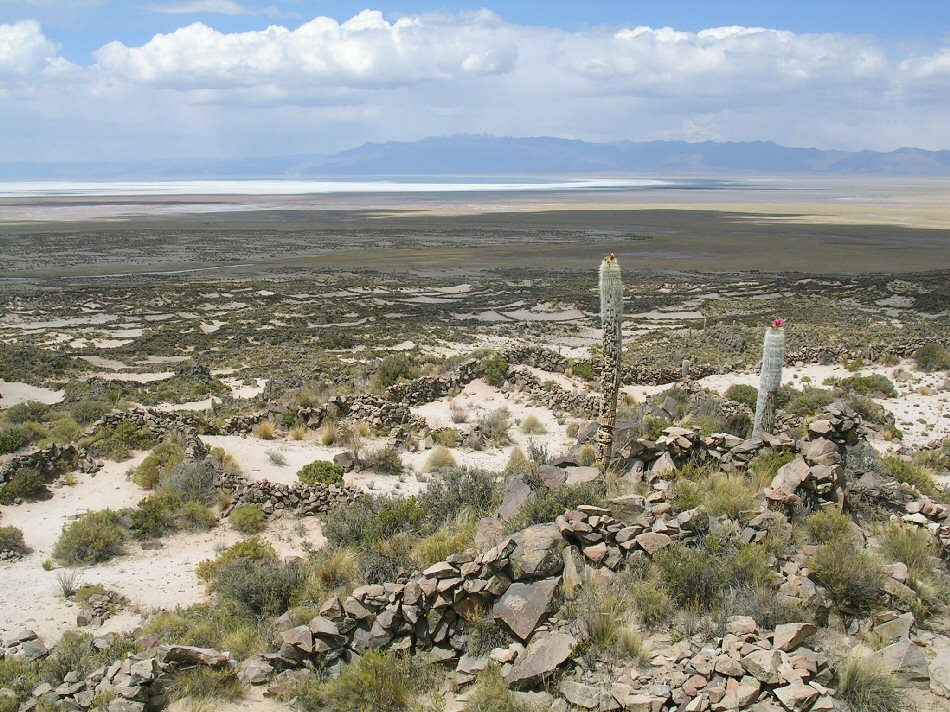
general view looking towards Lake Poopo.
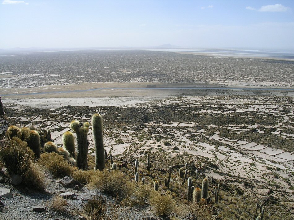
View from the
summit looking towards lake Poopo.
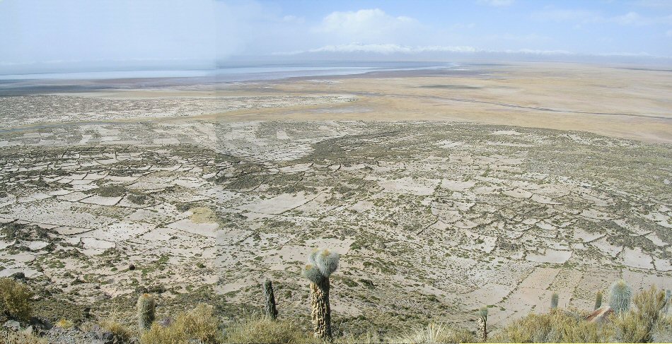
panorama towards lake Poopo.
general view of the acropolis
view of summit.
This is the northern rim of the volcano and shelters the platform on top of the volcano from the north: the platform is a gentle slope facing south.
view of level platform in centre of summit cone or acropolis.

view of level platform in centre of summit cone or acropolis.
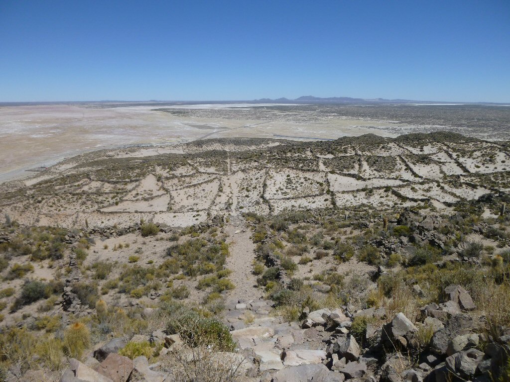
looking back down the ascending path.
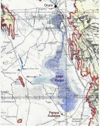
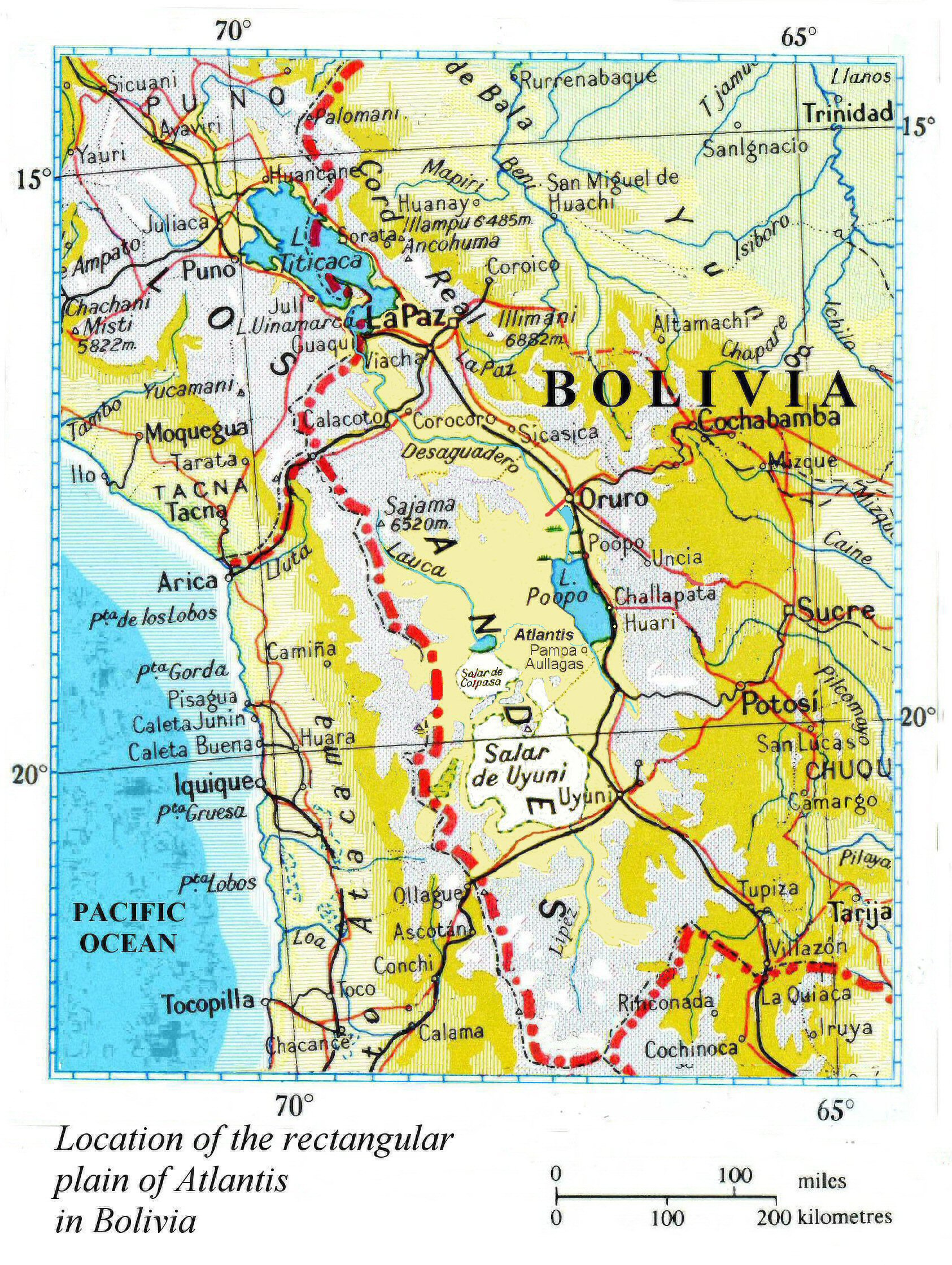
Location of Pampa Aullagas to the south of Lake Poopo


One
of the main features of Atlantis was a smooth level rectangular shaped plain
with the island city at its centre next to the sea.
The rectangular-shaped
Altiplano conforms very well to this description and has the mountain at Pampa
Aullagas at its centre.
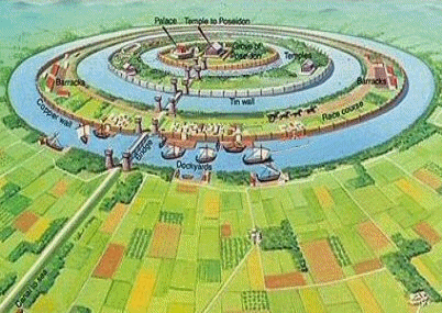
some popular concepts of Atlantis with its
central island surround by rings of land and water.
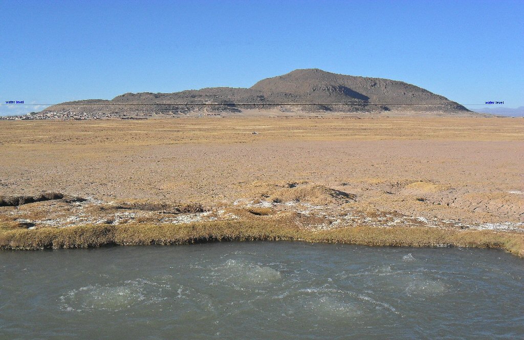
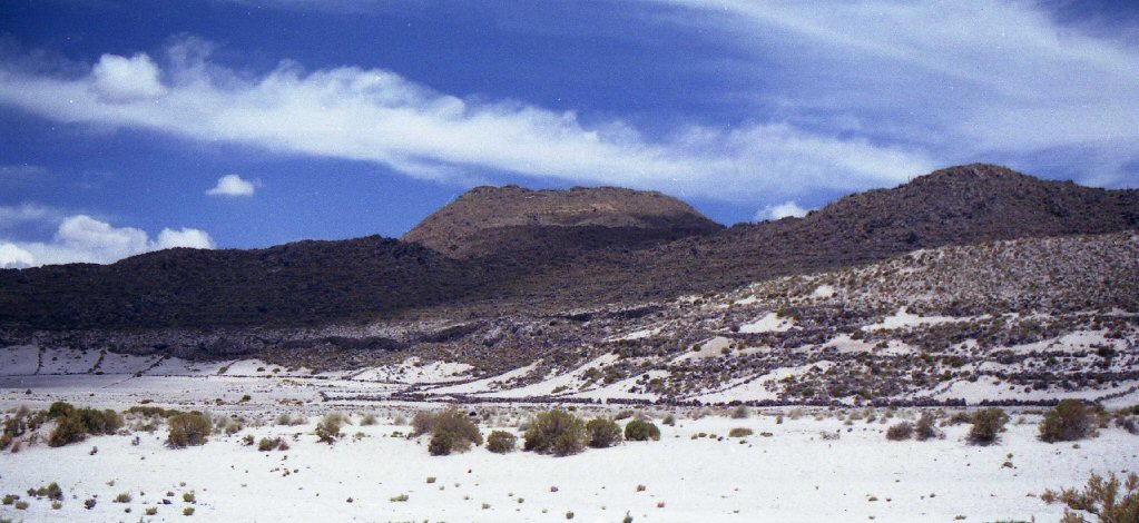
The mountain is surrounded by a band of stones covered in white, fossilised lake deposits which show the original level of the lake
at a much higher level than today, the surrounding plain has also dropped in elevation.

Hot and cold
springs also exist nearby.
Click for video

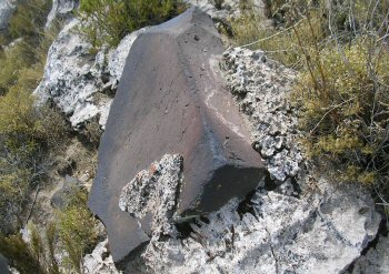

White, black and
red stones were a feature of Atlantis and are to be found at Pampa Aullagas.

beautiful sandy bay at Pampa Aullagas, if only the sea would come back!

flowering cactus in Pampa Aullagas

tourist map of Pampa Aullagas
The present village of Pampa aullagas was founded on the 3rd of May 1573 with the name of "Villa Real de Aullagas de Uruquillas" by Pedro de Zarate, amongst others.
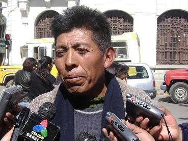
Victor Villca of Pampa Aullagas welcomes tourists
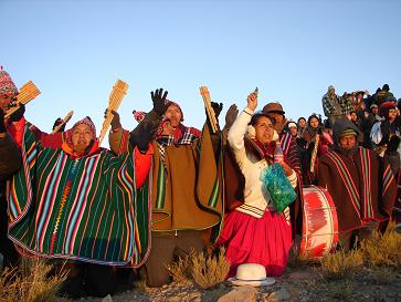
celebrating New year, 21st JUNE at Pampa Aullagas, year 5516 of the Aymara calendar, year 2008 of the western calendar
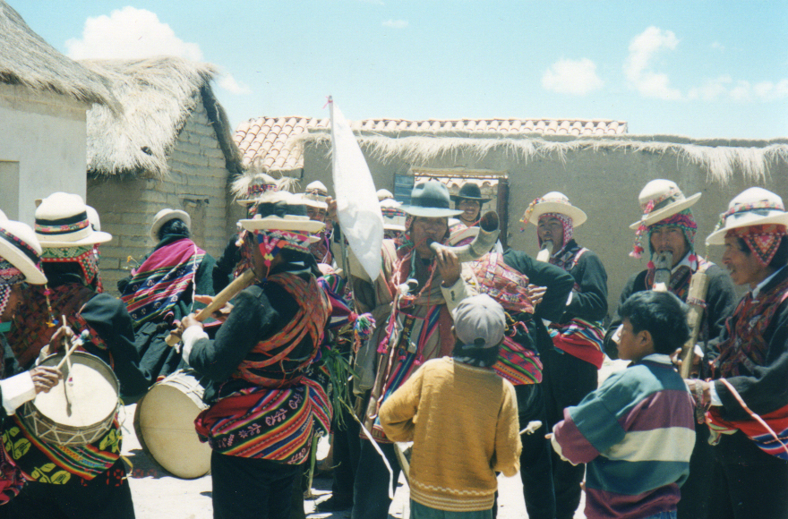
fiesta in Pampa Aullagas
plaza principal in Pampa Aullagas
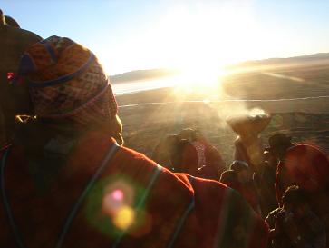
New year, 21st June, the winter solstice at Pampa Aullagas, year 5516 of the Aymara calendar

a welcome from the band

a little light music
Oblique view of Pampa Aullagas in the dry season with Lake Poopo beyond
Click for more oblique views

Oblique view of Pampa Aullagas showing the concentric rings on the north-west side
Click for more oblique views

view of Atlantis Pampa Aullagas from the rio Marquez

front view of hotel at Pampa Aullagas
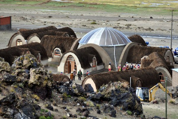
hotel complex at Pampa Aullagas
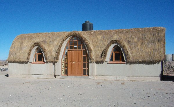
one of the hotel units at Pampa Aullagas
each unit has two rooms
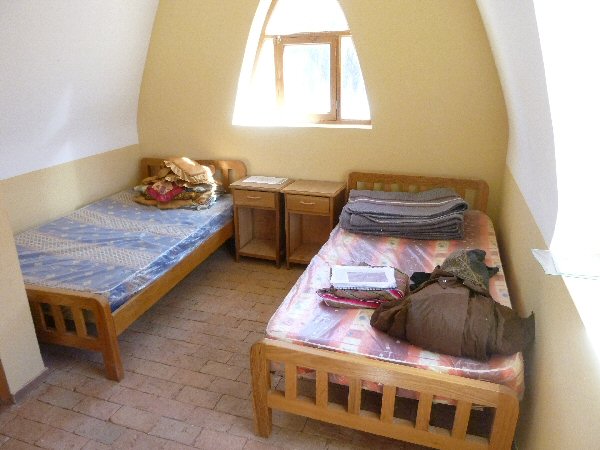
one of the hotel rooms at Pampa Aullagas, each room has private bathroom.
for advice or to organise your visit and stay at Pampa Aullagas, please contact Eduardo Montaño of
Showroom Atlantis Bolivia
La Paz: Edif. 16 de Julio PB. Loc 6 (Prado)
Tels. (591) 2- 2315153 / 2310463 / Cel. 73064446
email atlantisbolivia@hotmail.com

Click for gallery of photos around Pampa Aullagas,
volcan Tunupa and the salars
Click for atlantisbolivia.org homepage
Pampa Aullagas page by Jim Allen, author "Atlantis: the Andes Solution", "The Atlantis Trail", "Atlantis: Lost Kingdom of the Andes".
webatlantis@hotmail.com
more views of Pampa Aullagas in part 2
sailing to Atlantis, Pampa Aullagas
in the wet season
wwww.atlantisbolivia.org
homepage
