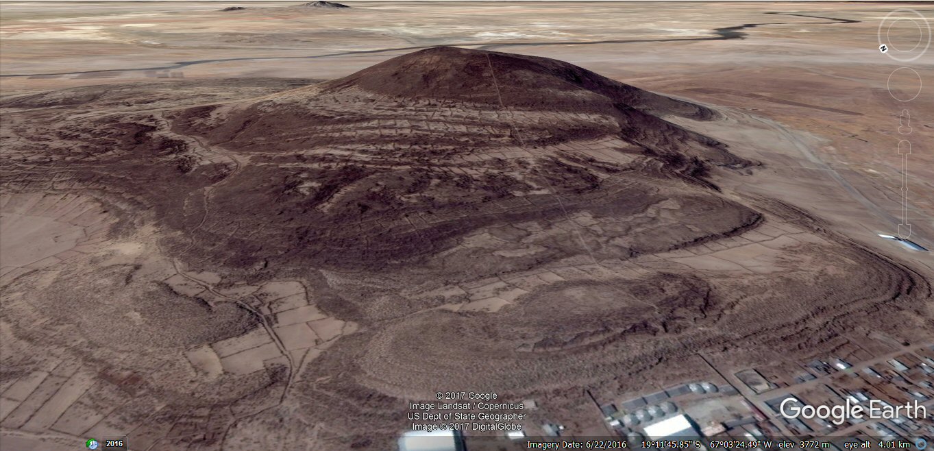
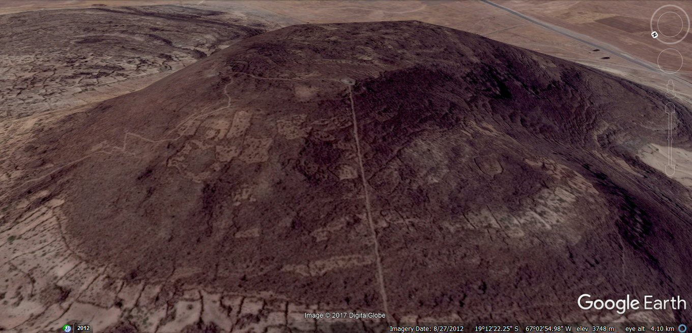
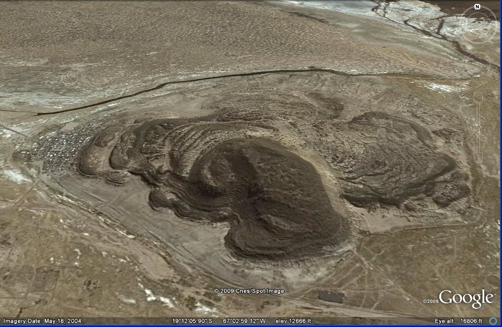
Above, satellite image of Pampa Aullagas.
The complete southern half of the volcano is missing.
Pampa Aullagas: Legend of Atlantis
Some views from Google Earth, continued from Pampa Aullagas part 1
Above, satellite image of Pampa Aullagas.
The complete southern half of the volcano is missing.
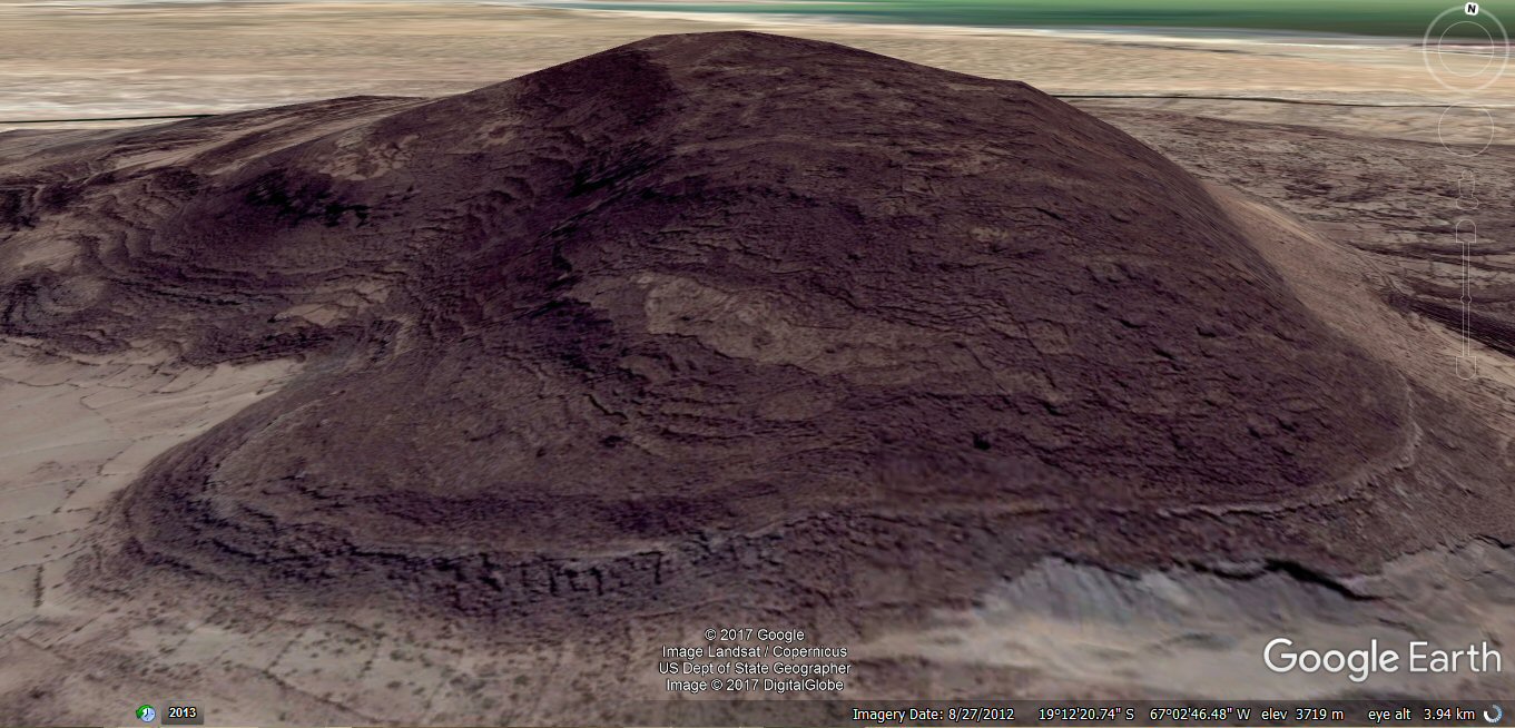
Above, view from north-west

Above, view from north-west showing rings of land and channels
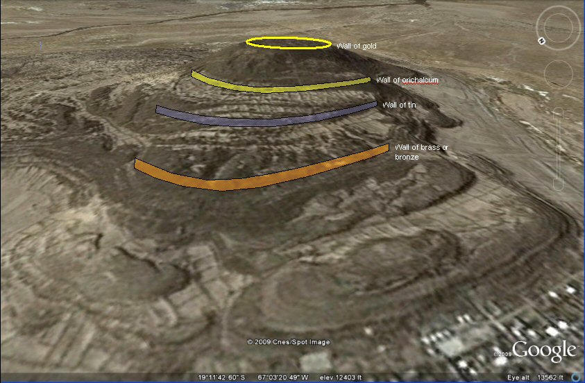
Above, oblique view from north-west showing reconstruction of probable position of walls according to the scheme of Plato.
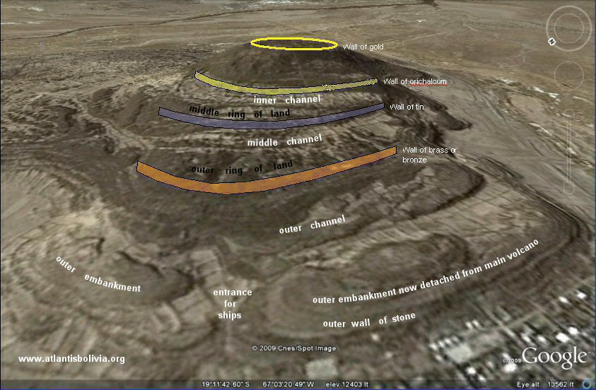
Above, oblique view showing reconstruction of probable position of walls in relation to rings of land and channels
according to the scheme of Plato.
The cities of Susa and Ecbatana in Persia had similar concentric walls on battlements,
the inner ones higher than the
outer and painted in different colours with gold and silver in the centre.
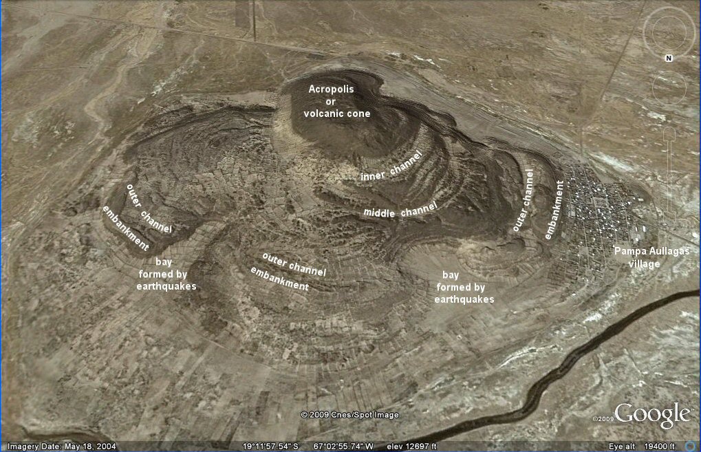
Above, oblique view from north showing the cross-like qualities of the site formed by
the opening up of two bays, probably due to earthquakes.
The inner channel shown here is now higher
up the mountain suggesting that this part of the volcano was pushed up later.
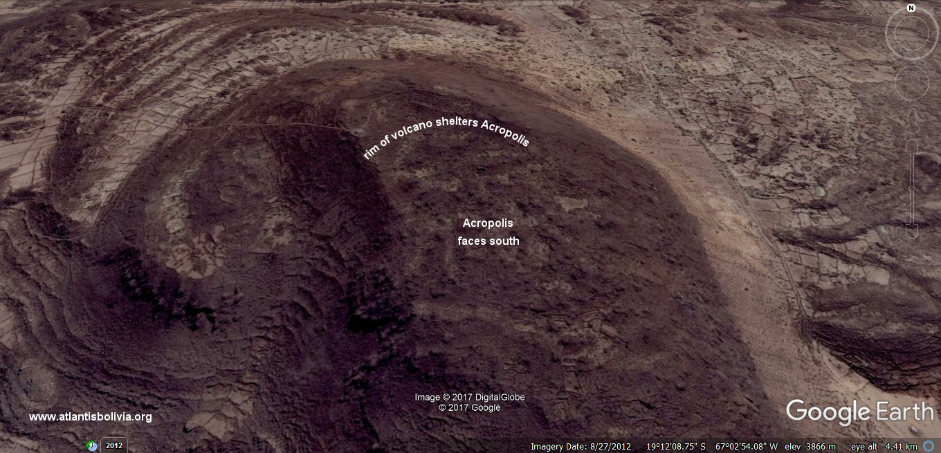
Above, view of summit or acropolis from north-west
Above, close-up view of summit or acropolis from the south-west
Above, view of summit or Acropolis from the south showing how the
central island or Acropolis faces towards the south and is sheltered from the north by the rim of the volcano.
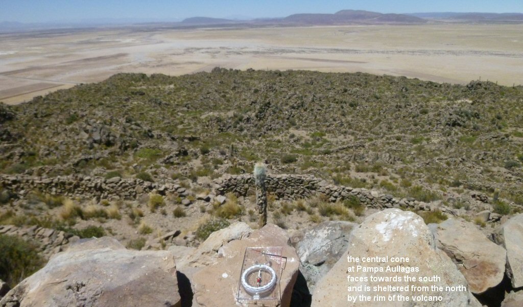
Above, view from the northern rim looking south. Plato: "This part of the island looked towards the south and was sheltered from the north".
Above, close-up view of summit or Acropolis from the south showing how the
central island or Acropolis faces towards the south and is sheltered from the north by the rim of the volcano.

Above, close-up view of summit or Acropolis..

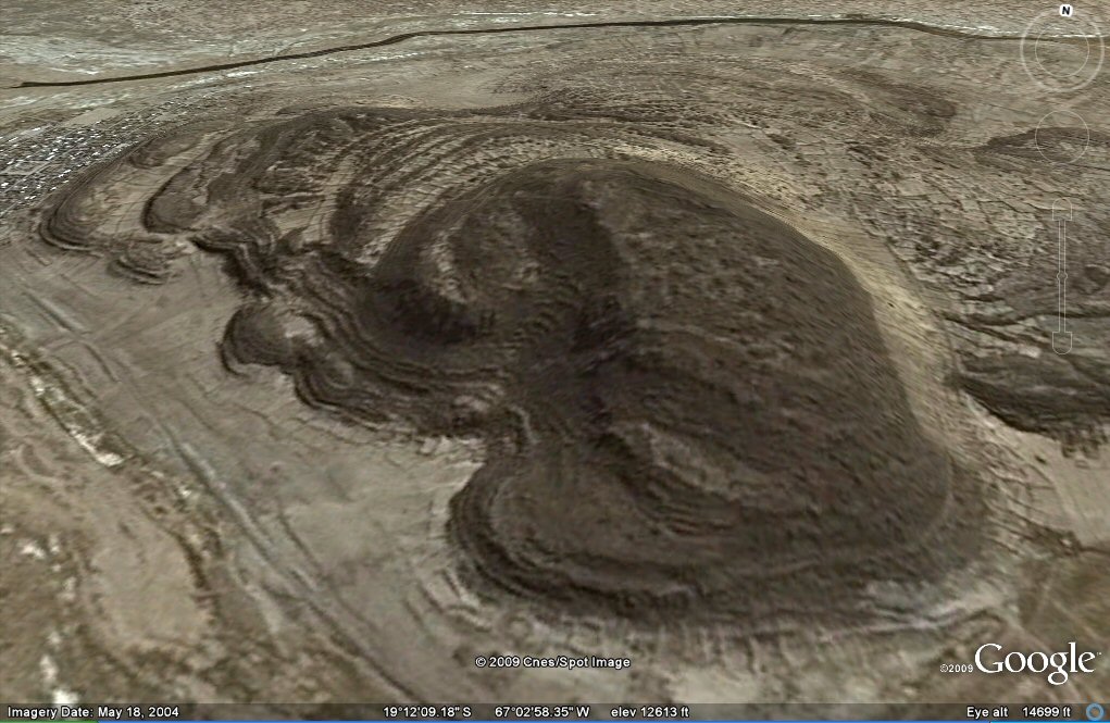
Above, close-up overview of the rings on north-west side
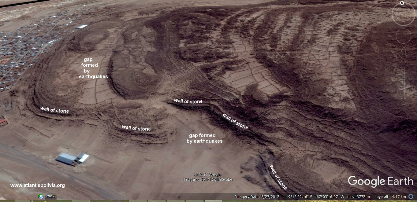
Above, view from the south showing the embankment faced with stones behind the village. I suspect this
has become detached from the main body of the volcano due to earthquakes and forced outwards creating
the sandy channel seen on the inside so that the wall of stone shown here would have been continuous instead of appearing broken off as it does at present.
Geological studies are necessary to establish what the original shape of the volcano may have been, which parts may have
sunk or risen and which parts may have become detached from their original locations.

Above, this section of the embankment behind the village is still covered in katawi - fossilised lake deposits from the time it was under the sea (lake Poopo).
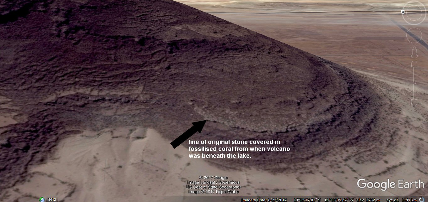
Above, only this white ribbon of stone remains of the original face of the volcano...
Some people call the white material coral, the local name is "katawi" - fossilised lake deposits from the time it was under the sea (lake Poopo).

Above, ground view of the above ribbon of stone clinging to face of volcano.
The other stones which would have been covered in the white katawi have fallen away and disappeared beneath the ground.


Above, only this white ribbon of stone remains of the original face of the volcano...


Above, close-ups of the white ribbon of stone remains of the original face of the volcano...
The remainder of the original outer stone from the volcano has fallen away and disappeared beneath the ground.
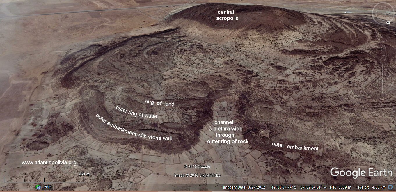
Above, oblique view showing outer ring of water 3 x stades of 100 cubits wide and the channel from the sea which pierced the outermost ring of rock.
Plato: "beginning at the sea, they bored a channel right through to the outermost circle, which was three plethra in breadth,
one hundred feet in depth, and fifty stades in length; and thus they made the entrance to it from the sea like that
to a harbor by opening out a mouth large enough for the greatest ships to sail through." (115d)

Above, oblique view measuring the channel though the outermost ring, reported as 3 x plethra = 3 x 110ft = 330ft (Sumerian Units).
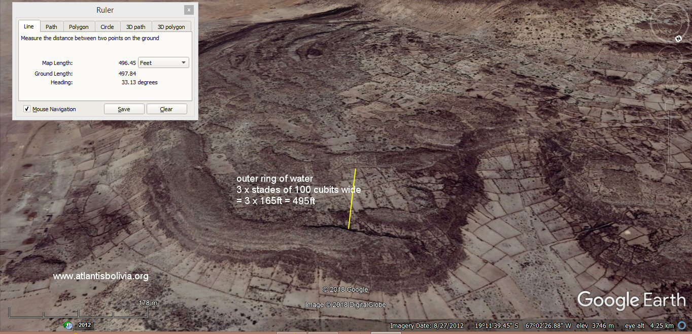
Above, oblique view measuring the outermost water channel 3 x stades of 100 cubits wide.
Plato: "The greatest of the circles into which a boring was made for the sea was three stades in breadth."

satellite image showing the passageway connecting the outer channel to the middle channel on west side.

Satellite image showing a passageway or channel which connected the outer circle of water
to the middle circle of water on west side.
The outer embankment at this point has broken away from the main volcano and been pushed outwards.
Part of the embankment which contained the outer ring has been sunk by earhquakes.
The middle and inner rings on this side have risen in elevation.

Ground view of the passageway connecting the outer channel to the middle channel on west side.
Plato: "Moreover, through the circles of land, [115e] which divided those of sea, over against the bridges they opened out a
channel leading from circle to circle".

Above, oblique view from the south-east, a question for geologists - did the
low plateau with the concentric rings come first then the volcanic cone force its way through
afterwards, or was the volcanic cone there first and the low platform formed afterwards?.
Has this part of the low plateau also become detached from its original location and why is one end squashed up against the volcanic cone?
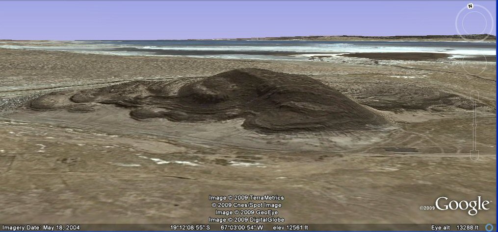
Above, oblique view from the south with Lake Poopo in the background.
Above, oblique view from the south.
J.M.Allen 1st Nov 2009, updated Sept 2017